Llantilio Crossenny
| |
---|---|
Church of St Teilo | |
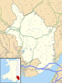
Location within Monmouthshire | |
Population | 731 (2011) [1] |
OS grid reference | SO398147 |
Community | |
Principal area | |
Preserved county | |
Country | Wales |
Sovereign state | United Kingdom |
Post town | ABERGAVENNY |
Postcode district | NP7 |
Dialling code | 01873 |
Police | Gwent |
Fire | South Wales |
Ambulance | Welsh |
UK Parliament | |
Llantilio Crossenny (Welsh : Llandeilo Gresynni) is a small village and much larger former community, now in the community of Whitecastle, in Monmouthshire, south east Wales, in the United Kingdom. It is situated between the two towns of Abergavenny and Monmouth on the B4233 road. The community included Penrhos, and Llanvihangel-Ystern-Llewern.
In January 2015 metal detectorists unearthed axe and spear heads, thought to be around 3,000 years old, in a field near the village. The items are thought to date back to Ewart Park phase of the late Bronze Age, about 1000-800 BC. The Principal Curator of Prehistory at Amgueddfa Cymru – National Museum Wales, Adam Gwilt, said: "Many whole and still usable bronze objects were carefully buried in the ground at this particular time and archaeologists now think that these may have been gifts to the gods and ancestors, buried during ritual ceremonies. It is curious that this place in the landscape was chosen for the burial of two hoards of the same date and very close to each other." [2]
The site of the village, or at least the locality, is associated with a battle between a Dark Ages King of the Welsh Kingdom of Gwent, Ynyr, and the incoming Saxons. The village is also associated with the incoming Normans in Wales who built many castles in this border area of the Welsh Marches and with Dafydd Gam, a local warrior and Welsh ally of King Henry V.
A Free Grammar School was founded in the village, on 10 August 1654, by James Powell, Gentleman of Cymmerau. In 1924 a history of the grammar school was published by local historian Sir Joseph Bradney. [3]
The Church of St Teilo dates from the 13th century and is "an unusually grand cruciform church." [4] It is a Grade I listed building and is dedicated to Saint Teilo. [5]
White Castle is a fine example of the medieval castle-builders art which stands on the hill overlooking the village. The Three Castles Walk passes close by. The fortification was established by the Normans in the wake of the invasion of England in 1066, to protect the route from Wales to Hereford. [6] Possibly commissioned by William fitz Osbern, the Earl of Hereford, it comprised three large earthworks with timber defences. [7]
Hen Gwrt is the site of a thirteenth-century manor house and a sixteenth-century hunting lodge. Originally constructed for the Bishops of Llandaff, it subsequently came into the possession of the Herberts of Raglan Castle. [8] [9]
Sir Henry Jackson, 2nd Baronet (1831–1881) Member of Parliament (MP) for Coventry from 1867 to 1868 and 1874–1881, and a Deputy Lieutenant of Monmouthshire lived at Llantilio Court from 1873 until his death in 1881. His son, Sir Henry Mather-Jackson, 3rd Baronet, bought the lordship of the manor of Llantilio Crossenny and the ruins of White Castle from the 9th Duke of Beaufort in May 1902. [10] Llantilio Court was demolished in 1922 but remnants of the landscape park remain and are listed on the Cadw/ICOMOS Register of Parks and Gardens of Special Historic Interest in Wales. [11]
The Offa's Dyke path passes through the village. [12] [13] Llantilio Crossenny holds an annual festival of music and drama which was co-founded in the 1960s by Welsh composer Mansel Thomas. [14] [15]
An electoral Ward in the same name exists. This ward stretches north to Llangattock-Vibon-Avel. The total population of this ward at the 2011 census was 1,755. [16] In the 2022 local elections, Paul Chandler became Monmouthshire's first Green councillor after being elected to represent the Llantilio Crossenny electoral ward. [17] Llantilio Crossenny community (parish) elected a Community Council of nine members. [18]
White Castle, also known historically as Llantilio Castle, is a ruined castle near the village of Llantilio Crossenny in Monmouthshire, Wales. The fortification was established by the Normans in the wake of the invasion of England in 1066, to protect the route from Wales to Hereford. Possibly commissioned by William fitz Osbern, the Earl of Hereford, it comprised three large earthworks with timber defences. In 1135, a major Welsh revolt took place and in response King Stephen brought together White Castle and its sister fortifications of Grosmont and Skenfrith to form a lordship known as the "Three Castles", which continued to play a role in defending the region from Welsh attack for several centuries.
Monmouthshire is a county in the south east of Wales. It borders Powys to the north; the English counties of Herefordshire and Gloucestershire to the north and east; the Severn Estuary to the south, and Torfaen, Newport and Blaenau Gwent to the west. The largest town is Abergavenny, and the administrative centre is Usk.
Llanvapley is a village in the community of Gobion Fawr, in Monmouthshire, south east Wales, United Kingdom. Llan has replaced the (earlier) Eglwys (1254). This village lies 4 miles north east of 2023’s Best Places to Live listed town, Abergavenny.
The Diocese of Monmouth is a diocese of the Church in Wales. Despite the name, its cathedral is located not in Monmouth but in Newport — the Cathedral Church of St Woolos. Reasons for not choosing the title of Newport included the existence of a Catholic Bishop of Newport until 1916. This apparent anomaly arose in 1921 when the diocese was created with no location for the cathedral yet chosen. Various options were being considered, such as restoring Tintern Abbey, building from scratch on Ridgeway Hill in Newport, and upgrading St Woolos, then a parish church; in the meantime the new diocese, as it covers more or less the territory of the county of Monmouth, was named the "Diocese of Monmouth". Prior to 1921 the area had been the archdeaconry of Monmouth.
Raglan (; is a village and community in Monmouthshire, south-east Wales, United Kingdom. It is located some 9 miles south-west of Monmouth, midway between Monmouth and Abergavenny on the A40 road very near to the junction with the A449 road. It is the location of Raglan Castle, built for William ap Thomas and now maintained by Cadw. The community includes the villages of Llandenny and Pen-y-clawdd. Raglan itself has a population of 1,183.
Grosmont is a village and community near Abergavenny in Monmouthshire, Wales. The population taken at the 2021 census was 869. The wider community (parish) includes the villages of Llangattock Lingoed, Llangua and Llanvetherine.
Llantilio Pertholey is a village and community (parish) in Monmouthshire, south east Wales. It is located 2 miles (3.2 km) to the north-east of the market town of Abergavenny, which it is part of, just off the A465 road to Hereford. The parish covers a large area beneath the Skirrid, an outlier of the Black Mountains; much of the parish lies within the easternmost part of the Brecon Beacons National Park.
Llanvihangel-Ystern-Llewern is a village in the community of Whitecastle, in Monmouthshire, south east Wales. It is located between Abergavenny and Monmouth and north of Raglan. The River Trothy passes close by.
Mitchel Troy is a village and community in Monmouthshire, south east Wales, in the United Kingdom. It is located 3 miles south west of the county town of Monmouth, just off the A40 road leading towards Raglan. Settlements within the community include Tregare, Dingestow, Cwmcarvan and Wonastow.
Monmouth Castle is a castle close to the centre of the town of Monmouth, the county town of Monmouthshire, on a hill above the River Monnow in south-east Wales.
The Church of St Teilo is the parish church of Llantilio Crossenny, Monmouthshire, Wales. "An unusually grand cruciform church", with an Early English tower crossed by a Decorated chancel, it was designated a Grade I listed building on 19 November 1953
Monmouthshire is a county and principal area of Wales. It borders Torfaen and Newport to the west; Herefordshire and Gloucestershire to the east; and Powys to the north. The largest town is Abergavenny, with the other major towns being Chepstow, Monmouth, and Usk. The county is 850 km2 in extent, with a population of 95,200 as of 2020. The present county was formed under the Local Government (Wales) Act 1994, which came into effect in 1996, and comprises some sixty percent of the historic county. Between 1974 and 1996, the county was known by the ancient title of Gwent, recalling the medieval Welsh kingdom. In his essay on local government in the fifth and final volume of the Gwent County History, Robert McCloy suggests that the governance of "no county in the United Kingdom in the twentieth century was so transformed as that of Monmouthshire".
Monmouthshire is a county of Wales. It borders Torfaen and Newport to the west; Herefordshire and Gloucestershire to the east; and Powys to the north. The largest town is Abergavenny, with the other major towns being Chepstow, Monmouth, and Usk. The county is 850 km2 in extent, with a population of 95,200 as of 2020. The present county was formed under the Local Government (Wales) Act 1994, which came into effect in 1996, and comprises some sixty percent of the historic county. Between 1974 and 1996, the county was known by the ancient title of Gwent, recalling the medieval Welsh kingdom. In his essay on local government in the fifth and final volume of the Gwent County History, Robert McCloy suggests that the governance of "no county in the United Kingdom in the twentieth century was so transformed as that of Monmouthshire".
Tal-y-coed Court,, Llanvihangel-Ystern-Llewern, Monmouthshire, Wales, is a Victorian country house. Constructed in 1881–1883, it was built for the Monmouthshire antiquarian Joseph Bradney, author of A History of Monmouthshire from the Coming of the Normans into Wales down to the Present Time. A Grade II* listed building, the house is a "fine historicist essay in the Queen Anne Style, one of the earliest examples in Wales." Its gardens and park are designated Grade II on the Cadw/ICOMOS Register of Parks and Gardens of Special Historic Interest in Wales.
Hen Gwrt,, Llantilio Crossenny, Monmouthshire is the site of a thirteenth century manor house and a sixteenth century hunting lodge. Originally constructed for the Bishops of Llandaff, it subsequently came into the possession of the Herberts of Raglan Castle. The bishops constructed a substantial manor house on the site in the thirteenth century, which was moated in the fourteenth. The building was then adapted by the Herberts to create a lodge within their extensive hunting grounds. The lodge continued in use until the slighting of Raglan Castle in the English Civil War.
Wern-ddu farmhouse, Llantilio Pertholey, Monmouthshire is a farmhouse of 17th century origins. It has been significantly altered in the 18th, 19th and 20th centuries and the Monmouthshire antiquarian, Sir Joseph Bradney recorded that it had "suffered so much by continual alterations that it shows but little of its antiquity". It is a Grade II* listed building.
The 2022 election to Monmouthshire County Council took place on 5 May 2022 as part of the 2022 Welsh local elections.
Grosmont Town Hall is a municipal building in Grosmont, Monmouthshire, Wales. The structure, which is the meeting place of Grosmont Community Council, is a Grade II listed building.
Perth-hir House, Rockfield, Monmouthshire, Wales, was a major residence of the Herbert family. It stood at a bend of the River Monnow, to the north-west of the village. At its height in the 16th century, the mansion, entered by two drawbridges over a moat, comprised a great hall and a number of secondary structures. Subsequently in the ownership of the Powells, and then the Lorimers, the house became a centre of Catholic recusancy following the English Reformation. By the 19th century, the house had declined to the status of a farmhouse and it was largely demolished in around 1830. Its ruins, and the site which contains considerable remnants of a Tudor garden, are a scheduled monument.
Monmouthshire is a county of Wales. It borders Torfaen and Newport to the west; Herefordshire and Gloucestershire to the east; and Powys to the north. The largest town is Abergavenny, with other large settlements being Chepstow, Monmouth, and Usk. The present county was formed under the Local Government (Wales) Act 1994, which came into effect in 1996. It has an area of 850 km2 (330 sq mi), with a population of 93,200 as of 2021. Monmouthshire comprises some sixty per cent of the historic county, and was known as Gwent between 1974 and 1996.