Lobeco, South Carolina

Last updated

Lobeco
USA South Carolina location map.svg
Red pog.svg
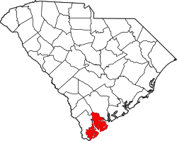
Lobeco
Location within the state of South Carolina
Coordinates: 32°33′10″N80°44′36″W / 32.55278°N 80.74333°W / 32.55278; -80.74333
Country United States
State South Carolina
County Beaufort
Area
[1]
  Total2.63 sq mi (6.80 km2)
  Land2.63 sq mi (6.80 km2)
  Water0.00 sq mi (0.00 km2)
Elevation
17 ft (5 m)
Population
 (2020) [2]
  Total292
  Density111.24/sq mi (42.94/km2)
Time zone UTC-5 (Eastern (EST))
  Summer (DST) UTC-4 (EDT)
ZIP codes
29931
Area code(s) 843, 854
FIPS code 45-42145

Lobeco (pronounced luh-BEE-co) is an unincorporated community and census-designated place (CDP) located in Beaufort County, South Carolina, United States. [3] According to the 2020 census, the population was 292. [4]

Contents

Situated about 10 miles (12 km) north of Beaufort, it is a predominantly agricultural area that has retained its rural character. A small community area consisting of a library, post office, and produce market serve as an anchor for the surrounding community. It is served by U.S. Highway 21. Nearby communities include Dale, Seabrook, and Sheldon. Its zipcode is: 29931. [5]

The community name comes from an acronym of Long, Bellamy, and Company. [6]

Lobeco has a public library, a branch of the Beaufort County Library. [7]

Demographics

Historical population
CensusPop.Note
2020 292
U.S. Decennial Census [8]
2020 [9] [2]

2020 census

Lobeco CDP, South Carolina – Demographic Profile
(NH = Non-Hispanic)
Note: the US Census treats Hispanic/Latino as an ethnic category. This table excludes Latinos from the racial categories and assigns them to a separate category. Hispanics/Latinos may be of any race.
Race / EthnicityPop 2020 [9] % 2020
White alone (NH)9933.90%
Black or African American alone (NH)15553.08%
Native American or Alaska Native alone (NH)10.34%
Asian alone (NH)41.37%
Pacific Islander alone (NH)00.00%
Some Other Race alone (NH)41.37%
Mixed Race/Multi-Racial (NH)124.11%
Hispanic or Latino (any race)175.82%
Total292100.00%

Notes

  1. "ArcGIS REST Services Directory". United States Census Bureau. Retrieved October 15, 2022.
  2. 1 2 "Census Population API". United States Census Bureau. Retrieved October 15, 2022.
  3. "Lobeco, South Carolina". Geographic Names Information System . United States Geological Survey, United States Department of the Interior.
  4. "Lobeco CDP, South Carolina". United States Census Bureau . Retrieved April 15, 2022.
  5. United States Postal Service (2012). "USPS - Look Up a ZIP Code" . Retrieved February 15, 2012.
  6. Stewart, George R. (1970). American place-names; a concise and selective dictionary for the continental United States of America . New York: Oxford University Press.
  7. "South Carolina libraries and archives". SCIWAY. Retrieved June 7, 2019.
  8. "Decennial Census of Population and Housing by Decades". US Census Bureau.
  9. 1 2 "P2 HISPANIC OR LATINO, AND NOT HISPANIC OR LATINO BY RACE – 2020: DEC Redistricting Data (PL 94-171) – Lobeco CDP, South Carolina". United States Census Bureau .


Related Research Articles

Pauline is an unincorporated community and census-designated place (CDP) in Spartanburg County, South Carolina, United States. It was first listed as a CDP in the 2020 census with a population of 209.

Beech Island is an unincorporated community and census-designated place (CDP) in Aiken County, South Carolina, United States. It was first listed as a CDP in the 2020 census with a population of 1,421.

<span class="mw-page-title-main">Green Sea, South Carolina</span> Census-designated place in South Carolina, United States

Green Sea is an unincorporated community and census-designated place (CDP) in Horry County, South Carolina, United States, near the city of Loris. It was first listed as a CDP in the 2020 census with a population of 105.

<span class="mw-page-title-main">Sheldon, South Carolina</span> Census-designated place in South Carolina, United States

Sheldon is an unincorporated community and census-designated place (CDP) in Beaufort County, South Carolina, United States. It was first listed as a CDP in the 2020 census with a population of 579.

Harbor Island is a small residential island located 14 miles (22 km) east of Beaufort, South Carolina. It is one of the Carolina Sea Islands. The swing drawbridge has been replaced by a fixed high level bridge, Harbor River Bridge, that connects the island to Saint Helena Island towards the west. A small causeway crossing Johnson Creek connects Harbor Island with Hunting Island towards the south.

Little Rock is an unincorporated community and census-designated place (CDP) in Dillon County, South Carolina, United States. Per the 2020 census, the population was 658.

<span class="mw-page-title-main">Seabrook, South Carolina</span> Census-designated place in South Carolina, United States

Seabrook is an unincorporated community and census-designated place (CDP) located in Beaufort County, South Carolina, United States. It was first listed as a CDP in the 2020 census with a population of 1,255.

La France is an unincorporated community and census-designated place (CDP) in Anderson County, South Carolina. It was first listed as a CDP in the 2020 census with a population of 476.

Dale, South Carolina, is an unincorporated community and census-designated place (CDP) located in northern Beaufort County in the southern corner of the state of South Carolina, U.S.A. It was first listed as a CDP in the 2020 census with a population of 633.

Drayton is an unincorporated community and census-designated place (CDP) in Spartanburg County, in the U.S. state of South Carolina. It was first listed as a CDP in the 2020 census with a population of 1,115.

Cypress Landing is a planned community and census-designated place (CDP) in Beaufort County, North Carolina, United States. It was first listed as a CDP in the 2020 census with a population of 1,257.

Live Oak is an unincorporated community and census-designated place (CDP) in Horry County, South Carolina, United States. As of the 2020 census it had a population of 93.

East Camden is an unincorporated area and census-designated place (CDP) in Kershaw County, South Carolina, United States. It was first listed as a CDP prior to the 2020 census with a population of 3,215.

Edmund is an unincorporated community and census-designated place (CDP) in Lexington County, South Carolina, United States. It was first listed as a CDP in the 2020 census with a population of 969.

Fairview Crossroads is an unincorporated community and census-designated place (CDP) in Lexington County, South Carolina, United States. It was first listed as a CDP prior to the 2020 census with a population of 540.

White Knoll is an unincorporated area and census-designated place (CDP) in Lexington County, South Carolina, United States. It was first listed as a CDP in the 2020 census with a population of 7,858.

Arkwright is an unincorporated area and census-designated place (CDP) adjacent to the city of Spartanburg in Spartanburg County, South Carolina, United States. It was first listed as a CDP prior to the 2020 census with a population of 2,311.

Ben Avon is an unincorporated area and census-designated place (CDP) adjacent to the city of Spartanburg in Spartanburg County, South Carolina, United States. It was first listed as a CDP prior to the 2020 census. The population as of 2020 was 2,428.

Camp Croft is an unincorporated area and census-designated place (CDP) in Spartanburg County, South Carolina, United States. It was first listed as a CDP prior to the 2020 census. The 2020 census lists a population of 2,110.

Whitney is an unincorporated area and census-designated place (CDP) adjacent to the city of Spartanburg in Spartanburg County, South Carolina, United States. It was first listed as a CDP prior to the 2020 census with a population of 4,409.