Väskinde is a locality on the Swedish island of Gotland.

Bäl is a populated area, a socken, on the Swedish island of Gotland. It comprises the same area as the administrative Bäl District, established on 1 January 2016.
Fole is a populated area, a socken, on the Swedish island of Gotland. It comprises the same area as the administrative Fole District, established on 1 January 2016.

Lummelunda is a populated area, a socken, on the Swedish island of Gotland. It comprises the same area as the administrative Lummelunda District, established on 1 January 2016.
Vamlingbo is a populated area, a socken, on the Swedish island of Gotland. It comprises the same area as the administrative Vamlingbo District, established on 1 January 2016.

Bro is a populated area, a socken, on the Swedish island of Gotland. It comprises the same area as the administrative Bro District, established on 1 January 2016.

Tofta, also known as Gotlands Tofta, is a populated area, a socken, on the Swedish island of Gotland. It comprises the same area as the administrative Tofta District, established on 1 January 2016.

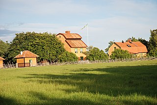
Lau is a populated area, a socken, on the Swedish island of Gotland. It comprises the same area as the administrative Lau District, established on 1 January 2016. Originally an island, it is now part of the main Gotland island due to the isostasy. It is mostly known for the good water from the spring Lau Käldu.

Burs is a populated area, a socken, on the Swedish island of Gotland. It comprises the same area as the administrative Burs District, established on 1 January 2016. As of 2015, Gustaf Edman from Burs was probably Sweden's tallest man.

Eskelhem is a populated area, a socken, on the Swedish island of Gotland. The area is rural with farms. It comprises the same area as the administrative Eskelhem District, established on 1 January 2016.

Ardre is a populated area, a socken, on the Swedish island of Gotland. It comprises the same area as the administrative Ardre District, established on 1 January 2016. It is most noted for the Viking Ardre image stones found under the floor boards of the Ardre Church.

Hamra is a populated area, a socken, on the Swedish island of Gotland. It comprises the same area as the administrative Hamra District, established on 1 January 2016.
Fide is a populated area, a socken, on the Swedish island of Gotland. It comprises the same area as the administrative Fide District, established on 1 January 2016.

Öja is a populated area, a socken, on the Swedish island of Gotland. It comprises the same area as the administrative Öja District, established on 1 January 2016.

Rone is a populated area, a socken, on the Swedish island of Gotland. It comprises the same area as the administrative Rone District, established on 1 January 2016.

Vänge is a populated area, a socken, on the Swedish island of Gotland. It comprises the same area as the administrative Vänge District, established on 1 January 2016.
Östergarn is a populated area, a socken, on the Swedish island of Gotland. It comprises the same area as the administrative Östergarn District, established on 1 January 2016.

Väte is a populated area, a socken, on the Swedish island of Gotland. It comprises the same area as the administrative Väte District, established on 1 January 2016.

Västergarn is a populated area, a socken, on the Swedish island of Gotland. It comprises the same area as the administrative Västergarn District, established on 1 January 2016.

Hejnum is a populated area, a socken, on the Swedish island of Gotland. It comprises the same area as the administrative Hejnum District, established on 1 January 2016.