Roma, Gotland

Last updated • 1 min readFrom Wikipedia, The Free Encyclopedia
Roma
Romakloster
Roma (Gotland) (2717361785).jpg
The old sugar refinery in Roma
Sweden Gotland location map modified.svg
Red pog.svg
Roma
Location of Romakloster on Gotland
Coordinates: 57°30′19.7″N18°27′14.6″E / 57.505472°N 18.454056°E / 57.505472; 18.454056
Country Sweden
Province Gotland
County Gotland County
Municipality Gotland Municipality
Area
[1]
  Total
1.26 km2 (0.49 sq mi)
Population
 (31 December 2014) [2]
  Total
936
Time zone UTC+1 (CET)
  Summer (DST) UTC+2 (CEST)

Roma (Swedish pronunciation: [ˈrûːma] ), [3] also by proxy referred to as Romakloster, is a locality on the Swedish island of Gotland, with 936 inhabitants in 2014. [2]

Contents

Roma is also the name of the larger populated area, socken (not to be confused with parish). [4] It comprises the same area as the administrative Roma District, established on 1 January 2016. [5]

Roma Abbey, a ruined medieval monastery and crown estate manor, lies in Roma. [6]

Geography

Roma is the name of the main locality in the socken. It is also the name of the socken as well as the district. Roma is situated in the central part of Gotland. [7] The medieval Roma Church, [8] is situated in the smaller locality Lövsta, sometimes referred to as Roma kyrkby, in Roma socken.

As of 2019, Roma Church belongs to Roma parish in Romaklosters pastorat. [9] [10]

History

In 1995 the locality known as Roma was divided by Statistics Sweden into a part with the tentative name of "Roma kyrkby" or "Lövsta" (pop. 277) and the remaining part that retained the name "Roma" (pop. 913), but is using "Romakloster" as the postal address. [11] Some confusion is caused by the fact that Lövsta/Roma kyrkby has been referred to as "Roma" in the statistical figures since 2000. [a]

Railways

Roma got a railway connection to Visby in 1878 and was from 1902 the island's main railway hub as a junction for its two main railways Both lines used the Swedish three-foot narrow gauge (891 mm). The railways were closed in 1953 and 1960 respectively. In 2015, however, the heritage railway Gotlands Hesselby Jernväg was extended to Roma, which thus regained access to rail traffic. [14] The railway is maintained by the Gotland Train Association. [15]

See also

Notes

  1. Cf. the population figures from 1995 for Roma kyrkby/Roma (277 people) and Romakloster (902) given in Tätorter 1995, p. 30, and Tätorter 2000, p. 27. [12] [13]

Related Research Articles

<span class="mw-page-title-main">Hemse</span> Place in Gotland, Sweden

Hemse is a locality situated on the Swedish island of Gotland with 1,700 inhabitants in 2014. It is the second largest locality on the island. Hemse is the main center of population in the southern part of the island, and it is known for its markets.

<span class="mw-page-title-main">Lärbro</span> Place in Gotland, Sweden

Lärbro is a locality on the Swedish island of Gotland, with 963 inhabitants in 2014.

<span class="mw-page-title-main">Havdhem</span> Place in Gotland, Sweden

Havdhem is a locality situated on the Swedish island of Gotland with 300 inhabitants in 2014.

<span class="mw-page-title-main">När</span> Place in Gotland, Sweden

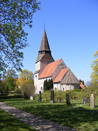
När is a populated area, a socken, on the Swedish island of Gotland, with 413 inhabitants in 2014. It comprises the same area as the administrative När District, established on 1 January 2016.

<span class="mw-page-title-main">Lövsta, Gotland</span> Place in Gotland, Sweden

Lövsta is a locality on the Swedish island of Gotland, with 261 inhabitants in 2010.

<span class="mw-page-title-main">Bäl</span> Place in Gotland, Sweden

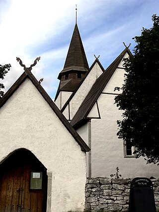
Bäl is a populated area, a socken, on the Swedish island of Gotland. It comprises the same area as the administrative Bäl District, established on 1 January 2016.

<span class="mw-page-title-main">Dalhem, Gotland</span> Place in Gotland, Sweden

Dalhem, is a populated area, a socken, on the Swedish island of Gotland. It comprises the same area as the administrative Dalhem District, established on 1 January 2016.

<span class="mw-page-title-main">Eskelhem</span> Place in Gotland, Sweden

Eskelhem is a populated area, a socken, on the Swedish island of Gotland. The area is rural with farms. It comprises the same area as the administrative Eskelhem District, established on 1 January 2016.

<span class="mw-page-title-main">Akebäck</span> Place in Gotland, Sweden

Akebäck is a populated area, a socken, on the Swedish island of Gotland. It comprises the same area as the administrative Akebäck District, established on 1 January 2016.

<span class="mw-page-title-main">Sundre, Gotland</span> Place in Gotland, Sweden

Sundre is a populated area, a socken, on the Swedish island of Gotland. It comprises the same area as the administrative Sundre District, established on 1 January 2016.

<span class="mw-page-title-main">Hörsne-Bara</span> Place in Gotland, Sweden

Hörsne-Bara is a populated area, a socken, on the Swedish island of Gotland. Formerly two sockens, Hörsne and Bara, Bara was merged with Hörsne under the name Hörsne socken or Hörsne with Bara socken. It comprises the same area as the administrative Hörsne-Bara District, established on 1 January 2016.

<span class="mw-page-title-main">Ala, Gotland</span> Place in Gotland, Sweden

Ala is a populated area, a socken, on the Swedish island of Gotland. It comprises the same area as the administrative Ala District, established on 1 January 2016.

<span class="mw-page-title-main">Boge, Gotland</span> Place in Gotland, Sweden

Boge is a populated area, a socken, on the Swedish island of Gotland. It comprises the same area as the administrative Boge District, established on 1 January 2016.

<span class="mw-page-title-main">Ekeby, Gotland</span> Place in Gotland, Sweden

Ekeby is a populated area, a socken, on the Swedish island of Gotland. It comprises the same area as the administrative Ekeby District, established on 1 January 2016.

<span class="mw-page-title-main">Endre, Gotland</span> Place in Gotland, Sweden

Endre is a populated area, a socken, on the Swedish island of Gotland. It comprises the same area as the administrative Endre District, established on 1 January 2016.

<span class="mw-page-title-main">Etelhem</span> Place in Gotland, Sweden

Etelhem is a populated area, a socken, on the Swedish island of Gotland. It comprises the same area as the administrative Etelhem District, established on 1 January 2016.

<span class="mw-page-title-main">Follingbo</span> Region of the Swedish island of Gotland

Follingbo is a populated area, a socken, on the Swedish island of Gotland. It comprises the same area as the administrative Follingbo District, established on 1 January 2016.

<span class="mw-page-title-main">Gammelgarn</span> Place in Gotland, Sweden

Gammelgarn is a populated area, a socken, on the Swedish island of Gotland. It comprises the same area as the administrative Gammelgarn District, established on 1 January 2016.

<span class="mw-page-title-main">Ganthem</span> Place in Gotland, Sweden

Ganthem is a populated area, a socken, on the Swedish island of Gotland. It comprises the same area as the administrative Ganthem District, established on 1 January 2016.

<span class="mw-page-title-main">Klinte</span> Place in Gotland, Sweden

Klinte is a populated socken on the Swedish island of Gotland. It comprises the same area as the administrative Klinte District, established on 1 January 2016.

References

  1. "Tätorternas landareal, folkmängd och invånare per km2 2005 och 2010" (in Swedish). Statistics Sweden. 14 December 2011. Archived from the original on 27 January 2012. Retrieved 10 January 2012.
  2. 1 2 "Gotland i siffror 2015" [Gotland in numbers 2015]. www.gotland.se. Gotland Municipality . Retrieved 25 May 2016.
  3. Jöran Sahlgren; Gösta Bergman (1979). Svenska ortnamn med uttalsuppgifter (in Swedish). p. 20.
  4. The exact extent of the socken, now district, can be obtained by clicking on Kartinställningar and check the Socken box in the menu of this map from the Swedish National Heritage Board database.
  5. "Förordning om district" [Regulation of districts](PDF). Ministry of Finance. 17 June 2015. Retrieved 24 May 2016.
  6. Lagerlöf, Erland; Svahnström, Gunnar (1973). Gotlands kyrkor[Gotland's Churches] (in Swedish). Stockholm: Rabén & Sjögren. pp. 221–223. ISBN   91-29-41035-5. SELIBR   7232718.
  7. "Roma". www.ne.se. Nationalencyklopedin . Retrieved 31 May 2016.
  8. Lagerlöf, Erland; Svahnström, Gunnar (1973). Gotlands kyrkor[Gotland's Churches] (in Swedish). Stockholm: Rabén & Sjögren. pp. 223–224. ISBN   91-29-41035-5. SELIBR   7232718.
  9. "Församlingar på Gotland". www.svenskakyrkan.se. Church of Sweden . Retrieved 12 January 2019.
  10. "Visby stifts indelning 2018". www.svenskakyrkan.se. Church of Sweden . Retrieved 12 January 2019.
  11. Tätorter 1995, p. 30 (population; see footnote for the tentative character of the names), 62 (list of new localities since 1990)
  12. "Tätorter 1995, Statistiska meddelanden" (PDF). Be. Stockholm: SCB, Programmet för regional planering och naturresurser, Beställningsnummer Be 16 SM 9601. 1996.
  13. "Tätorter 2000, Sveriges Officiella statistik. Statistiska meddelanden, MI 38 SM 0101" (PDF). MI. Stockholm: SCB. 2002.
  14. Svensson, Anders. "Slite- Roma 1902, 33 km". www.gotlandstaget.se. Gotland Train Association. Retrieved 26 May 2016.
  15. Molin, Maria. "En resa bakåt i tiden med Gotlandståget". www.gotland.net. Gotlands Media AB. Retrieved 26 May 2016.