| Los Arrayanes National Park | |
|---|---|
| Parque Nacional Los Arrayanes | |
IUCN category II (national park) | |
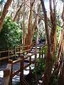
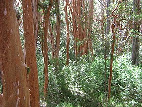
The Arrayán forest, in Los Arrayanes National Park | |
 | |
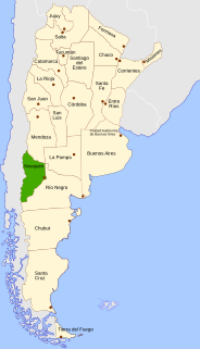
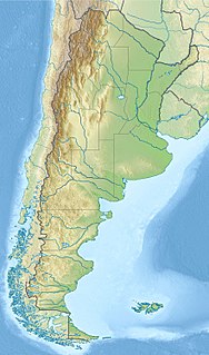
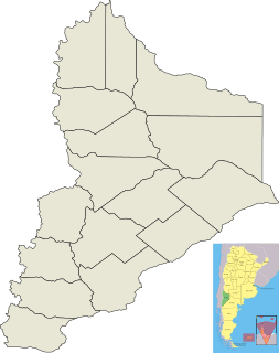
| Location | Neuquén Province, Argentina |
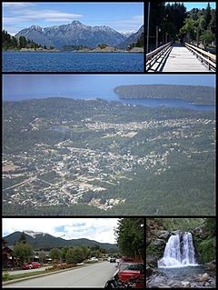
| Nearest city | Villa La Angostura |
| Coordinates | 40°50′S71°37′W / 40.833°S 71.617°W Coordinates: 40°50′S71°37′W / 40.833°S 71.617°W |
| Area | 17.53 km2 (6.77 sq mi) |
| Established | 1971 |
| Governing body | Administración de Parques Nacionales |
Los Arrayanes National Park (Spanish : Parque Nacional Los Arrayanes) is a national park of Argentina with an area of 17.53 square kilometres. It covers the Quetrihué Peninsula on the shore of the Nahuel Huapi Lake in the province of Neuquén, 3 km from Villa la Angostura.

Spanish or Castilian is a Romance language that originated in the Castile region of Spain and today has hundreds of millions of native speakers in the Americas and Spain. It is a global language and the world's second-most spoken native language, after Mandarin Chinese.

A national park is a park in use for conservation purposes. Often it is a reserve of natural, semi-natural, or developed land that a sovereign state declares or owns. Although individual nations designate their own national parks differently, there is a common idea: the conservation of 'wild nature' for posterity and as a symbol of national pride. An international organization, the International Union for Conservation of Nature (IUCN), and its World Commission on Protected Areas (WCPA), has defined "National Park" as its Category II type of protected areas.
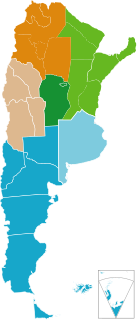
Argentina, officially the Argentine Republic, is a country located mostly in the southern half of South America. Sharing the bulk of the Southern Cone with Chile to the west, the country is also bordered by Bolivia and Paraguay to the north, Brazil to the northeast, Uruguay and the South Atlantic Ocean to the east, and the Drake Passage to the south. With a mainland area of 2,780,400 km2 (1,073,500 sq mi), Argentina is the eighth-largest country in the world, the fourth largest in the Americas, and the largest Spanish-speaking nation. The sovereign state is subdivided into twenty-three provinces and one autonomous city, Buenos Aires, which is the federal capital of the nation as decided by Congress. The provinces and the capital have their own constitutions, but exist under a federal system. Argentina claims sovereignty over part of Antarctica, the Falkland Islands, and South Georgia and the South Sandwich Islands.
Contents
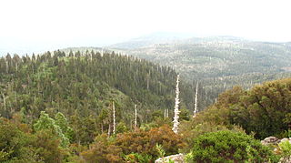
Even though arrayán trees (Luma apiculata) can be seen on the way to the end of the peninsula, the forest of 300-year-old arrayanes covers 0.2 km² of the southern point, with individuals of over 600 years. The forest can be reached by boat from different points of the Nahuel Huapi lake, or a 12 km path from the beginning of the park at the port of Villa La Angostura. This path, full of ups and downs, is also popularly done by mountain bike.

Luma apiculata, the Chilean myrtle, is a species of flowering plant in the myrtle family, native to the central Andes between Chile and Argentina, at 33 to 45° south latitude. Growing to 10–15 m (33–49 ft) tall and wide, it is a vigorous, bushy, evergreen tree with fragrant flowers.
A peninsula is a landform surrounded by water on the majority of its border while being connected to a mainland from which it extends. The surrounding water is usually understood to be continuous, though not necessarily named as a single body of water. Peninsulas are not always named as such; one can also be a headland, cape, island promontory, bill, point, or spit. A point is generally considered a tapering piece of land projecting into a body of water that is less prominent than a cape. A river which courses through a very tight meander is also sometimes said to form a "peninsula" within the loop of water. In English, the plural versions of peninsula are peninsulas and, less commonly, peninsulae.

A mountain bike or mountain bicycle is a bicycle designed for off-road cycling. Mountain bikes share similarities with other bicycles, but incorporate features designed to enhance durability and performance in rough terrain. These typically include a front or full suspension, large knobby tires, more durable wheels, more powerful brakes, straight handlebars, and lower gear ratios for climbing steep grades.
There are a few pudú and huemul deer, guanacos, monitos de monte and small foxes. Among the birds, condors, eagles, hawks and woodpeckers can be found here.

The pudús are two species of South American deer from the genus Pudu, and are the world's smallest deer. The name is a loanword from Mapudungun, the language of the indigenous Mapuche people of central Chile and south-western Argentina. The two species of pudús are the northern pudú from Venezuela, Colombia, Ecuador, and Peru, and the southern pudú from southern Chile and south-western Argentina. Pudús range in size from 32 to 44 centimeters tall, and up to 85 centimeters (33 in) long. The southern pudu is currently classified as near threatened, while the northern pudu is classified as Data Deficient in the IUCN Red List.
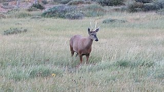
The south Andean deer, also known as the southern guemal, Chilean huemul or güemul, is an endangered species of deer native to the mountains of Argentina and Chile. One of two mid-sized deer of the Hippocamelus genus, the south Andean deer ranges across the high mountainsides and cold valleys of the Andes. The distribution and habitat, behaviour, and diet of the deer have all been the subject of study. The viability of the small remaining population is an outstanding concern to researchers.
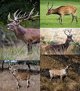
Deer are the hoofed ruminant mammals forming the family Cervidae. The two main groups of deer are the Cervinae, including the muntjac, the elk (wapiti), the fallow deer, and the chital; and the Capreolinae, including the reindeer (caribou), the roe deer, and the moose. Female reindeer, and male deer of all species except the Chinese water deer, grow and shed new antlers each year. In this they differ from permanently horned antelope, which are part of a different family (Bovidae) within the same order of even-toed ungulates (Artiodactyla).
Even though it was already part of the Nahuel Huapi National Park, Los Arrayanes was created in 1971 to protect its forest of rare arrayán trees. To protect the soil and the roots of these fragile trees, a wooden path has been made for the tourist to enjoy the view of the cinnamon-coloured trees.

Nahuel Huapi National Park is the oldest national park in Argentina, established in 1934. It surrounds Nahuel Huapi Lake in the foothills of the Patagonian Andes. The largest of the national parks in the region, it has an area of 7,050 km2 (2,720 sq mi), or nearly 2 million acres. Its landscapes represent the north Patagonian Andean Zone consisting of three types, namely, the Altoandino, the Andino-Patagónico and the Patagonian steppe. It also represents small parts of the Valdivian Rainforest.
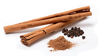
Cinnamon is a spice obtained from the inner bark of several tree species from the genus Cinnamomum. Cinnamon is used mainly as an aromatic condiment and flavouring additive in a wide variety of cuisines, sweet and savoury dishes, breakfast cereals, snackfoods, tea and traditional foods. The aroma and flavour of cinnamon derive from its essential oil and principal component, cinnamaldehyde, as well as numerous other constituents, including eugenol.