
The River Severn, at 220 miles (354 km) long, is the longest river in Great Britain. It is also the river with the most voluminous flow of water by far in all of England and Wales, with an average flow rate of 107 m3/s (3,800 cu ft/s) at Apperley, Gloucestershire. It rises in the Cambrian Mountains in mid Wales, at an altitude of 2,001 feet (610 m), on the Plynlimon massif, which lies close to the Ceredigion/Powys border near Llanidloes. The river then flows through Shropshire, Worcestershire and Gloucestershire. The county towns of Shrewsbury, Worcester and Gloucester lie on its course.

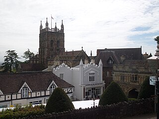
Worcester is a cathedral city in Worcestershire, England, of which it is the county town. It is 30 mi (48 km) south-west of Birmingham, 27 mi (43 km) north of Gloucester and 23 mi (37 km) north-east of Hereford. The population was 103,872 in the 2021 census.

The Battle of Worcester took place on 3 September 1651 in and around the city of Worcester, England and was the last major battle of the 1642 to 1651 Wars of the Three Kingdoms. A Parliamentarian army of around 28,000 under Oliver Cromwell defeated a largely Scottish Royalist force of 16,000 led by Charles II of England.

The River Teme rises in Mid Wales, south of Newtown, and flows southeast roughly forming the border between England and Wales for several miles through Knighton before entering England in the vicinity of Bucknell and continuing east to Ludlow in Shropshire. From there, it flows to the north of Tenbury Wells on the Shropshire/Worcestershire border on its way to join the River Severn south of Worcester. The whole of the River Teme was designated as an SSSI by English Nature in 1996.
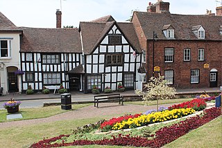
Upton-upon-Severn is a town and civil parish in the Malvern Hills District of Worcestershire, England. Lying on the A4104, the 2021 census recorded a population of 2,903 for the town.
Malvern Hills is a local government district in Worcestershire, England. Its council is based in Malvern, the district's largest town. The district also includes the towns of Tenbury Wells and Upton-upon-Severn and a large rural area covering much of the western side of the county, including numerous villages. The district is named after the Malvern Hills, which are a designated Area of Outstanding Natural Beauty.

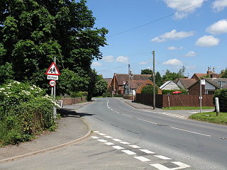
Abberley is a village and civil parish in north west Worcestershire, England.

Shelsley Walsh is a small village and civil parish in Worcestershire, England, on the western side of the River Teme. For administrative purposes it is presently located in the Teme Valley ward of the county’s Malvern Hills district. In the 2011 Census there was an estimated population of 28 people in 12 households. The site has been farmed since Anglo Saxon times and there are also vestiges of former industry, but it is now best known for its association with the Shelsley Walsh Speed Hill Climb.

Kempsey is a village and civil parish in the Malvern Hills District in the county of Worcestershire, England. It is bounded by the River Severn on the west, and the A38 main road runs through it and is about 3 miles (5 km) south of Worcester. The village has a long history. Its name is derived from the Saxon "Kemys' Eye", or the island of Kemys. Kemys was a Saxon chief, whose island lay between marshes and the River Severn. One of the roads in Kempsey, Lyf's Lane, is named after another Saxon chief. The village was recorded in the 11th century Domesday Book as having a value of £7.

Powick is a village and civil parish in the Malvern Hills district of Worcestershire, England, located two miles south of the city of Worcester and four miles north of Great Malvern. The parish includes the village of Callow End and the hamlets of Bastonford, Clevelode, Collett's Green, and Deblins Green.
Holt is a village and civil parish in the Malvern Hills District of the county of Worcestershire, England. The church is dedicated to St. Martin, and dates from about the 12th century. Holt Bridge, over the River Severn, was designed by Thomas Telford, and opened in 1830.
Little Witley is a village and civil parish in the Malvern Hills District in the county of Worcestershire, England.

Clifton upon Teme is a village and civil parish in the Malvern Hills District in the county of Worcestershire, England.
Callow End is a constituent village of the civil parish of Powick in the Malvern Hills District of Worcestershire, England. It is located on the B4424 road about 1 mile (1.6 km) to the south of its junction with the main A449 Malvern to Worcester road. The River Severn runs down the eastern side of the village.

St John's is a western suburb of Worcester in Worcestershire, England, lying west of the city centre and the River Severn. St. John's is referred to locally as the "Village in the City", which is partly due to being an independent township, before joining the city in 1837. There is still a sense of identity within the community.

Worcestershire was the county where the first battle and last battle of the English Civil War took place. The first battle, the Battle of Powick Bridge, fought on 23 September 1642, was a cavalry skirmish and a victory for the Royalists (Cavaliers). The final battle, the battle of Worcester, fought on 3 September 1651, was decisive and ended the war with a Parliamentary (Roundhead) victory and King Charles II a wanted fugitive.

The River Corve is a minor river in Shropshire, England. It is a tributary of the River Teme which it joins in the town of Ludlow, and which joins the River Severn at Powick near Worcester. The valley it flows through is known as the Corvedale, a term used as a general name for the area, and a name used for example by the primary school in Diddlebury. It is sometimes (archaically) spelled "Corf", which is its pronunciation.

Diglis is an inner-city area and suburb of Worcester in Worcestershire, England. It is located around half a mile south of the city centre on the banks of River Severn. The Worcester and Birmingham Canal starts in Diglis, connected to the Severn. Diglis Lock is a wide-beam lock allowing river craft access to Diglis Basin. Diglis Island is a sliver of land in the middle of the River Severn opposite the opening of The Worcester and Birmingham Canal, which has featured art displays and tours. Diglis House Hotel sits on the banks of the River Severn to the south of Worcester Cathedral. The area immediately next to the river is often affected by flooding such as in autumn 2000 and summer 2007. New apartments have been built in Diglis and there has been some investment in the popular waterfront areas with tourists. Diglis Bridge, a pedestrian and cycle bridge across the Severn, opened in 2010 linking Diglis and St Peter's with Lower Wick. In 2021, Princess Anne opened a fish viewing gallery at the Severn Bridge.

