Redditch

Last updated

Redditch
Town and Borough
Church Green East, Redditch - geograph.org.uk - 2132059.jpg
Church Green East, Redditch.
Motto: 
REDDITE DEO [1]
B postcode area map.svg
Redditch as seen under the B97 & B98 Postcodes.
Coordinates: 52°18′00″N1°56′00″W / 52.3°N 1.933333°W / 52.3; -1.933333
Country United Kingdom
Constituent country England
Region West Midlands
Ceremonial County Worcestershire
District Redditch
New Town status10 April 1964
Borough status15 May 1980
UK Parliament Redditch
District Redditch
Government
  TypeNon-metropolitan district council
  Body Redditch Borough Council
   MP Rachel Maclean (Conservative)
Area
[2]
   District 20.95 sq mi (54.25 km2)
  Rank240th
Elevation
430 ft (130 m)
Population
 (2021) [3]
   District 86,996
  Rank272nd
  Density4,150/sq mi (1,604/km2)
   Urban
[4]
81,635
Ethnicity (2021)
[5]
   Ethnic groups
List
Religion (2021)
[5]
   Religion
List
  Summer (DST)GMT
Postcodes
B96, B97, B98
Post town
redditch
Dialling code 01527
ONS code 47UD (ONS)
E07000236 (GSS)
Website www.redditchbc.gov.uk

Redditch is a town and borough in Worcestershire, England. It is located south of Birmingham, east of Bromsgrove, northwest of Alcester and northeast of Worcester. The borough had a population of 87,037 in 2021. In the 19th century, it became a centre for the needle and fishing tackle industry.

Contents

90% of the world's needles were manufactured in the town and its surrounding areas. [6] In the 1960s, it became part of the new town planning movement which included it expanding into neighbouring villages and hamlets surrounding the town. It is the second largest settlement in Worcestershire, after Worcester.

History

Commemorative pavement plaque in Alcester Street Redditch 004.jpg
Commemorative pavement plaque in Alcester Street

The first recorded mention of Redditch (Red-Ditch, thought to be a reference to the red clay of the nearby River Arrow) is in 1348, the year of the outbreak of the Black Death. During the Middle Ages, it became a centre of needle-making and later prominent industries were fish-hooks, fishing tackle, motorcycles and springs, the last of which was notably undertaken by Herbert Terry and Sons. Redditch was designated a new town on 10 April 1964, [7] and the population increased dramatically[ when? ] from 32,000 to around 77,000. Housing developments such as Church Hill, Matchborough, Winyates, Lodge Park, and Woodrow were created to accommodate a large overspill from the industrially expanding Birmingham. Redditch was built as a "flagship" town using new methods and new town planning: all the main roads (mostly new dual carriageways as well as a ring road for the town centre) were banked to reduce noise to the new housing estates, and the whole of Redditch was landscaped. Historically, much of present-day Redditch was located within Warwickshire, but it is now in its entirety administered as a part of Worcestershire.

By the 21st century, needle-making and other traditional industries had been replaced by modern light industry and services, with Redditch also functioning as a dormitory town for Birmingham. The automotive retailer Halfords and engineering company GKN both have their headquarters in Redditch. Manufacturer of precious metal contacts, Samuel Taylor Ltd, has manufacturing plants within the town. Following the redevelopment of the flagship Kingfisher Shopping Centre in 2002, Redditch is undergoing an economic and cultural renaissance.[ citation needed ]

The town is home to several historical sites.[ citation needed ] The National Needle Museum and the ruins of Bordesley Abbey are located in the Abbey Ward district, and the remains of a medieval moated settlement called Moons Moat are within the Church Hill estate. [8] [9] [10]

Governance

There are two main tiers of local government covering Redditch, at district and county level: Redditch Borough Council and Worcestershire County Council. The borough council is based at Redditch Town Hall on Walter Stranz Square, which was purpose-built for the council and opened in 1982. [11] [12]

The borough contains just one civil parish at Feckenham, in the more rural south-western part of the borough. The rest of the borough is an unparished area. [13]

The parliamentary constituency of Redditch is represented by Rachel Maclean of the Conservatives, elected in the 2017 General Election.

Geography

Redditch is south of the West Midlands urban area. It is north of Evesham on the A435, which skirts it to the east. The main access routes are the A441 via junction 2 of the M42 Motorway, the A435 from junction 3 of the M42 and the A448 via junctions 4 or 5 of the M5. The Roman Road known as Icknield Street is prominent, running north to south through the eastern side of the town.

Districts of Redditch

The Borough of Redditch is divided into several districts. To the east of the town are "New Town Districts" built in the 1970s and 1980s. To the west of the Borough are older "Former Village Districts" that dominate the south and west.

See: Districts of Redditch

Since 2011, Redditch has participated in the Greater Birmingham & Solihull Local Enterprise Partnership along with neighbouring authorities Birmingham, Bromsgrove, Cannock Chase, East Staffordshire, Lichfield, Solihull, Tamworth, and Wyre Forest.

Green belt

Redditch is within a green belt region that extends into the wider surrounding counties, and is in place to reduce urban sprawl, prevent further convergence between the towns surrounding the West Midlands conurbations of Birmingham and Coventry, protect the identity of outlying communities, encourage brownfield reuse, and preserve nearby countryside. This is achieved by restricting inappropriate development within the designated areas, and imposing stricter conditions on permitted building. [14]

The main urban area up to the Webheath, Walkwood, and Hunt End suburbs, Astwood Bank, and the southernmost extent of the borough are exempt from the green belt area, bar small adjacent green belt 'wedges', but surrounding smaller villages, hamlets, and rural areas such as Feckenham, Littleworth, Old Yarr, and Ham Green up to the B4090 Salt Way road are 'washed over' by the designation. The green belt was first drawn up under Worcestershire County Council, and the size in the borough in 2017 amounted to some 1,800 hectares (18 km2; 6.9 sq mi). [15] [16]

Transport

The M42 motorway is a short drive away and it is linked by dual carriageways and A-class roads to surrounding towns such as Bromsgrove and Evesham. There are regular bus services to Studley, Bromsgrove, Catshill, and Birmingham.

Railway

The railway station is the southern terminus of the Cross-City Line and provides a regular train service via Birmingham New Street to Four Oaks and Lichfield. Redditch railway station was first opened as the terminus of the Redditch Railway on 19 September 1859, alongside what is now Clive Road. This first station stayed until 4 May 1868 when the last section from Alcester to Redditch of the Redditch and Evesham Railway was closed, at which point a second station was built alongside the junction of Bromsgrove Road and Plymouth Road. This station was provided with a standard Midland Railway design and two platforms. The current station was built in 1993.

Buses

The former Redditch Bus Station, c. 1996 Redditch Bus Station 1996.jpg
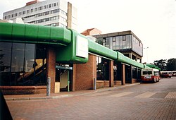
The former Redditch Bus Station, c.1996

There is an extensive network of local bus services run by Diamond West Midlands and other operators (including Stagecoach and a community run bus). Many services run from the bus station in the town centre, a postcard of which was voted Britain's most boring postcard in a competition run by the photographer Martin Parr [ citation needed ]. The bus station was rebuilt as part of the 2002 shopping centre expansion.

Some areas of Redditch have dedicated bus routes; however, there have been issues with safety on these routes and 3 children have died over the past 15 years.[ citation needed ]

Road system

Redditch is occasionally noted[ by whom? ] for its confusing road system dominated by a system of dual carriageways built when it became a New Town, including the only cloverleaf interchange in England at the junction of the A441 and the Bromsgrove-bound A448. The system is designed to allow rapid flow of large volumes of traffic around the various districts and into the town centre, whilst keeping fast moving vehicles separated from residential streets. Redditch was briefly famous (via The Graham Norton Show) for a tongue-in-cheek calendar featuring its "picturesque" roundabouts created by a local printing company. The calendar was called, unsurprisingly, 'Roundabouts of Redditch' and it proved so successful that it sparked a national series.[ citation needed ] This self-similar pattern is found on a smaller scale in many of the modern estates in the town, which follow a Radburn style of planned community.

Education

Redditch is one of the few areas of the country where the three-tier system of first, middle, and high schools still exists. Students attend first school from the age of 4, middle school from the age of 9, and high school at the age of 13. Other areas of Worcestershire adopted this system at the same time as Redditch (in the 1970s), but many have reverted to the traditional 5–7 infant, 7–11 junior and 11-16/18 secondary schools.

Redditch currently has four high schools (RSA Academy Arrow Vale, Saint Augustine's Catholic High School, Tudor Grange Academy, Trinity High School) and six middle schools.

Heart of Worcestershire College (often referred to locally as "HOW College") is a large general further education college: one of its four campuses is in central Redditch; the other three are in Bromsgrove, Worcester, and Malvern. The closest university is the University of Birmingham, 12.5 miles (20 km) to the north.

Media

Local news and television programmes are provided by BBC West Midlands and ITV Central. Television signals are received from the Sutton Coldfield transmitter. [17]

Local radio stations are BBC Hereford and Worcester, Heart West Midlands, Radio Wyvern, Capital Mid-Counties, Greatest Hits Radio Midlands, Free Radio, and Smooth West Midlands.

Redditch's local newspapers are The Redditch Standard and Redditch Advertiser. [18] [19]

Amenities

St Stephen's Church (Church of England) Church of St Stephen, Redditch - geograph.org.uk - 7218.jpg
St Stephen's Church (Church of England)

Since June 2013, the swimming pool at Abbey Stadium Leisure Centre has been warmed using waste heat from the nearby Redditch Crematorium, in a scheme designed to save around £15,000 a year. [20]

The 2012 film Sightseers is partly set in Redditch. [21]

Redditch is featured in a section heading in An Utterly Impartial History of Britain by John O'Farrell. [22]

Birmingham and national TV comedian Jasper Carrott makes Redditch a repeated butt of his jokes, for example over the difficulty of escaping the Redditch ring road. [23]

There is a listed theatre in Redditch called the Palace Theatre.

Places of interest

Redditch Landmarks

Kingfisher Shopping Centre

Worcester Square Redditch001.jpg
Worcester Square

Kingfisher Shopping Centre was opened in 1976 by the then Prime Minister James Callaghan and now forms the town's primary retail centre.

The centre has over 1,100,000 square feet (100,000 m2) of retail space, [24] with stores including Primark, Next plc, Boots UK, H&M, The Perfume Shop, and Warren James Jewellers. It is one of the largest covered shopping centres in the United Kingdom. In 2007, a cinema opened on the new upper floor and is now owned by Vue Cinemas.

Arrow Valley Country Park

View across Arrow Valley Lake ArrowValleyLake WaterTower.JPG
View across Arrow Valley Lake

Redditch has 900 acres (3.6 km2) of public open space in Arrow Valley Country Park. This incorporates the 30-acre (120,000 m2) Arrow Valley Lake, fed by the River Arrow. The park incorporates a Local Nature Reserve, Proctor's Barn Meadow. [25] The Arrow Valley Countryside centre, opened in 2000 in the Country Park, has a lakeside café, gift shop and an interactive exhibition. The lake is also used for water sports. There are four waymarked trails for walking and cycling around the lake and through the Country Park. There is a skate park in the south of the park with walks along the river Arrow through the Country Park to the Forge Mill Museum in the north. There are interactive events and family activities at the Countryside Centre and a comprehensive children's play area.

Royal Enfield motorcycles

Redditch was the home of the Royal Enfield motorcycle. This is where the main factory of the original company was located and the business continued manufacturing until the 1960s, the last model being the Interceptor. The Redditch factory was closed in 1967 and production was moved to the Bradford on Avon factory, which closed in 1970, ending English Enfield manufacturing.[ citation needed ] In the mid 1950s, the company established a partner, Madras Motors, in Madras, India, who manufactured the Bullet 350 model. The Indian factory is producing new models and has taken Royal Enfield into its third century of manufacturing.[ citation needed ] Some of the original factory buildings in Redditch still remain, most are in a derelict state and can be seen from Hewell Road. Some buildings have been taken over and now make the old part of Enfield Industrial Estate close to the town centre on Hewell Road.

Notable people

Town twinning

In 1956, Redditch was twinned with Auxerre in Burgundy, France. This twinning proved sufficiently popular to form an organisation named The Friends of Auxerre (FoA). At the beginning of June each year the coupling of these two towns is officially celebrated.

In 1986, Redditch was twinned with Mtwara in Tanzania. Frequent events are organised with assistance from the community of Tanzanian students at Birmingham University and Selly Oak College.

Redditch also has formal "Friendship" links [36] with:

Sport

Redditch sport teams include:

Climate

Redditch has an oceanic climate (Köppen climate classification Cfb) similar to almost all of the United Kingdom.

Climate data for Redditch
MonthJanFebMarAprMayJunJulAugSepOctNovDecYear
Mean daily maximum °C (°F)7
(45)
7
(45)
10
(50)
13
(55)
16
(61)
19
(66)
21
(70)
21
(70)
18
(64)
14
(57)
10
(50)
8
(46)
14
(57)
Mean daily minimum °C (°F)2
(36)
1
(34)
3
(37)
4
(39)
7
(45)
10
(50)
12
(54)
12
(54)
10
(50)
7
(45)
4
(39)
2
(36)
6
(43)
Average precipitation mm (inches)71.4
(2.81)
50.8
(2.00)
58
(2.3)
58
(2.3)
53.5
(2.11)
58
(2.3)
50
(2.0)
67.7
(2.67)
61.8
(2.43)
70.0
(2.76)
71.0
(2.80)
75.1
(2.96)
745.3
(29.44)
Average precipitation days129111099899111111119
Source: NOAA [41]

See also

Related Research Articles

<span class="mw-page-title-main">Worcestershire</span> County of England

Worcestershire is a ceremonial county in the West Midlands of England. It is bordered by Shropshire, Staffordshire, and the West Midlands county to the north, Warwickshire to the east, Gloucestershire to the south, and Herefordshire to the west. The city of Worcester is the largest settlement and the county town.

<span class="mw-page-title-main">West Midlands (county)</span> County of England

West Midlands is a metropolitan and ceremonial county in the larger West Midlands region of England. A landlocked county, it is bordered by Staffordshire to the north and west, Worcestershire to the south, and is surrounded by Warwickshire to the east. The largest settlement is the city of Birmingham.

<span class="mw-page-title-main">Evesham</span> Human settlement in England

Evesham is a market town and parish in the Wychavon district of Worcestershire, in the West Midlands region of England. It is located roughly equidistant between Worcester, Cheltenham and Stratford-upon-Avon. It lies within the Vale of Evesham, an area comprising the flood plain of the River Avon, which has been renowned for market gardening. The town centre, situated within a meander of the river, is subjected regularly to flooding. The 2007 floods were the most severe in recorded history.

<span class="mw-page-title-main">West Midlands (region)</span> Region of England

The West Midlands is one of nine official regions of England at the first level of International Territorial Level for statistical purposes. It covers the western half of the area traditionally known as the Midlands. The region consists of the counties of Herefordshire, Shropshire, Staffordshire, Warwickshire, West Midlands and Worcestershire. The region has seven cities; Birmingham, Coventry, Hereford, Lichfield, Stoke-on-Trent, Wolverhampton and Worcester.

<span class="mw-page-title-main">Alcester</span> Market town and civil parish in Warwickshire, England

Alcester is a market town and civil parish in the Stratford-on-Avon District in Warwickshire, England. It is 8 mi (13 km) west of Stratford-upon-Avon, and 7 miles south of Redditch. The town dates back to the times of Roman Britain and is located at the junction of the River Alne and River Arrow.

<span class="mw-page-title-main">Bromsgrove District</span> Non-metropolitan district in England

Bromsgrove is a local government district in north-east Worcestershire, England. It is named after its only town, Bromsgrove, where its council is based, but also includes several villages and surrounding rural areas. It borders the built-up area of Birmingham to the north. Other places in the district include Alvechurch, Aston Fields, Belbroughton, Catshill, Clent, Hagley, Rubery, Stoke Prior and Wythall. The population at the 2021 census was 99,475.

<span class="mw-page-title-main">Metropolitan Borough of Solihull</span> Metropolitan borough in England

The Metropolitan Borough of Solihull is a metropolitan borough in West Midlands county, England. It is named after its largest town, Solihull, from which Solihull Metropolitan Borough Council is based. For Eurostat purposes it is a NUTS 3 region and is one of seven boroughs or unitary districts that comprise the "West Midlands" NUTS 2 region. Much of the large residential population in the north of the borough centres on the communities of Castle Bromwich, Kingshurst, Marston Green and Smith's Wood as well as the towns of Chelmsley Wood and Fordbridge. In the south are the towns of Shirley and Solihull, as well as the large villages of Knowle, Dorridge, Meriden and Balsall Common.

<span class="mw-page-title-main">Studley, Warwickshire</span> Village and civil parish in the Stratford-on-Avon district of Warwickshire, England

Studley is a large village and civil parish in the Stratford-on-Avon district of Warwickshire, England. Situated on the western edge of Warwickshire near the border with Worcestershire, it is 3.5 miles (6 km) southeast of Redditch and 13 miles (21 km) northwest of Stratford-upon-Avon. The Roman road of Ryknild Street, now the A435, passes through the village on its eastern edge, parallel to the River Arrow. The name derives from the Old English leah, being a meadow or pasture, where horses, stod, are kept.

<span class="mw-page-title-main">Government of Birmingham</span>

Birmingham, a city and metropolitan borough in the West Midlands, England, is the second-largest city in the United Kingdom.

The West Midlands region straddles the historic borders between the counties of Warwickshire, Staffordshire in the north, and Worcestershire in the south.

<span class="mw-page-title-main">Redditch railway station</span> Railway station in Worcestershire, England

Redditch railway station serves the town of Redditch, North Worcestershire, England. It is the southern terminus of the Cross-City Line 14.5 miles (23 km) south of Birmingham New Street. The station, and all trains serving it, are operated by West Midlands Trains. Redditch station sits at the end of a single track branch line from Barnt Green which forms part of the Cross-City Line. The line used to continue south to Ashchurch and also Evesham but this was closed in the 1960s.

<span class="mw-page-title-main">Callow Hill, Worcestershire</span> Human settlement in England

Callow Hill is an area of Redditch, in Worcestershire, England. Other villages nearby include Astwood Bank, Feckenham, Cookhill, and Webheath.

<span class="mw-page-title-main">Harvington</span> Human settlement in England

Harvington is a village near Evesham in Worcestershire, England. Bounded by the River Avon to the south and the Lench Hills to the north, three miles northeast of Evesham and now on the Worcestershire/Warwickshire border. The village today is an amalgamation of two smaller villages, Harvington and Harvington Cross, and has a population of around 1,750.

Redditch is a town and local government district in Worcestershire, England. The town is divided into separate districts. All street-name signs in Redditch have the street name in white lettering on a blue background and the district name in black lettering on a white background at the bottom of the sign. In the New Town areas the roads are usually named in alphabetical order and house numbering in the cul-de-sac closes is consecutive, starting with number 1 as the first house on the left as you enter, and the highest house number will be on the opposite side of the road as you leave.

<span class="mw-page-title-main">Evolution of Worcestershire county boundaries since 1844</span>

The administrative boundaries of Worcestershire, England have been fluid for over 150 years since the first major changes in 1844. There were many detached parts of Worcestershire in the surrounding counties, and conversely there were islands of other counties within Worcestershire. The 1844 Counties Act began the process of eliminating these, but the process was not completed until 1966, when Dudley was absorbed into Staffordshire.

The Greater Birmingham & Solihull Local Enterprise Partnership (GBSLEP) is one of 39 Local Enterprise Partnerships set up by Government to drive economic development in England.

<span class="mw-page-title-main">West Midlands Green Belt</span> British urban planning policy to maintain countryside around West Midlands urban areas

The West Midlands Green Belt is a statutory green belt environmental and planning policy that regulates the rural space within the West Midlands region of England. It is contained within the counties of the West Midlands, Shropshire, Staffordshire, Warwickshire and Worcestershire. Essentially, the function of the green belt is to more rigorously manage development around the cities, towns and villages in the large West Midlands conurbations centred around Birmingham and Coventry, discouraging convergence. It is managed by local planning authorities on guidance from central government.

<span class="mw-page-title-main">Jason Cowley (footballer)</span> English footballer

Jason John Cowley is an English footballer who plays as a forward for National League North club Hereford.

References

  1. "Borough Crest". Redditch Borough Council. 11 August 2021.
  2. "Mid-Year Population Estimates, UK, June 2021". Office for National Statistics. 21 December 2022. Retrieved 18 October 2023.
  3. "Mid-Year Population Estimates, UK, June 2021". Office for National Statistics. 21 December 2022. Retrieved 18 October 2023.
  4. "Towns and cities, characteristics of built-up areas, England and Wales: Census 2021". Census 2021. Office for National Statistics. Retrieved 8 August 2023.
  5. 1 2 UK Census (2021). "2021 Census Area Profile – Redditch Local Authority (E07000236)". Nomis. Office for National Statistics . Retrieved 5 January 2024.
  6. "Forge Mill Needle Museum and Bordesley Abbey Visitor Centre, Redditch". Forge Mill Needle Museum. Retrieved 28 February 2014.
  7. "No. 43296". The London Gazette . 14 April 1964. p. 3202.
  8. "Moons Moat". redditchhistory.com. Retrieved 6 July 2021.
  9. "Moated site known as Moon's Moat, Non Civil Parish - 1019855 | Historic England". historicengland.org.uk. Retrieved 6 July 2021.
  10. "Home". www.moonsmoatconservation.info. Retrieved 6 July 2021.
  11. "Facts and history of Redditch" (PDF). Retrieved 8 February 2021.
  12. "New Town Development Events" . Retrieved 8 February 2021.
  13. "Election Maps". Ordnance Survey. Retrieved 9 January 2023.
  14. "A Study of Green Belt Land & Areas of Development Restraint within Redditch Borough" (PDF). redditchbc.gov.uk.
  15. "Green belt statistics - GOV.UK". gov.uk. 16 September 2022.
  16. "Redditch Green Belt Release to meet Growth Needs" (PDF). redditchbc.gov.uk.
  17. "Sutton Coldfield (Birmingham, England) Full Freeview transmitter". UK Free TV. 1 May 2004. Retrieved 25 September 2023.
  18. "Redditch Standard" . Retrieved 25 September 2023.
  19. "Redditch Advertiser" . Retrieved 25 September 2023.
  20. "Redditch Crematorium begins to heat town pool". BBC News. 28 June 2013.
  21. "Sightseers". Independent Film Office. November 2012. Archived from the original on 21 February 2014. Retrieved 8 February 2014. Tina's mother's house is in Redditch; many Internet sources describe Chris and Tina as "a Redditch couple"
  22. England Divided into Separate Kingdoms: no one wants Redditch, p49
  23. "Are these the worst ring roads in England?". BBC News. 5 April 2014.
  24. "Major UK Shopping Transaction with Prudential" (PDF). Liberty International. March 2005. Archived from the original (PDF) on 27 October 2007. Retrieved 29 February 2008.
  25. "Habitats". Redditch Borough Council. 22 November 2013. Archived from the original on 28 February 2014. Retrieved 28 February 2014.
  26. Bonham, Mick. Bonham by Bonham: My Brother John (Solihull: Icarus Publications, 2003). ISBN   0-9545717-0-3
  27. Clute and Nicholls's Encyclopedia of Science Fiction (1993)
  28. "RallyBase". Rallybase. 16 August 1945. Retrieved 28 February 2014.
  29. Oxford Dictionary of National Biography
  30. See Jacqui Smith MP's web site archived on Wayback Machine. Note though Ms Smith's actual place of residence was subject to some controversy in 2009, see her article.
  31. Fricker, Martin (26 April 2013). "Freddie Starr: Police are after me because they failed to nail Jimmy Savile – Mirror Online". Daily Mirror. Retrieved 28 February 2014.
  32. Des Styles (@des styles) (22 December 2013). "Des Styles, 'Funny stuff.. Bromsgrove Advertiser says H might be born there? He was born in Redditch, we were there just in time!We lived in Evesham. X'".
  33. "Harry Styles born in Redditch – confirmed". Redditch Standard. 3 January 2014. Archived from the original on 3 January 2014. Retrieved 28 February 2014.
  34. "National recognition as Redditch comedian scoops 'Best Newcomer' in Chortle Comedy Awards". Redditch Standard. 23 February 2023.
  35. "British towns twinned with French towns". Archant Community Media Ltd. Retrieved 11 July 2013.
  36. Archived 27 June 2006 at the Wayback Machine
  37. "Redditch Roller Sports Club homepage". Archived from the original on 5 February 2011.
  38. "Bromsgrove and Redditch Athletic Club homepage".
  39. "Redditch Swimming Club". Redditch Swimming Club. Retrieved 28 February 2014.
  40. "Redditch Road & Path Cycling Club – Home". Redditch Road & Path Cycling Club. Retrieved 28 February 2014.
  41. "Redditch, UK - Weather Averages". NOAA. Retrieved 26 August 2020.