
Kstovsky District is an administrative district (raion), one of the forty in Nizhny Novgorod Oblast, Russia. Municipally, it is incorporated as Kstovsky Municipal District. It is located in the center of the oblast. The area of the district is 1,225 square kilometers (473 sq mi). Its administrative center is the town of Kstovo. Population: 112,823 ; 46,759 (2002 Census); 47,917 (1989 Soviet census). The population of Kstovo accounts for 59.1% of the district's total population.

Lyskovsky District is an administrative district (raion), one of the forty in Nizhny Novgorod Oblast, Russia. Municipally, it is incorporated as Lyskovsky Municipal District. It is located in the east of the oblast on both sides of the Volga River. The area of the district is 2,134 square kilometers (824 sq mi). Its administrative center is the town of Lyskovo. Population: 39,964 ; 43,755 (2002 Census); 46,895 (1989 Soviet census). The population of Lyskovo accounts for 54.7% of the district's total population.

Lukoyanov is a town and the administrative center of Lukoyanovsky District in Nizhny Novgorod Oblast, Russia, located on the Tyosha River, 173 kilometers (107 mi) south of Nizhny Novgorod, the administrative center of the oblast. Population: 14,951 (2010 Census); 12,856 (2002 Census); 12,276 (1989 Soviet census).
Sergach is a town and the administrative center of Sergachsky District in Nizhny Novgorod Oblast, Russia, located on the Pyana River, 150 kilometers (93 mi) southeast of Nizhny Novgorod, the administrative center of the oblast. Population: 21,386 (2010 Census); 22,887 (2002 Census); 25,231 (1989 Soviet census).

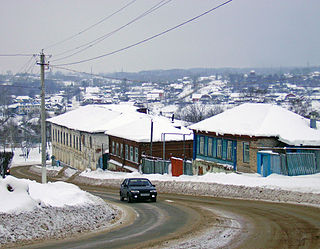
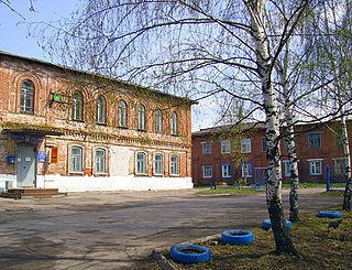
Uren is a town and the administrative center of Urensky District in Nizhny Novgorod Oblast, Russia, located on the right bank of the Usta River, 183 kilometers (114 mi) northeast of Nizhny Novgorod, the administrative center of the oblast. It has population: 12,304 (2010 Census); 12,558 (2002 Census); 13,560 (1989 Soviet census).

Chkalovsk is a town in Nizhny Novgorod Oblast, Russia, located on the right bank of the Volga River, 95 kilometers (59 mi) northwest of Nizhny Novgorod, the administrative center of the oblast. As of the 2010 Census, its population was 12,368.

Bolshemurashkinsky District is an administrative district (raion), one of the forty in Nizhny Novgorod Oblast, Russia. Municipally, it is incorporated as Bolshemurashkinsky Municipal District. It is located in the center of the oblast. The area of the district is 658.6 square kilometers (254.3 sq mi). Its administrative center is the urban locality of Bolshoye Murashkino. Population: 10,508 ; 12,585 (2002 Census); 13,867 (1989 Soviet census). The population of Bolshoye Murashkino accounts for 52.9% of the district's total population.

Buturlinsky District is an administrative district (raion), one of the forty in Nizhny Novgorod Oblast, Russia. Municipally, it is incorporated as Buturlinsky Municipal District. It is located in the southeastern central part of the oblast. The area of the district is 1,105.2 square kilometers (426.7 sq mi). Its administrative center is the urban locality of Buturlino. Population: 14,471 ; 16,723 (2002 Census); 16,792 (1989 Soviet census). The population of Buturlino accounts for 44.3% of the district's total population.

Chkalovsky District was an administrative and municipal district (raion) in Nizhny Novgorod Oblast, Russia. It was located in the west of the oblast. The area of the district was 861.5 square kilometers (332.6 sq mi). Its administrative center was the town of Chkalovsk. As of the 2010 Census, the total population of the district was 21,963, with the population of Chkalovsk accounting for 56.3% of that number.

Gorodetsky District is an administrative district (raion), one of the forty in Nizhny Novgorod Oblast, Russia. Municipally, it is incorporated as Gorodetsky Municipal District. It is located in the west of the oblast. The area of the district is 1,473.7 square kilometers (569.0 sq mi). Its administrative center is the town of Gorodets. Population: 91,577 ; 64,700 (2002 Census); 69,451 (1989 Soviet census). The population of Gorodets accounts for 33.5% of the district's total population.
Knyagininsky District is an administrative district (raion), one of the forty in Nizhny Novgorod Oblast, Russia. Municipally, it is incorporated as Knyagininsky Municipal District. It is located in the east of the oblast. The area of the district is 769.9 square kilometers (297.3 sq mi). Its administrative center is the town of Knyaginino. Population: 11,922 ; 12,758 (2002 Census); 12,827 (1989 Soviet census). The population of Knyaginino accounts for 56.3% of the district's total population.

Lukoyanovsky District is an administrative district (raion), one of the forty in Nizhny Novgorod Oblast, Russia. Municipally, it is incorporated as Lukoyanovsky Municipal District. It is located in the south of the oblast. The area of the district is 1,890.7 square kilometers (730.0 sq mi). Its administrative center is the town of Lukoyanov. Population: 32,384 ; 35,828 (2002 Census); 38,359 (1989 Soviet census). The population of Lukoyanov accounts for 46.2% of the district's total population.

Pilninsky District is an administrative district (raion), one of the forty in Nizhny Novgorod Oblast, Russia. Municipally, it is incorporated as Pilninsky Municipal District. It is located in the east of the oblast. The area of the district is 1,312.9 square kilometers (506.9 sq mi). Its administrative center is the urban locality of Pilna. Population: 21,960 ; 25,352 (2002 Census); 28,937 (1989 Soviet census). The population of Pilna accounts for 33.4% of the district's total population.

Sergachsky District is an administrative district (raion), one of the forty in Nizhny Novgorod Oblast, Russia. Municipally, it is incorporated as Sergachsky Municipal District. It is located in the southeast of the oblast. The area of the district is 1,243.8 square kilometers (480.2 sq mi). Its administrative center is the town of Sergach. Population: 31,296 ; 35,779 (2002 Census); 42,588 (1989 Soviet census). The population of Sergach accounts for 68.3% of the district's total population.

Sokolsky District is an administrative district (raion), one of the forty in Nizhny Novgorod Oblast, Russia. As a municipal division, it is incorporated as Sokolsky Urban Okrug. It is located in the northwest of the oblast. The area of the district is 1,981.4 square kilometers (765.0 sq mi). Its administrative center is the urban locality of Sokolskoye. Population: 14,139 ; 16,137 (2002 Census); 19,559 (1989 Soviet census). The population of Sokolskoye accounts for 44.9% of the district's total population.

Sosnovsky District is an administrative district (raion), one of the forty in Nizhny Novgorod Oblast, Russia. Municipally, it is incorporated as Sosnovsky Municipal District. It is located in the southwest of the oblast. The area of the district is 1,170.6 square kilometers (452.0 sq mi). Its administrative center is the urban locality of Sosnovskoye. Population: 19,546 ; 21,923 (2002 Census); 25,513 (1989 Soviet census). The population of Sosnovskoye accounts for 44.7% of the district's total population.

Tonshayevsky District is an administrative district (raion), one of the forty in Nizhny Novgorod Oblast, Russia. Municipally, it is incorporated as Tonshayevsky Municipal District. It is located in the northeast of the oblast. The area of the district is 2,353.1 square kilometers (908.5 sq mi). Its administrative center is the urban locality of Tonshayevo. Population: 20,219 ; 20,038 (2002 Census); 19,588 (1989 Soviet census). The population of Tonshayevo accounts for 22.6% of the district's total population.
Volodarsky District is an administrative district (raion), one of the forty in Nizhny Novgorod Oblast, Russia. Municipally, it is incorporated as Volodarsky Municipal District. It is located in the west of the oblast. The area of the district is 1,045.6 square kilometers (403.7 sq mi). Its administrative center is the town of Volodarsk. Population: 58,807 ; 59,498 (2002 Census). The population of Volodarsk accounts for 16.9% of the district's total population.

Voskresensky District is an administrative district (raion), one of the forty in Nizhny Novgorod Oblast, Russia. Municipally, it is incorporated as Voskresensky Municipal District. It is located in the east of the oblast. The area of the district is 3,554.5 square kilometers (1,372.4 sq mi). Its administrative center is the urban locality of Voskresenskoye. Population: 21,645 ; 25,083 (2002 Census); 29,360 (1989 Soviet census). The population of Voskresenskoye accounts for 28.6% of the district's total population.
Arya is an urban locality in Urensky District of Nizhny Novgorod Oblast, Russia. Population: 5,015 (2010 Census); 5,016 (2002 Census); 5,481 (1989 Soviet census).


