
Balakhna is a town and the administrative center of Balakhninsky District in Nizhny Novgorod Oblast, Russia, located on the right bank of the Volga River, 32 kilometers (20 mi) north of Nizhny Novgorod, the administrative center of the oblast. Population: 51,519 (2010 Census); 57,338 (2002 Census); 32,133 (1989 Soviet census); 33,500 (1968).

Pervomaysk is a town in Nizhny Novgorod Oblast, Russia, located 190 kilometers (120 mi) south of Nizhny Novgorod. Population: 14,568 (2010 Census); 15,094 (2002 Census); 16,428 (1989 Soviet census); 16,000 (1974).

Bogorodsk is a town and the administrative center of Bogorodsky District in Nizhny Novgorod Oblast, Russia, located 43 kilometers (27 mi) southwest of Nizhny Novgorod, the administrative center of the oblast. Population: 35,499 (2010 Census); 37,095 (2002 Census); 38,401 (1989 Soviet census).

Vyksa is a town in Nizhny Novgorod Oblast, Russia. It is located on the Oka River, 186 kilometers (116 mi) southwest of Nizhny Novgorod. Population: 56,201 (2010 Census); 61,657 (2002 Census); 61,149 (1989 Soviet census).

Zavolzhye is a town in Gorodetsky District of Nizhny Novgorod Oblast, Russia, located on the right bank of the Volga River, opposite Gorodets, the administrative centre of the district, and 56 kilometers (35 mi) northwest of Nizhny Novgorod, the administrative center of the oblast. Population: 40,460 (2010 Census); 43,971 (2002 Census); 44,630 (1989 Soviet census).

Lukoyanov is a town and the administrative center of Lukoyanovsky District in Nizhny Novgorod Oblast, Russia, located on the Tyosha River, 173 kilometers (107 mi) south of Nizhny Novgorod, the administrative center of the oblast. Population: 14,951 (2010 Census); 12,856 (2002 Census); 12,276 (1989 Soviet census).

Vorsma is a town in Pavlovsky District of Nizhny Novgorod Oblast, Russia, located on the Kishma River, 71 kilometers (44 mi) southwest of Nizhny Novgorod, the administrative center of the oblast. Population: 11,620 (2010 Census); 12,629 (2002 Census); 13,648 (1989 Soviet census).

Navashino is a town in Nizhny Novgorod Oblast, Russia, located on a branch of the Oka River, 10 km east of Murom and 158 kilometers (98 mi) southwest of Nizhny Novgorod. As of the 2010 Census, its population was 16,416.

Uren is a town and the administrative center of Urensky District in Nizhny Novgorod Oblast, Russia, located on the right bank of the Usta River, 183 kilometers (114 mi) northeast of Nizhny Novgorod, the administrative center of the oblast. It has population: 12,304 (2010 Census); 12,558 (2002 Census); 13,560 (1989 Soviet census).

Chkalovsk is a town in Nizhny Novgorod Oblast, Russia, located on the right bank of the Volga River, 95 kilometers (59 mi) northwest of Nizhny Novgorod, the administrative center of the oblast. As of the 2010 Census, its population was 12,368.

Perevoz is a town and the administrative center of Perevozsky District in Nizhny Novgorod Oblast, Russia, located on the Pyana River, 120 kilometers (75 mi) southeast of Nizhny Novgorod, the administrative center of the oblast. Population: 9,201 (2010 Census); 9,386 (2002 Census); 8,313 (1989 Soviet census).

Knyaginino is a town and the administrative center of Knyagininsky District in Nizhny Novgorod Oblast, Russia, located on the Imza River, 107 kilometers (66 mi) southeast of Nizhny Novgorod, the administrative center of the oblast. Population: 6,708 (2010 Census); 6,838 (2002 Census); 6,374 (1989 Soviet census).

Ardatovsky District is an administrative district (raion), one of the forty in Nizhny Novgorod Oblast, Russia. Municipally, it is incorporated as Ardatovsky Municipal District. It is located in the southwest of the oblast. The area of the district is 1,887.6 square kilometers (728.8 sq mi). Its administrative center is the urban locality of Ardatov. Population: 26,428 ; 30,346 (2002 Census); 32,361 (1989 Soviet census). The population of Ardatov accounts for 36.2% of the district's total population.

Arzamassky District is an administrative district (raion), one of the forty in Nizhny Novgorod Oblast, Russia. Municipally, it is incorporated as Arzamassky Municipal District. It is located in the southern central part of the oblast. The area of the district is 2,016.9 square kilometers (778.7 sq mi). Its administrative center is the city of Arzamas. Population: 43,723 ; 46,086 (2002 Census); 54,491 (1989 Soviet census).

Dalnekonstantinovsky District is an administrative district (raion), one of the forty in Nizhny Novgorod Oblast, Russia. Municipally, it is incorporated as Dalnekonstantinovsky Municipal District. It is located in the center of the oblast. The area of the district is 1,377.1 square kilometers (531.7 sq mi). Its administrative center is the urban locality of Dalneye Konstantinovo. Population: 22,474 ; 25,251 (2002 Census); 25,481 (1989 Soviet census). The population of Dalneye Konstantinovo accounts for 21.3% of the district's total population.
Urensky District is an administrative district (raion), one of the forty in Nizhny Novgorod Oblast, Russia. Municipally, it is incorporated as Urensky Municipal District. It is located in the north of the oblast. The area of the district is 2,102.7 square kilometers (811.9 sq mi). Its administrative center is the town of Uren. Population: 30,106 ; 32,045 (2002 Census); 36,847 (1989 Soviet census). The population of Uren accounts for 40.9% of the district's total population.

Vachsky District is an administrative district (raion), one of the forty in Nizhny Novgorod Oblast, Russia. Municipally, it is incorporated as Vachsky Municipal District. It is located in the southwest of the oblast. The area of the district is 979.5 square kilometers (378.2 sq mi). Its administrative center is the urban locality of Vacha. Population: 19,979 ; 23,349 (2002 Census); 29,198 (1989 Soviet census). The population of Vacha accounts for 30.0% of the district's total population.

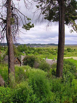
Varnavinsky District is an administrative district (raion), one of the forty in Nizhny Novgorod Oblast, Russia. Municipally, it is incorporated as Varnavinsky Municipal District. It is located in the north of the oblast. The area of the district is 2,523.4 square kilometers (974.3 sq mi). Its administrative center is the urban locality of Varnavino. Population: 13,366 ; 15,867 (2002 Census); 15,130 (1989 Soviet census). The population of Varnavino accounts for 26.0% of the district's total population.
Volodarsky District is an administrative district (raion), one of the forty in Nizhny Novgorod Oblast, Russia. Municipally, it is incorporated as Volodarsky Municipal District. It is located in the west of the oblast. The area of the district is 1,045.6 square kilometers (403.7 sq mi). Its administrative center is the town of Volodarsk. Population: 58,807 ; 59,498 (2002 Census). The population of Volodarsk accounts for 16.9% of the district's total population.

Kulebaki is a town in Nizhny Novgorod Oblast, Russia, located 188 kilometers (117 mi) southwest of Nizhny Novgorod, the administrative center of the oblast. As of the 2010 Census, its population was 35,759.


