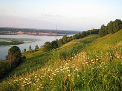
Bogorodsk is a town and the administrative center of Bogorodsky District in Nizhny Novgorod Oblast, Russia, located 43 kilometers (27 mi) southwest of Nizhny Novgorod, the administrative center of the oblast. Population: 35,499 (2010 Census); 37,095 (2002 Census); 38,401 (1989 Census).

Arzamassky District is an administrative district (raion), one of the forty in Nizhny Novgorod Oblast, Russia. Municipally, it is incorporated as Arzamassky Municipal District. It is located in the southern central part of the oblast. The area of the district is 2,016.9 square kilometers (778.7 sq mi). Its administrative center is the city of Arzamas. Population: 43,723 ; 46,086 (2002 Census); 54,491 (1989 Census).

Bolsheboldinsky District is an administrative district (raion), one of the forty in Nizhny Novgorod Oblast, Russia. Municipally, it is incorporated as Bolsheboldinsky Municipal District. It is located in the southeast of the oblast. The area of the district is 866.5 square kilometers (334.6 sq mi). Its administrative center is the rural locality of Bolshoye Boldino. Population: 12,035 ; 13,035 (2002 Census); 14,156 (1989 Census). The population of Bolshoye Boldino accounts for 42.2% of the district's total population.

Dalnekonstantinovsky District is an administrative district (raion), one of the forty in Nizhny Novgorod Oblast, Russia. Municipally, it is incorporated as Dalnekonstantinovsky Municipal District. It is located in the center of the oblast. The area of the district is 1,377.1 square kilometers (531.7 sq mi). Its administrative center is the urban locality of Dalneye Konstantinovo. Population: 22,474 ; 25,251 (2002 Census); 25,481 (1989 Census). The population of Dalneye Konstantinovo accounts for 21.3% of the district's total population.
Diveyevsky District is an administrative district (raion), one of the forty in Nizhny Novgorod Oblast, Russia. Municipally, it is incorporated as Diveyevsky Municipal District. It is located in the south of the oblast. The area of the district is 844.8 square kilometers (326.2 sq mi). Its administrative center is the rural locality of Diveyevo. Population: 16,618 ; 17,848 (2002 Census); 18,375 (1989 Census). The population of Diveyevo accounts for 38.6% of the district's total population.

Gaginsky District is an administrative district (raion), one of the forty in Nizhny Novgorod Oblast, Russia. Municipally, it is incorporated as Gaginsky Municipal District. It is located in the southeast of the oblast. The area of the district is 1,064.2 square kilometers (410.9 sq mi). Its administrative center is the rural locality of Gagino. Population: 12,444 ; 15,079 (2002 Census); 17,473 (1989 Census). The population of Gagino accounts for 31.3% of the district's total population.
Knyagininsky District is an administrative district (raion), one of the forty in Nizhny Novgorod Oblast, Russia. Municipally, it is incorporated as Knyagininsky Municipal District. It is located in the east of the oblast. The area of the district is 769.9 square kilometers (297.3 sq mi). Its administrative center is the town of Knyaginino. Population: 11,922 ; 12,758 (2002 Census); 12,827 (1989 Census). The population of Knyaginino accounts for 56.3% of the district's total population.

Lukoyanovsky District is an administrative district (raion), one of the forty in Nizhny Novgorod Oblast, Russia. Municipally, it is incorporated as Lukoyanovsky Municipal District. It is located in the south of the oblast. The area of the district is 1,890.7 square kilometers (730.0 sq mi). Its administrative center is the town of Lukoyanov. Population: 32,384 ; 35,828 (2002 Census); 38,359 (1989 Census). The population of Lukoyanov accounts for 46.2% of the district's total population.

Perevozsky District is an administrative district (raion), one of the forty in Nizhny Novgorod Oblast, Russia. Municipally, it is incorporated as Perevozsky Municipal District. It is located in the southern central part of the oblast. The area of the district is 769.2 square kilometers (297.0 sq mi). Its administrative center is the town of Perevoz. Population: 16,519 ; 18,024 (2002 Census); 17,146 (1989 Census). The population of Perevoz accounts for 55.7% of the district's total population.

Sechenovsky District is an administrative district (raion), one of the forty in Nizhny Novgorod Oblast, Russia. Municipally, it is incorporated as Sechenovsky Municipal District. It is located in the southeast of the oblast. The area of the district is 991 square kilometers (383 sq mi). Its administrative center is the rural locality of Sechenovo. Population: 15,446 ; 17,741 (2002 Census); 19,338 (1989 Census). The population of Sechenovo accounts for 34.1% of the district's total population.

Sergachsky District is an administrative district (raion), one of the forty in Nizhny Novgorod Oblast, Russia. Municipally, it is incorporated as Sergachsky Municipal District. It is located in the southeast of the oblast. The area of the district is 1,243.8 square kilometers (480.2 sq mi). Its administrative center is the town of Sergach. Population: 31,296 ; 35,779 (2002 Census); 42,588 (1989 Census). The population of Sergach accounts for 68.3% of the district's total population.

Shatkovsky District is an administrative district (raion), one of the forty in Nizhny Novgorod Oblast, Russia. Municipally, it is incorporated as Shatkovsky Municipal District. It is located in the south of the oblast. The area of the district is 1,440.7 square kilometers (556.3 sq mi). Its administrative center is the urban locality of Shatki. Population: 27,018 ; 28,841 (2002 Census); 30,364 (1989 Census). The population of Shatki accounts for 35.7% of the district's total population.

Sosnovsky District is an administrative district (raion), one of the forty in Nizhny Novgorod Oblast, Russia. Municipally, it is incorporated as Sosnovsky Municipal District. It is located in the southwest of the oblast. The area of the district is 1,170.6 square kilometers (452.0 sq mi). Its administrative center is the urban locality of Sosnovskoye. Population: 19,546 ; 21,923 (2002 Census); 25,513 (1989 Census). The population of Sosnovskoye accounts for 44.7% of the district's total population.
Spassky District is an administrative district (raion), one of the forty in Nizhny Novgorod Oblast, Russia. Municipally, it is incorporated as Spassky Municipal District. It is located in the east of the oblast. The area of the district is 706.6 square kilometers (272.8 sq mi). Its administrative center is the rural locality of Spasskoye. Population: 10,998 ; 13,533 (2002 Census); 16,204 (1989 Census). The population of Spasskoye accounts for 35.9% of the district's total population.

Tonkinsky District is an administrative district (raion), one of the forty in Nizhny Novgorod Oblast, Russia. Municipally, it is incorporated as Tonkinsky Municipal District. It is located in the northeast of the oblast. The area of the district is 1,018.5 square kilometers (393.2 sq mi). Its administrative center is the urban locality of Tonkino. Population: 9,007 ; 11,097 (2002 Census); 12,551 (1989 Census). The population of Tonkino accounts for 56.7% of the district's total population.

Vachsky District is an administrative district (raion), one of the forty in Nizhny Novgorod Oblast, Russia. Municipally, it is incorporated as Vachsky Municipal District. It is located in the southwest of the oblast. The area of the district is 979.5 square kilometers (378.2 sq mi). Its administrative center is the urban locality of Vacha. Population: 19,979 ; 23,349 (2002 Census); 29,198 (1989 Census). The population of Vacha accounts for 30.0% of the district's total population.

Vadsky District is an administrative district (raion), one of the forty in Nizhny Novgorod Oblast, Russia. Municipally, it is incorporated as Vadsky Municipal District. It is located in the southern central part of the oblast. The area of the district is 742.7 square kilometers (286.8 sq mi). Its administrative center is the rural locality of Vad. Population: 15,626 ; 16,442 (2002 Census); 15,365 (1989 Census). The population of Vad accounts for 42.9% of the district's total population.
Vetluzhsky District is an administrative district (raion), one of the forty in Nizhny Novgorod Oblast, Russia. Municipally, it is incorporated as Vetluzhsky Municipal District. It is located in the north of the oblast. The area of the district is 2,992.4 square kilometers (1,155.4 sq mi). Its administrative center is the town of Vetluga. Population: 16,330 ; 18,902 (2002 Census); 22,559 (1989 Census). The population of Vetluga accounts for 54.8% of the district's total population.
Volodarsky District is an administrative district (raion), one of the forty in Nizhny Novgorod Oblast, Russia. Municipally, it is incorporated as Volodarsky Municipal District. It is located in the west of the oblast. The area of the district is 1,045.6 square kilometers (403.7 sq mi). Its administrative center is the town of Volodarsk. Population: 58,807 ; 59,498 (2002 Census). The population of Volodarsk accounts for 16.9% of the district's total population.

Voskresensky District is an administrative district (raion), one of the forty in Nizhny Novgorod Oblast, Russia. Municipally, it is incorporated as Voskresensky Municipal District. It is located in the east of the oblast. The area of the district is 3,554.5 square kilometers (1,372.4 sq mi). Its administrative center is the urban locality of Voskresenskoye. Population: 21,645 ; 25,083 (2002 Census); 29,360 (1989 Census). The population of Voskresenskoye accounts for 28.6% of the district's total population.