The Nueva Sparta State (in Spanish: Estado Nueva Esparta, is one of the 23 states of Venezuela. It comprises Margarita Island, Coche, and the largely uninhabited Cubagua.

Margarita Island is the largest island in the Venezuelan state of Nueva Esparta, situated off the northeastern coast of the country, in the Caribbean Sea. The capital city of Nueva Esparta, La Asunción, is located on the island.

The Federal Dependencies of Venezuela encompass most of Venezuela's offshore islands in the Caribbean Sea and the Gulf of Venezuela, excluding those islands that form the State of Nueva Esparta and some Caribbean coastal islands that are integrated with nearby states. These islands, with a total area of 342 square kilometres, are sparsely populated – according to the preliminary results of the 2011 Census only 2,155 people live there permanently, with another hundred from Margarita Island who live there seasonally to engage in fishing. Local government is officially under the authority of Central government in Caracas, although de facto power is often held in the heads of the sparse and somewhat isolated communities that decorate the territories.

La Asunción is a city in Venezuela. The capital of Nueva Esparta state, it lies on the Isla Margarita in the Caribbean Sea, off the South American mainland. It is 6 miles (10 km) inland from Porlamar and is in a genuine colonial setting. It has an imposing backdrop of Santa Rosa Castle, also known as the Santa Rosa Fort, which was built to protect the city. The most important structures in the city are built around the Plaza Bolivar. The Catedral Nuestra Señora de La Asunción, dated to the 16th century, is one of the earliest churches in the country. According to the 2011 census, it has a population of 28,513 people.

The following is an alphabetical list of topics related to the Bolivarian Republic of Venezuela.

Pico Bolívar is the highest mountain in Venezuela, at 4,978 metres (16,332 ft). Located in Mérida State, its top is permanently covered with névé snow and three small glaciers. It can be reached only by walking; the Mérida cable car, which was the highest and longest cable car in the world when it was built, only reaches Pico Espejo. From there it is possible to climb to Pico Bolívar. The peak is named after the Venezuelan independence hero Simón Bolívar.
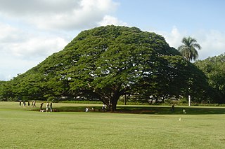
Samanea saman, also sometimes known as the rain tree, is a species of flowering tree in the pea family, Fabaceae, now in the Mimosoid clade and is native to Central and South America. Its range extends from Mexico south to Peru and Brazil, but it has been widely introduced to South and Southeast Asia, as well as the Pacific Islands, including Hawaii. Common names include saman, rain tree and monkeypod. It is often placed in the genus Samanea, which by yet other authors is subsumed in Albizia entirely.
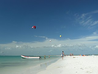
Isla de Coche is one of three islands forming the Nueva Esparta State of Venezuela, located in the Caribbean between Isla Margarita and the mainland. The other two islands are Isla Margarita, the main island of the state, and Cubagua, the smallest. Coche is coterminous with the municipality of Villalba, with the municipal seat at San Pedro de Coche, the largest town. Moreover, Cache Island has continue to sustain the fishing tradition.

The Venezuelan Coastal Range, also known as Venezuelan Caribbean Mountain System is a mountain range system and one of the eight natural regions of Venezuela, that runs along the central and eastern portions of Venezuela's northern coast. The range is a northeastern extension of the Andes, and is also known as the Maritime Andes. It covers around 48,866 km2, being the 4th largest natural region in Venezuela.
The Insular Region is one of the eight natural regions of Venezuela and also, one of the 10 administrative regions in which Venezuela was divided for its development plans; it comprises all of the nation's islands, and is formed by the state of Nueva Esparta and the Federal Dependencies.

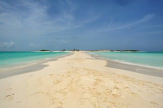
Cubagua or Isla de Cubagua is the smallest and least populated of the three islands constituting the Venezuelan state of Nueva Esparta, after Isla Margarita and Coche. It is located 16 kilometres (10 mi) north of Araya Peninsula, the closest mainland area.

Andres Miguel Salazar Marcano Airport is an airport serving Isla de Coche, an island in the Venezuelan state of Nueva Esparta.

Fernando Cervigón Marcos was a Spanish ichthyologist and marine biologist, who lived most of his life in Venezuela. He discovered and described numerous species of fish including the Caribbean roughshark and is author of numerous works on fish and Venezuela's ocean environment including Los Peces Marinos de Venezuela. He was the president of the Museo del Mar on Margarita Island, Nueva Esparta, Venezuela.
Garcia Álvarez de Figueroa was a Spanish soldier who was Governor of the Margarita Province, based on Isla Margarita off the coast of what today is Venezuela, from 1626 to 1630.

Laguna de la Restinga is a national park on the Isla Margarita, Nueva Esparta state, Venezuela. The main part of the park is a large salt lagoon, rich in fish and birdlife. It is on the Ramsar list of wetlands of international importance, and is classified as an Important Bird Area.
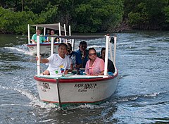
La Guardia is a fishing and tourist community on the northwest coast of Isla Margarita, Venezuela.

Vasum muricatum, common name the Caribbean vase, is a species of medium to large sea snail, a marine gastropod mollusk in the family Turbinellidae.
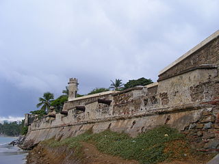
San Carlos de Borromeo Fortress is a colonial fortress in the Bay of Pampatar in the northeast of Isla Margarita, Venezuela. It was completed in 1684 for protection against the constant threat of pirates. The fortress was ransacked several times before Venezuela gained independence from Spain. Today the castle has been restored and serves as a museum.

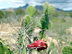
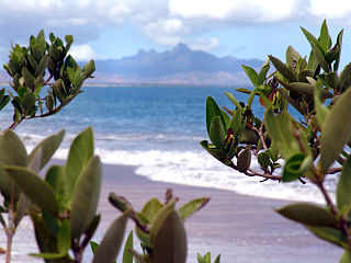
The Araya and Paria xeric scrub (NT1301) is an ecoregion in Venezuela that stretches along the Caribbean coast to the west of Trinidad, and that includes Margarita Island and some smaller islands. The ecoregion includes dune herbs, dry thorn scrubs and deciduous forests. The mountains on Margarita Island hold montane forests similar to those in the mainland coastal range. The beaches are used for breeding by sea turtles. Some endemic bird species are threatened with extinction by illegal capture for the pet trade. Deforestation and over-grazing by goats are also problems.
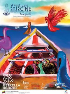
The Margarita Latin American and Caribbean Film Festival, sometimes known as FilMar,:107 is an important international cultural event dedicated to generating spaces for the distribution and promotion of the best of Venezuelan, Latin American, and Caribbean film.