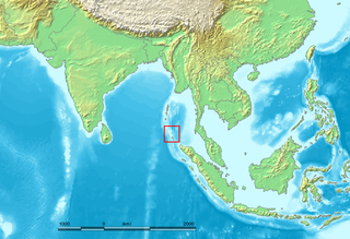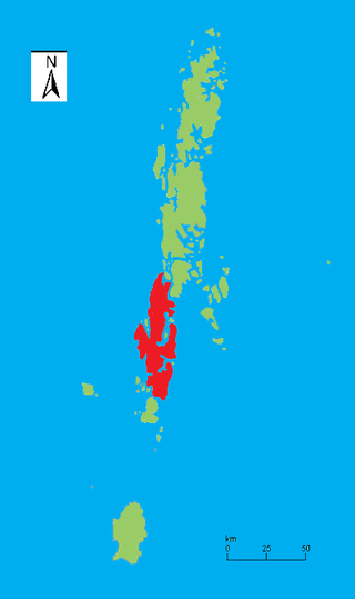
The Andaman and Nicobar Islands is a union territory of India comprising 836 islands, of which only 31 are inhabited. These islands are grouped into two main clusters: the northern Andaman Islands and the southern Nicobar Islands, separated by a 150 km (93 mi) wide channel. The capital and largest city of the territory, Port Blair, is located approximately 1,190 km (740 mi) from Chennai and 1,255 km (780 mi) from Kolkata in mainland India. The islands are situated between the Bay of Bengal to the west and the Andaman Sea to the east. The northernmost point is 901 km (560 mi) from the mouth of the Hooghly River. Indira Point, located at 6°45’10″N and 93°49’36″E on the southern tip of Great Nicobar, is the southernmost point of India.

The Nicobar Islands are an archipelagic island chain in the eastern Indian Ocean. They are located in Southeast Asia, 150 kilometres (93 mi) northwest of Aceh on Sumatra, and separated from Thailand to the east by the Andaman Sea. Located 1,300 kilometres (810 mi) southeast of the Indian subcontinent, across the Bay of Bengal, they are part of India, as the Nicobar district within the union territory of the Andaman and Nicobar Islands. Together with the Andaman Islands to their north, the Nicobar Islands serve as a maritime boundary between the Bay of Bengal to the west and the Andaman Sea to the east.

South Andaman Island is the southernmost island of the Great Andaman and is home to the majority of the population of the Andaman Islands. It belongs to the South Andaman administrative district, part of the Indian union territory of Andaman and Nicobar Islands. It is the location of Sri Vijaya Puram, capital of the Andaman and Nicobar Islands.
Indira Point, the southernmost point of India's territory, is a village in the Nicobar district at Great Nicobar Island of Andaman and Nicobar Islands in India. It is located in the Great Nicobar tehsil.

Mahatma Gandhi Marine National Park is a national park in India, near Wandoor on the Andaman Islands. It belongs to the South Andaman administrative district, part of the Indian union territory of the Andaman and Nicobar Islands.
Interview Island is an island of the Andaman Islands. It belongs to the North and Middle Andaman administrative district, part of the Indian union territory of Andaman and Nicobar Islands. It lies 125 km (78 mi) north of Port Blair.
Strait Island is an island of the Andaman Islands. It belongs to the North and Middle Andaman administrative district, part of the Indian union territory of Andaman and Nicobar Islands. The island lies 63 km (39 mi) north from Port Blair.
Trinket Bay is a village in the Nicobar district of Andaman and Nicobar Islands, India. It is located in the Great Nicobar tehsil. It is located between Lawful and Afra on Great Nicobar island.
Tillangchong, also known as Tillanchang, is an island and a village in the Nicobar district of Andaman and Nicobar Islands, India.
Pulomilo is an island in the Nicobar district of Andaman and Nicobar Islands, India, and is home to a village of the same name. It is located just north of Little Nicobar Island.
Tourism in Andaman and Nicobar Islands relates to tourism in union territory of India, Andaman and Nicobar Islands. The Andamans are an archipelago of over 572 tropical islands, of which only 38 are inhabited. In 2004 Radhanagar beach at Havelock Island was bestowed with the title of "Asia’s Best Beach" and as the world's seventh most spectacular beach by Time magazine.
Car Nicobar Tehsil is one of three local administrative divisions of the Indian district of Nicobar, part of the Indian union territory of Andaman and Nicobar Islands. It is a subdivision and also a tehsil, roughly equivalent to a county in its range of administrative powers. It is located in the Northern Nicobar Islands.
Nancowry Subdivision is one of three local administrative divisions of the Indian district of Nicobar, part of the Indian union territory of Andaman and Nicobar Islands.
Great Nicobar Subdivision is one of three local administrative divisions of the Indian district of Nicobar, part of the Indian union territory of Andaman and Nicobar Islands. It is located in the Southern Nicobar Islands.
East Island is an island of the Andaman Islands. It belongs to the North and Middle Andaman administrative district, part of the Indian union territory of Andaman and Nicobar Islands. The island is located 220 km (137 mi) north from Port Blair.
Smith Island is an island of the Andaman Islands. It belongs to the North and Middle Andaman administrative district, part of the Indian union territory of Andaman and Nicobar Islands. The island lies 298 km (185 mi) north of Port Blair.
Curlew Island is an island of the Andaman Islands. It belongs to the North and Middle Andaman administrative district, part of the Indian union territory of Andaman and Nicobar Islands. The island lies 150 km (93 mi) north of Port Blair.
Stewart Island is an island of the Andaman Islands. It belongs to the North and Middle Andaman administrative district, part of the Indian union territory of Andaman and Nicobar Islands. The island lies 150 km (93 mi) north of Port Blair. Its population only consists of two people.
Long Island is an island of the Andaman Islands. It belongs to the North and Middle Andaman administrative district, part of the Indian union territory of Andaman and Nicobar Islands. The island is located 80 km (50 mi) north from Port Blair.
North Passage Island is an island of the Andaman Islands. It belongs to the North and Middle Andaman administrative district, part of the Indian union territory of Andaman and Nicobar Islands. The island lies 80 km (50 mi) north from Port Blair.


