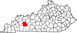
Martwick, Kentucky

Last updated

Martwick is an unincorporated community in Muhlenberg County, in the U.S. state of Kentucky. [1]

Muhlenberg County, Kentucky County in the United States

Muhlenberg County is a county located in the U.S. Commonwealth of Kentucky. As of the 2010 census, the population was 31,499. Its county seat is Greenville.

U.S. state constituent political entity of the United States

In the United States, a state is a constituent political entity, of which there are currently 50. Bound together in a political union, each state holds governmental jurisdiction over a separate and defined geographic territory and shares its sovereignty with the federal government. Due to this shared sovereignty, Americans are citizens both of the federal republic and of the state in which they reside. State citizenship and residency are flexible, and no government approval is required to move between states, except for persons restricted by certain types of court orders. Four states use the term commonwealth rather than state in their full official names.

Kentucky State of the United States of America

Kentucky, officially the Commonwealth of Kentucky, is a state located in the east south-central region of the United States. Although styled as the "State of Kentucky" in the law creating it, (because in Kentucky's first constitution, the name state was used) Kentucky is one of four U.S. states constituted as a commonwealth. Originally a part of Virginia, in 1792 Kentucky became the 15th state to join the Union. Kentucky is the 37th most extensive and the 26th most populous of the 50 United States.

History

A post office called Martwick was in operation from 1912 until 1962. [2] The community's name is an amalgamation of Martin and Wickliffe, the names of two local families. [3]

Related Research Articles

McLean County, Kentucky County in the United States

McLean County is a county located in the U.S. state of Kentucky. As of the 2010 census, the population was 9,531. Its county seat is Calhoun. McLean is a prohibition or dry county.

Hopkins County, Kentucky County in the United States

Hopkins County is a county located in the western part of the U.S. state of Kentucky. As of the 2010 census, the population was 46,920. Its county seat is Madisonville. The county was formed in 1806 and named for General Samuel Hopkins, an officer in both the American Revolutionary War and War of 1812, and later a Kentucky legislator and U.S. Congressman.

Bremen, Kentucky City in Kentucky, United States

Bremen is a home rule-class city in Muhlenberg County, Kentucky, in the United States. The population was 365 at the 2000 census.

Central City, Kentucky City in Kentucky, United States

Central City is a home rule-class city in Muhlenberg County, Kentucky, in the United States. The population was 5,978 at the 2010 census. It is also the largest city in the county and the principal community in the Central City Micropolitan Statistical Area, which includes all of Muhlenberg County.

Greenville, Kentucky City in Kentucky, United States

Greenville is a home rule-class city in Muhlenberg County, Kentucky, in the United States. It is the seat of its county. The population was 4,312 at the 2010 census.

Powderly, Kentucky City in Kentucky, United States

Powderly is a home rule-class city in Muhlenberg County, Kentucky, in the United States. The population was 846 during the year 2000 U.S. Census.

Mountain Retreat, California Unincorporated community in California, United States

Mountain Retreat is an unincorporated community in Calaveras County, California. It lies at an elevation of 4052 feet.

Kimberly Hills is an unincorporated community in Cumberland County, in the U.S. state of Virginia.

Bevier, Kentucky Unincorporated community in Kentucky, United States

Bevier is an unincorporated community located in Muhlenberg County, Kentucky, United States.

Browder, Kentucky Unincorporated community in Kentucky, United States

Browder is an unincorporated community located in Muhlenberg County, Kentucky, United States.

Weir, Kentucky Unincorporated community in Kentucky, United States

Weir is an unincorporated community located in Muhlenberg County, Kentucky, United States.

Luzerne, Kentucky Unincorporated community in Kentucky, United States

Luzerne is an unincorporated community located in Muhlenberg County, Kentucky, United States.

Graham, Kentucky CDPs in Kentucky, United States

Graham is a census-designated place (CDP) located in Muhlenberg County, Kentucky, United States.

Penrod, Kentucky Unincorporated community in Kentucky, United States

Penrod is an unincorporated community in Muhlenberg County, Kentucky, United States.

Gishton is an unincorporated community in Muhlenberg County, in the U.S. state of Kentucky.

McNary is an unincorporated community in Muhlenberg County, in the U.S. state of Kentucky.

Gus is an unincorporated community in Muhlenberg County, in the U.S. state of Kentucky.

Calumet is an unincorporated community in eastern Pike County, in the U.S. state of Missouri. The community is located at the intersection of Missouri routes N and D about six miles southwest of Clarkesville and six miles north of Eolia. Calumet Creek flows past to the south of the community.

Wintersville is an unincorporated community in Sullivan County, in the U.S. state of Missouri.

References

  1. U.S. Geological Survey Geographic Names Information System: Martwick, Kentucky
  2. "Muhlenberg County". Jim Forte Postal History. Retrieved 16 April 2015.
  3. Anderson, Bobby (September 19, 2007). "Sandy Called These Names". Leader-News. pp. A12. Retrieved 16 May 2015.

Coordinates: 37°19′37″N87°01′26″W / 37.32694°N 87.02389°W / 37.32694; -87.02389

Geographic coordinate system Coordinate system

A geographic coordinate system is a coordinate system that enables every location on Earth to be specified by a set of numbers, letters or symbols. The coordinates are often chosen such that one of the numbers represents a vertical position and two or three of the numbers represent a horizontal position; alternatively, a geographic position may be expressed in a combined three-dimensional Cartesian vector. A common choice of coordinates is latitude, longitude and elevation. To specify a location on a plane requires a map projection.