Knightsburg, Kentucky

Last updated

Knightsburg, Kentucky
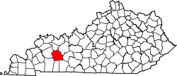
USA Kentucky location map.svg
Red pog.svg
Knightsburg
Usa edcp location map.svg
Red pog.svg
Knightsburg
Coordinates: 37°12′46″N86°55′10″W / 37.21278°N 86.91944°W / 37.21278; -86.91944
Country United States
State Kentucky
County Muhlenberg
Elevation
420 ft (130 m)
Time zone UTC-6 (Central (CST))
  Summer (DST) UTC-5 (CDT)
Area code 270
GNIS feature ID508403 [1]

Knightsburg is an unincorporated community in Muhlenberg County, Kentucky, United States.

Contents

Geography

Knightsburg is located on Kentucky Route 70, 1.5 miles (2.4 km) west of Rochester. [2]

Point of Interest

The Rochester Dam is located almost a mile east of the community, along with the John Prine Memorial Park at Rochester Dam.

Related Research Articles

<span class="mw-page-title-main">Muhlenberg County, Kentucky</span> County in Kentucky, United States

Muhlenberg County is a county in the U.S. Commonwealth of Kentucky. As of the 2020 census, the population was 30,928. Its county seat is Greenville and its largest city is Central City.

<span class="mw-page-title-main">McLean County, Kentucky</span> County in Kentucky, United States

McLean County is a county located in the U.S. state of Kentucky. As of the 2020 census, the population was 9,152. Its county seat is Calhoun and its largest city is Livermore. McLean is a prohibition or dry county. McLean County is part of the Owensboro, KY Metropolitan Statistical Area, which has a population of some 114,752.

<span class="mw-page-title-main">Butler County, Kentucky</span> County in Kentucky, United States

Butler County is a county located in the US state of Kentucky. As of the 2020 Census, the population was 12,371. Its county seat is Morgantown. The county was formed in 1810, becoming Kentucky's 53rd county. Butler County is included in the Bowling Green, Kentucky, Metropolitan Statistical Area.

<span class="mw-page-title-main">Rochester, Kentucky</span> City in Kentucky

Rochester is a home rule-class city in Butler County, Kentucky, United States, at the confluence of the Green and Mud rivers. The population was 114 as of the 2020 Census

<span class="mw-page-title-main">Central City, Kentucky</span> City in Kentucky, United States

Central City is a home rule-class city in Muhlenberg County, Kentucky, in the United States. The population was 5,819 at the 2020 census. It is the largest city in the county and the principal community in the Central City Micropolitan Statistical Area, which includes all of Muhlenberg County.

<span class="mw-page-title-main">Greenville, Kentucky</span> City in Kentucky, United States

Greenville is a home rule-class city in Muhlenberg County, Kentucky, in the United States. It is the seat of its county. The population was 4,492 as of the 2020 census.

<span class="mw-page-title-main">Powderly, Kentucky</span> City in Kentucky, United States

Powderly is a home rule-class city in Muhlenberg County, Kentucky, in the United States. The population was 788 as of the 2020 census.

<span class="mw-page-title-main">Green River (Kentucky)</span> River in Kentucky, United States

The Green River is a 384-mile-long (618 km) tributary of the Ohio River that rises in Lincoln County in south central Kentucky. Tributaries of the Green River include the Barren River, the Nolin River, the Pond River and the Rough River. The river was named after Nathanael Greene, a general of the American Revolutionary War.

The Mud River is a tributary of the Green River in western Kentucky in the United States. Via the Green and Ohio rivers, it is part of the Mississippi River watershed. It is about 70.9 miles (114.1 km) long.

<span class="mw-page-title-main">Kentucky Route 70</span> State highway in Kentucky, United States

Kentucky Route 70 (KY 70) is a long east-east state highway that originates at a junction with U.S. Route 60 (US 60) in Smithland in Livingston County, just east of the Ohio River. The route continues through the counties of Crittenden, Caldwell, Hopkins, Muhlenberg, Butler, Edmonson, Barren, Barren, Metcalfe, Green, Taylor, Casey, Pulaski, Lincoln and back into Pulaski again to terminate at a junction with US 150 near Maretburg in Rockcastle.

Beechmont is a census-designated place and unincorporated community in Muhlenberg County, Kentucky, United States. As of the 2020 census, the population was 776, up from 689 in 2010.

Belton is an unincorporated community located in Muhlenberg County, Kentucky, United States.
Cleaton is an unincorporated community and census-designated place in Muhlenberg County, Kentucky, United States. As of the 2020 census, it had a population of 168.

Graham is an unincorporated community in Muhlenberg County, Kentucky, United States.

Dunmor is an unincorporated community and census-designated place (CDP) in Muhlenberg and Logan counties, Kentucky, United States. As of the 2020 census it had a population of 322.

Rumsey is an unincorporated community in McLean County, Kentucky, United States.

Holt is an unincorporated community in Muhlenberg County, Kentucky, United States. It is part of the Cleaton census-designated place. Holt is located near U.S. Route 431, 3 miles (4.8 km) south-southeast of Central City.

Skilesville is an unincorporated community in Muhlenberg County, Kentucky, United States. Skilesville is located on the Green River and Kentucky Route 70 on the eastern border of Muhlenberg County, 0.6 miles (0.97 km) west of Rochester.

Logansport is an unincorporated community in northwestern Butler County in south-central Kentucky, United States. Logansport is part of the Bowling Green Metropolitan Statistical Area.

References

  1. "Knightsburg". Geographic Names Information System . United States Geological Survey, United States Department of the Interior.
  2. State Primary Road System: Muhlenberg County (PDF) (Map). Kentucky Transportation Cabinet. 2013. Retrieved May 1, 2013.