Powderly, Kentucky

Last updated
Powderly, Kentucky
Powderly-Willis-Dr-cc-ky.jpg
Powderly
Muhlenberg County Kentucky Incorporated and Unincorporated areas Powderly Highlighted 2162652.svg
Location in Muhlenberg County, Kentucky
Coordinates: 37°14′25″N87°9′25″W / 37.24028°N 87.15694°W / 37.24028; -87.15694
Country United States
State Kentucky
County Muhlenberg
Incorporated1963 [1]
Named for a labor organizer
Area
[2]
  Total1.60 sq mi (4.15 km2)
  Land1.56 sq mi (4.05 km2)
  Water0.04 sq mi (0.10 km2)
Elevation
449 ft (137 m)
Population
 (2020) [3]
  Total788
  Density504.16/sq mi (194.69/km2)
Time zone UTC-6 (Central (CST))
  Summer (DST) UTC-5 (CDT)
ZIP code
42367
Area code 270
FIPS code 21-62652
GNIS feature ID0501233

Powderly is a home rule-class city in Muhlenberg County, Kentucky, in the United States. The population was 788 as of the 2020 census. [3]

Contents

History

The city developed around a coal mine opened by the Cooperative Coal Company in 1887. The community was named for Terence Powderly, an early labor leader, when the post office was established the next year. [4] [5] [6]

Geography

Powderly is located in central Muhlenberg County at 37°14′25″N87°9′25″W / 37.24028°N 87.15694°W / 37.24028; -87.15694 (37.240274, -87.157042). [7] The city is situated along U.S. Route 62 between Central City to the northeast and Greenville to the southwest. Kentucky Route 189 serves as a bypass route around Powderly.

According to the United States Census Bureau, the city has a total area of 1.60 square miles (4.1 km2), of which 0.04 square miles (0.10 km2), or 2.50%, are water. [2] The city drains south to Caney Creek and north to Little Cypress Creek, both part of the Green River watershed.

Demographics

Historical population
CensusPop.Note
1970 631
1980 84834.4%
1990 748−11.8%
2000 84613.1%
2010 745−11.9%
2020 7885.8%
U.S. Decennial Census [8]

As of the census [9] of 2000, there were 846 people, 342 households, and 235 families residing in the city. The population density was 586.7 inhabitants per square mile (226.5/km2). There were 396 housing units at an average density of 274.6 per square mile (106.0/km2). The racial makeup of the city was 96.10% White, 2.96% African American, 0.24% Native American, and 0.71% from two or more races. Hispanic or Latino of any race were 0.24% of the population.

There were 342 households, out of which 29.8% had children under the age of 18 living with them, 55.0% were married couples living together, 10.2% had a female householder with no husband present, and 31.0% were non-families. 26.0% of all households were made up of individuals, and 13.2% had someone living alone who was 65 years of age or older. The average household size was 2.47 and the average family size was 2.98.

In the city, the population was spread out, with 24.2% under the age of 18, 10.5% from 18 to 24, 27.5% from 25 to 44, 22.9% from 45 to 64, and 14.8% who were 65 years of age or older. The median age was 36 years. For every 100 females, there were 92.7 males. For every 100 females age 18 and over, there were 81.6 males.

The median income for a household in the city was $23,750, and the median income for a family was $28,063. Males had a median income of $29,250 versus $16,591 for females. The per capita income for the city was $11,705. About 10.3% of families and 15.6% of the population were below the poverty line, including 21.5% of those under age 18 and 18.6% of those age 65 or over.

Sites of interest

Muhlenberg County Agriculture and Convention Center

The Convention Center is frequently the site of horse shows, rodeoes, tractor pulls, cattle auctions, and go-kart races. [10] It is also the site for Muhlenberg County's annual Relay for Life event.

Paradise Park

Paradise Park montage Powderly KY Paradise Park.jpg
Paradise Park montage

Located near the Muhlenberg County Agriculture and Convention Center on the Highway 189 bypass, Paradise Park is the site of weekly "Pickin' in the Park" events during the months of June through September. [11] Several historic buildings have been moved or constructed in Paradise Park, including:

Notable native

Related Research Articles

<span class="mw-page-title-main">Muhlenberg County, Kentucky</span> County in Kentucky, United States

Muhlenberg County is a county in the U.S. Commonwealth of Kentucky. As of the 2020 census, the population was 30,928. Its county seat is Greenville and its largest city is Central City.

<span class="mw-page-title-main">Hopkins County, Kentucky</span> County in Kentucky, United States

Hopkins County is a county located in the western part of the U.S. state of Kentucky. As of the 2020 census, the population was 45,423. Its county seat is Madisonville. Hopkins County was created December 9, 1806 from Henderson County. It was named for General Samuel Hopkins, an officer in both the American Revolutionary War and War of 1812, and later a Kentucky legislator and U.S. Congressman.

<span class="mw-page-title-main">Hiseville, Kentucky</span> Unincorporated community in Kentucky, United States

Hiseville is an unincorporated community and census-designated place (CDP) in Barren County, Kentucky, United States. The population was 240 at the 2010 census. It is part of the Glasgow Micropolitan Statistical Area. Hiseville was a city until it disincorporated in 2004.

<span class="mw-page-title-main">Corydon, Kentucky</span> City in Kentucky, United States

Corydon is a home rule-class city and former coal town in Henderson County, Kentucky, United States. The population was 720 at the 2010 census.

<span class="mw-page-title-main">Earlington, Kentucky</span> City in Kentucky, United States

Earlington is a home rule-class city in Hopkins County, Kentucky, in the United States. As of the 2010 census, the city had a population of 1,413, down from 1,649 at the 2000 census.

<span class="mw-page-title-main">Nortonville, Kentucky</span> City in Kentucky, United States

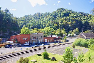
Nortonville is a home rule-class city in Hopkins County, Kentucky, in the United States. The population was 1,204 as of the 2010 census.

<span class="mw-page-title-main">St. Charles, Kentucky</span> City in Kentucky, United States

St. Charles is a home rule-class city in Hopkins County, Kentucky, United States. The population was 277 at the 2010 U.S. Census.

<span class="mw-page-title-main">Hurstbourne, Kentucky</span> City in Kentucky, United States

Hurstbourne is a home rule-class city in Jefferson County, Kentucky, United States. The population was 4,216 at the 2010 census, up from 3,884 at the time of the 2000 U.S. census. It is part of the Louisville Metro Government.

<span class="mw-page-title-main">Fleming-Neon, Kentucky</span> City in Kentucky, United States

Fleming-Neon also known as Neon, is a home rule-class city in Letcher County, Kentucky, in the United States. The population was 770 at the 2010 census, down from 840 at the 2000 census.

<span class="mw-page-title-main">Bremen, Kentucky</span> City in Kentucky, United States

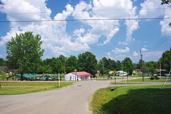
Bremen is a home rule-class city in Muhlenberg County, Kentucky, in the United States. The population was 172 at the 2020 census.

<span class="mw-page-title-main">Central City, Kentucky</span> City in Kentucky, United States

Central City is a home rule-class city in Muhlenberg County, Kentucky, in the United States. The population was 5,819 at the 2020 census. It is the largest city in the county and the principal community in the Central City Micropolitan Statistical Area, which includes all of Muhlenberg County.

<span class="mw-page-title-main">Drakesboro, Kentucky</span> City in Kentucky, United States

Drakesboro is a home rule-class city in Muhlenberg County, Kentucky, United States. The population was 481 at the 2020 census. Incorporated in 1888, the city was named for early pioneer William Drake.

<span class="mw-page-title-main">Greenville, Kentucky</span> City in Kentucky, United States

Greenville is a home rule-class city in Muhlenberg County, Kentucky, in the United States. It is the seat of its county. The population was 4,492 as of the 2020 census.

<span class="mw-page-title-main">South Carrollton, Kentucky</span> City in Kentucky, United States

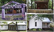
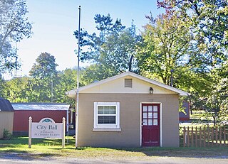
South Carrollton is a home rule-class city in Muhlenberg County, Kentucky, United States. The population was 141 at the 2020 census, down from 184 in 2010. Founded as "Randolph Old Farm" in 1838, an early pioneer changed the name of the city to honor his son, Carroll. The name was prefixed with "South" in order to distinguish it from the city of Carrollton.

<span class="mw-page-title-main">Vicco, Kentucky</span> City in Kentucky, United States

Vicco is a Kentucky defunct city in Perry and Knott counties, Kentucky, United States as defined by Kentucky Act Acts Ch. 25. The population was 334 at the 2010 census.

<span class="mw-page-title-main">Coal Run Village, Kentucky</span> City in Kentucky, United States

Coal Run Village is a home rule-class city in Pike County, Kentucky, in the United States. Bordered to the north, south, and east by Pikeville, the population was 1,706 at the 2010 census. It was the fastest-growing city in Kentucky from 2007 to 2008, with a population increase of 17.3%.

<span class="mw-page-title-main">Providence, Kentucky</span> City in Kentucky, United States

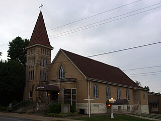
Providence is a home rule-class city in Webster County, Kentucky, in the United States. The population was 3,193 at the time of the 2010 United States Census, making the most populous community in the county.

<span class="mw-page-title-main">Wheatcroft, Kentucky</span> City in Kentucky, United States

Wheatcroft is a home rule-class city in Webster County, Kentucky, United States. The population was 173 at the 2000 census.

<span class="mw-page-title-main">Greenfield, Tennessee</span> City in Tennessee, United States

Greenfield is a city in southwestern Weakley County, Tennessee, United States. The population was 2,182 at the 2010 census and 2,078 in 2018.

<span class="mw-page-title-main">Dawson Springs, Kentucky</span> City in Kentucky, United States

Dawson Springs is a home rule-class city in Hopkins and Caldwell counties in the U.S. state of Kentucky. As of the 2020 census, the population of the city was 2,452.

References

  1. Commonwealth of Kentucky. Office of the Secretary of State. Land Office. "Powderly, Kentucky". Accessed 27 September 2013.
  2. 1 2 "2022 U.S. Gazetteer Files: Kentucky". United States Census Bureau. Retrieved May 23, 2023.
  3. 1 2 "P1. Race – Powderly city, Kentucky: 2020 DEC Redistricting Data (PL 94-171)". U.S. Census Bureau. Retrieved May 23, 2023.
  4. "Dictionary of Places: Powderly". Encyclopedia of Kentucky. New York, New York: Somerset Publishers. 1987. ISBN   0-403-09981-1.
  5. Rennick, Robert. Kentucky Place Names, p. 241. University Press of Kentucky (Lexington), 1987. Accessed 27 September 2013.
  6. Anderson, Bobby (September 19, 2007). "Sandy Called These Names". Leader-News. pp. A12. Retrieved 16 May 2015.
  7. "US Gazetteer files: 2010, 2000, and 1990". United States Census Bureau. 2011-02-12. Retrieved 2011-04-23.
  8. "Census of Population and Housing". Census.gov. Retrieved June 4, 2015.
  9. "U.S. Census website". United States Census Bureau . Retrieved 2008-01-31.
  10. "Centralcitykytourism.com".
  11. "Centralcitykytourism.com". Archived from the original on 2007-02-06. Retrieved 2006-09-23.