Belton, Kentucky

Last updated

Belton, Kentucky
USA Kentucky location map.svg
Red pog.svg
Belton
Usa edcp location map.svg
Red pog.svg
Belton
Coordinates: 37°9′36″N87°1′42″W / 37.16000°N 87.02833°W / 37.16000; -87.02833
Country United States
State Kentucky
County Muhlenberg
Elevation
453 ft (138 m)
Time zone UTC-6 (Central (CST))
  Summer (DST) UTC-5 (CST)
ZIP codes
42324
Area code 270
GNIS feature ID507312 [1]

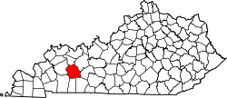
Belton is an unincorporated community located in Muhlenberg County, Kentucky, United States.

Contents

History

Belton was formerly called Yost; the original name was in honor of a local family, and the present name is also local in origin, for the Bell family. [2] A post office called Yost was established in 1883, and the name was changed to Belton in 1926. [3]

Geography

The community is located in the southeastern portion of Muhlenberg County at the junction of U.S. Route 431 and Kentucky Route 2270. [4]

Related Research Articles

<span class="mw-page-title-main">Muhlenberg County, Kentucky</span> County in Kentucky, United States

Muhlenberg County is a county in the U.S. Commonwealth of Kentucky. As of the 2020 census, the population was 30,928. Its county seat is Greenville and its largest city is Central City.

<span class="mw-page-title-main">Central City, Kentucky</span> City in Kentucky, United States

Central City is a home rule-class city in Muhlenberg County, Kentucky, in the United States. The population was 5,819 at the 2020 census. It is the largest city in the county and the principal community in the Central City Micropolitan Statistical Area, which includes all of Muhlenberg County.

<span class="mw-page-title-main">Greenville, Kentucky</span> City in Kentucky, United States

Greenville is a home rule-class city in Muhlenberg County, Kentucky, in the United States. It is the seat of its county. The population was 4,492 as of the 2020 census.

<span class="mw-page-title-main">Powderly, Kentucky</span> City in Kentucky, United States

Powderly is a home rule-class city in Muhlenberg County, Kentucky, in the United States. The population was 788 as of the 2020 census.

<span class="mw-page-title-main">Belton, Missouri</span> City in Missouri, United States

Belton is a city in northwestern Cass County, Missouri, United States. The population was 23,116 at the 2010 census.

<span class="mw-page-title-main">Kentucky Route 90</span> State highway in Kentucky, USA

Kentucky Route 90 is a major east–west state highway in southern Kentucky. The route is 134.734 miles (216.833 km) long, and it traverses Barren, Metcalfe, Cumberland, Clinton, Wayne, Pulaski, McCreary and Whitley Counties in southern Kentucky. It runs from the KY 70 junction near Interstate 65 in Cave City to US 25W about 8 miles (13 km) from Interstate 75.

<span class="mw-page-title-main">Kentucky Route 70</span> State highway in Kentucky, United States

Kentucky Route 70 (KY 70) is a long east-east state highway that originates at a junction with U.S. Route 60 (US 60) in Smithland in Livingston County, just east of the Ohio River. The route continues through the counties of Crittenden, Caldwell, Hopkins, Muhlenberg, Butler, Edmonson, Barren, Barren, Metcalfe, Green, Taylor, Casey, Pulaski, Lincoln and back into Pulaski again to terminate at a junction with US 150 near Maretburg in Rockcastle.

<span class="mw-page-title-main">U.S. Route 431 in Kentucky</span> Section of U.S. Highway in Kentucky

U.S. Route 431 in Kentucky runs 86.93 miles (139.90 km) from the Tennessee state line south of Adairville to US 60 at Owensboro. It crosses the state in mainly west-central portions of the state, passing through or near towns such as Russellville, Lewisburg, Central City and Livermore. The route goes through Logan, Muhlenberg, McLean, and Daviess counties.

Cleaton is an unincorporated community and census-designated place in Muhlenberg County, Kentucky, United States. As of the 2020 census, it had a population of 168.

Weir is an unincorporated community located in Muhlenberg County, Kentucky, United States.
Rosewood is an unincorporated community located in Muhlenberg County, Kentucky, United States.

Graham is an unincorporated community in Muhlenberg County, Kentucky, United States.

Rhoda is an unincorporated community located in Edmonson County, Kentucky, United States.

Dunmor is an unincorporated community and census-designated place (CDP) in Muhlenberg and Logan counties, Kentucky, United States. As of the 2020 census it had a population of 322.

Rumsey is an unincorporated community in McLean County, Kentucky, United States.

Holt is an unincorporated community in Muhlenberg County, Kentucky, United States. It is part of the Cleaton census-designated place. Holt is located near U.S. Route 431, 3 miles (4.8 km) south-southeast of Central City.

Skilesville is an unincorporated community in Muhlenberg County, Kentucky, United States. Skilesville is located on the Green River and Kentucky Route 70 on the eastern border of Muhlenberg County, 0.6 miles (0.97 km) west of Rochester.

<span class="mw-page-title-main">Kentucky Route 106</span> State highway in Kentucky, United States

Kentucky Route 106 (KY 106) is a 35-mile-long (56 km) east-west state highway traversing three counties in west-central Kentucky.

<span class="mw-page-title-main">Kentucky Route 181</span>

Kentucky Route 181 (KY 181) is a north–south state highway that traverses two counties in western Kentucky.

Martwick is an unincorporated community in Muhlenberg County, in the U.S. state of Kentucky.

References

  1. U.S. Geological Survey Geographic Names Information System: Belton, Kentucky
  2. Anderson, Bobby (September 19, 2007). "Sandy Called These Names". Leader-News. pp. A12. Retrieved May 16, 2015.
  3. "Muhlenberg County". Jim Forte Postal History. Retrieved April 16, 2015.
  4. DeLorme (2010). Kentucky Atlas & Gazetteer (Map). 1:150000. Yarmouth, ME: DeLorme. p. 63. § E6. ISBN   0-89933-340-0.