Graham, Kentucky

Last updated

Graham, Kentucky
USA Kentucky location map.svg
Red pog.svg
Graham
Usa edcp location map.svg
Red pog.svg
Graham
Coordinates: 37°14′15″N87°16′48″W / 37.23750°N 87.28000°W / 37.23750; -87.28000
Country United States
State Kentucky
County Muhlenberg
Elevation
528 ft (161 m)
Time zone UTC-6 (Central (CST))
  Summer (DST) UTC-5 (CST)
ZIP codes
42344
Area code 270
GNIS feature ID2629623 [1]

Graham is an unincorporated community in Muhlenberg County, Kentucky, United States.

Contents

History

A post office was established in the community in 1904. [2] Graham was named for William Graham Duncan, the Scottish-American owner of the W. G. Duncan Coal Company for which the coal town was built. [3] [4]

Geography

Graham is located about 6 miles (9.7 km) west-northwest of Greenville. It is located at the junction of U.S. 62 and Kentucky Route 175. The town is also accessible from the Exit 48 interchange of the nearby Wendell H. Ford Western Kentucky Parkway, which passes through the general area.

Education

Students from Graham attend institutions of the Muhlenberg County School system, including Muhlenberg County High School.

Related Research Articles

<span class="mw-page-title-main">Muhlenberg County, Kentucky</span> County in Kentucky, United States

Muhlenberg County is a county in the U.S. Commonwealth of Kentucky. As of the 2020 census, the population was 30,928. Its county seat is Greenville and its largest city is Central City.

<span class="mw-page-title-main">McLean County, Kentucky</span> County in Kentucky, United States

McLean County is a county located in the U.S. state of Kentucky. As of the 2020 census, the population was 9,152. Its county seat is Calhoun and its largest city is Livermore. McLean is a prohibition or dry county. McLean County is part of the Owensboro, KY Metropolitan Statistical Area, which has a population of some 114,752.

<span class="mw-page-title-main">Hopkins County, Kentucky</span> County in Kentucky, United States

Hopkins County is a county located in the western part of the U.S. state of Kentucky. As of the 2020 census, the population was 45,423. Its county seat is Madisonville. Hopkins County was created December 9, 1806 from Henderson County. It was named for General Samuel Hopkins, an officer in both the American Revolutionary War and War of 1812, and later a Kentucky legislator and U.S. Congressman.

<span class="mw-page-title-main">Harlan County, Kentucky</span> County in Kentucky, United States

Harlan County is a county located in southeastern Kentucky. As of the 2020 census, the population was 26,831. Its county seat is Harlan. It is classified as a moist county—a county in which alcohol sales are prohibited, but containing a "wet" city, in this case Cumberland, where package alcohol sales are allowed. In the city of Harlan, restaurants seating 100+ may serve alcoholic beverages.

<span class="mw-page-title-main">Fleming-Neon, Kentucky</span> City in Kentucky, United States

Fleming-Neon also known as Neon, is a home rule-class city in Letcher County, Kentucky, in the United States. The population was 770 at the 2010 census, down from 840 at the 2000 census.

<span class="mw-page-title-main">Central City, Kentucky</span> City in Kentucky, United States

Central City is a home rule-class city in Muhlenberg County, Kentucky, in the United States. The population was 5,819 at the 2020 census. It is the largest city in the county and the principal community in the Central City Micropolitan Statistical Area, which includes all of Muhlenberg County.

<span class="mw-page-title-main">Greenville, Kentucky</span> City in Kentucky, United States

Greenville is a home rule-class city in Muhlenberg County, Kentucky, in the United States. It is the seat of its county. The population was 4,492 as of the 2020 census.

<span class="mw-page-title-main">Powderly, Kentucky</span> City in Kentucky, United States

Powderly is a home rule-class city in Muhlenberg County, Kentucky, in the United States. The population was 788 as of the 2020 census.

<span class="mw-page-title-main">Paradise, Kentucky</span> Former town in Muhlenberg County, Kentucky, United States

Paradise was a small town in Muhlenberg County, Kentucky, United States. The town was located 10.5 miles (16.9 km) east-north-east of Greenville and was formerly called Stom's Landing. It was once a trading post along the Green River. The area was strip mined in the 20th century, and what was left of the town was bought-up and torn down in 1967 by the Tennessee Valley Authority due to health concerns related to its proximity to a nearby coal-burning electric plant, Paradise Fossil Plant.

<span class="mw-page-title-main">Paradise Combined Cycle Plant</span> Natural gas power station in Muhlenberg County, Kentucky

The Paradise Combined Cycle Plant is a natural gas power plant operated by the Tennessee Valley Authority (TVA). Located just east of Drakesboro, Kentucky, it was the highest power capacity power plant in Kentucky. The plant currently has a capacity of 1.02-gigawatts. The plant originally consisted of three coal units, with a combined capacity of 2,632 MW. Units 1 and 2 were retired in 2017, and replaced with the natural gas units, and Unit 3 was retired in 2020.

Beech Creek is an unincorporated community located in Muhlenberg County, Kentucky, United States.
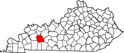
Belton is an unincorporated community located in Muhlenberg County, Kentucky, United States.

Browder is an unincorporated community located in Muhlenberg County, Kentucky, United States.

Cleaton is an unincorporated community and census-designated place in Muhlenberg County, Kentucky, United States. As of the 2020 census, it had a population of 168.

Weir is an unincorporated community located in Muhlenberg County, Kentucky, United States.

Luzerne is an unincorporated community located in Muhlenberg County, Kentucky, United States.

Rosewood is an unincorporated community located in Muhlenberg County, Kentucky, United States.

Dunmor is an unincorporated community and census-designated place (CDP) in Muhlenberg and Logan counties, Kentucky, United States. As of the 2020 census it had a population of 322.

Holt is an unincorporated community in Muhlenberg County, Kentucky, United States. It is part of the Cleaton census-designated place. Holt is located near U.S. Route 431, 3 miles (4.8 km) south-southeast of Central City.

Skilesville is an unincorporated community in Muhlenberg County, Kentucky, United States. Skilesville is located on the Green River and Kentucky Route 70 on the eastern border of Muhlenberg County, 0.6 miles (0.97 km) west of Rochester.

References

  1. U.S. Geological Survey Geographic Names Information System: Graham, Kentucky
  2. "Muhlenberg County". Jim Forte Postal History. Retrieved April 16, 2015.
  3. Rennick, Robert M. (1987). Kentucky Place Names. University Press of Kentucky. p. 121. ISBN   0813126312 . Retrieved April 28, 2013.
  4. Anderson, Bobby (September 19, 2007). "Sandy Called These Names". Leader-News. pp. A12. Retrieved May 16, 2015.