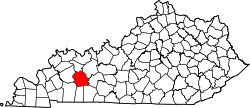
Airdrie, also known as Airdrie Hill, is a ghost town in Muhlenberg County, Kentucky. [1] It was established around 1855 by Robert Alexander on a hilly property along the Green River.
Alexander, a Scottish descendant born in Kentucky, purchased 17,000 acres to develop an ironwork foundry. [2] He named it after Airdrie, North Lanarkshire, Scotland where his parents lived and from where he brought over several Scottish miners and their families. By 1856, the incorporated town had 200 residents but the project failed by 1857 due to the Scots not being familiar with American ore and ironwork practices.
In 1866 Don Carlos Buell, a Civil War general, bought part of the land to prospect for oil but was unsuccessful leading to the town's eventual abandonment. The furnace stack and other ironworks remnants still remain on the land. [3] [4] [5]
Airdrie was located in eastern Muhlenberg County; it was just north of Paradise, another abandoned ghost town in the area. The general area is along Rockport–Paradise Road. [6]
Airdrie is a town in North Lanarkshire, Scotland. It lies on a plateau 400 ft above sea level, 12 miles (19 km) east of Glasgow. As of 2012, it had a population of 37,130. Historically part of Lanarkshire, Airdrie forms a conurbation with its neighbour Coatbridge, in what was formerly the Monklands district, with a population of approximately 90,000.
Muhlenberg County is a county in the U.S. Commonwealth of Kentucky. As of the 2020 census, the population was 30,928. Its county seat is Greenville and its largest city is Central City.
Central City is a home rule-class city in Muhlenberg County, Kentucky, in the United States. The population was 5,819 at the 2020 census. It is the largest city in the county and the principal community in the Central City Micropolitan Statistical Area, which includes all of Muhlenberg County.
Greenville is a home rule-class city in Muhlenberg County, Kentucky, in the United States. It is the seat of its county. The population was 4,492 as of the 2020 census.
Powderly is a home rule-class city in Muhlenberg County, Kentucky, in the United States. The population was 788 as of the 2020 census.
Coatbridge is a town in North Lanarkshire, Scotland, about 8+1⁄2 miles east of Glasgow city centre, set in the central Lowlands. Along with neighbouring town Airdrie, Coatbridge forms the area known as the Monklands, often considered to be part of the Greater Glasgow urban area – although officially they have not been included in population figures since 2016 due to small gaps between the Monklands and Glasgow built-up areas.
Airdrie is a city in Alberta, Canada, within the Calgary Region. It is located north of Calgary within the Calgary–Edmonton Corridor at the intersection of Queen Elizabeth II Highway and Highway 567.
The Pond River is a 90.8-mile-long (146.1 km) tributary of the Green River in western Kentucky in the United States. Via the Green and Ohio rivers, it is part of the watershed of the Mississippi River.
Paradise was a small town in Muhlenberg County, Kentucky, United States. The town was located 10.5 miles (16.9 km) east-north-east of Greenville and was formerly called Stom's Landing. It was once a trading post along the Green River. The area was strip mined in the 20th century. What was left of the town was bought-up and torn down in 1967 by the Tennessee Valley Authority due to health concerns over the adjacent coal-burning electric plant, Paradise Fossil Plant, and the need to expand the plant.
Robert Aitcheson Alexander was an American breeder of Thoroughbred and Standardbred horses.
Henry William Stiegel was a German-American glassmaker and ironmaster.
Alney McLean was a United States representative from Kentucky. McLean County, Kentucky, is named in his honor.
Kentucky Route 70 (KY 70) is a long east-east state highway that originates at a junction with U.S. Route 60 (US 60) in Smithland in Livingston County, just east of the Ohio River. The route continues through the counties of Crittenden, Caldwell, Hopkins, Muhlenberg, Butler, Edmonson, Barren, Barren, Metcalfe, Green, Taylor, Casey, Pulaski, Lincoln and back into Pulaski again to terminate at a junction with US 150 near Maretburg in Rockcastle.
Interstate 65 (I-65) is part of the Interstate Highway System that runs 887.30 miles (1,427.97 km) north–south from Mobile, Alabama, to Gary, Indiana. In Tennessee, I-65 traverses the middle portion of the state, running from Ardmore at the Alabama border to the Kentucky border near Portland. The route serves the state capital and largest city of Nashville, along with many of its suburbs. Outside of urban areas, the Interstate bypasses most cities and towns that it serves, instead providing access via state and U.S. Highways. The Interstate passes through the Highland Rim and Nashville Basin physiographic regions of Tennessee, and is often used as the dividing line between the eastern and western portions of the former.
U.S. Route 431 in Kentucky runs 86.93 miles (139.90 km) from the Tennessee state line south of Adairville to US 60 at Owensboro. It crosses the state in mainly west-central portions of the state, passing through or near towns such as Russellville, Lewisburg, Central City and Livermore. The route goes through Logan, Muhlenberg, McLean, and Daviess counties.
The Paradise Combined Cycle Plant is a natural gas power plant operated by the Tennessee Valley Authority (TVA). Located just east of Drakesboro, Kentucky, it was the highest power capacity power plant in Kentucky. The plant originally consisted of three coal units, with a combined capacity of 2,632 MW. Units 1 and 2 were retired in 2017, and replaced with the natural gas units, and Unit 3 was retired in 2020. The combined cycle natural gas plant had a capacity of 1.02-gigawatts as of 2017.
Kentucky Route 176 (KY 176) is a 12.742-mile state highway in Muhlenberg County, Kentucky that runs from U.S. Route 62 in Greenville to Rockport-Paradise Road at Paradise via Drakesboro.
Kyrock is a ghost town in Edmonson County in south central Kentucky, United States. The ghost town is located about 2.4 miles (3.9 km) east of Sweeden, or about 5 miles (8.0 km) north-northeast of the county seat of Brownsville. It was once a referred to as a “company town” along the Nolin River during much of the first half of the 20th century, but the industrial town was disincorporated in 1966, about nine years after the closure of the company that created the town.
Willow Grove was a small town in eastern Clay County, Tennessee, United States. Named for the willow trees in the area, the town was located 13 miles (21 km) due east of Celina. It was located along the banks of Iron Creek, a tributary of the Obey River.
Rev. Chasteen C. Stumm (1848–1895) was an American minister, teacher, journalist, editor, and newspaper publisher. He was from Kentucky, and also lived in Tennessee, Massachusetts, Pennsylvania, and Virginia.