
West Mayfield is a borough in northern Beaver County, Pennsylvania, United States. The population was 1,196 at the 2020 census. It is a part of the Pittsburgh metropolitan area.

The River Dee is a river in Aberdeenshire, Scotland. It rises in the Cairngorms and flows through southern Aberdeenshire to reach the North Sea at Aberdeen. The area it passes through is known as Deeside, or Royal Deeside in the region between Braemar and Banchory because Queen Victoria came for a visit there in 1848 and greatly enjoyed herself. She and her husband, Prince Albert, built Balmoral Castle there, replacing an older castle.

Blairgowrie and Rattray is a twin burgh in Perth and Kinross, Scotland. Locals refer to the town as "Blair". Blairgowrie is the larger of the two former burghs which were united by an Act of Parliament in 1928 and lies on the southwest side of the River Ericht while Rattray is on the northeast side. Rattray claims to be the older and certainly Old Rattray, the area round Rattray Kirk, dates back to the 12th century. New Rattray, the area along the Boat Brae and Balmoral Road dates from 1777 when the River was spanned by the Brig o' Blair. The town lies on the north side of Strathmore at the foot of the Grampian Mountains. The west boundary is formed by the Knockie, a round grassy hill, and Craighall Gorge on the Ericht. Blairgowrie and Rattray developed over the centuries at the crossroads of several historic routes with links from the town to Perth, Coupar Angus, Alyth and Braemar. The roads to Coupar Angus and Braemar form part of General Wade's military road from Perth to Ayrshire then over the tiny bridge to the hill Fort George. The town's centrepiece is the Wellmeadow, a grassy triangle in the middle of town which hosts regular markets and outdoor entertainment.

North Point is a mixed-use urban area in the Eastern District of Hong Kong. Located in the northeastern part of Hong Kong Island, the area is named after a cape between Causeway Bay and Tsat Tsz Mui that projects toward Kowloon Bay.
Braemar is a village in Aberdeenshire, Scotland, around 58 miles (93 km) west of Aberdeen in the Highlands. It is the closest significantly-sized settlement to the upper course of the River Dee sitting at an elevation of 339 metres (1,112 ft).

Springwood is a town in the Blue Mountains, New South Wales, Australia. Springwood is located 72 kilometres west of the Sydney CBD in the local government area of the City of Blue Mountains. At the 2016 census, Springwood had a population of 8,475 people.
South Croydon in south London is the area surrounding the valley south of central Croydon and running as far south as the former Red Deer public house on the Brighton Road. It is bounded by Waddon to the West and Selsdon and Sanderstead to the East. It is part of the South Croydon (CR2) post town and in the London Borough of Croydon. It is essentially a dormitory suburb for Croydon and London.

Newington is a neighbourhood of southern Edinburgh, Scotland. Developed from the early 19th century, it is an affluent, predominantly residential area.

East Zorra-Tavistock is a township in southwestern Ontario, Canada, formed on 1 January 1975 through the amalgamation of the Township of East Zorra and the Village of Tavistock. It is part of Oxford County. The township had a population of 7,129 in the Canada 2016 Census.
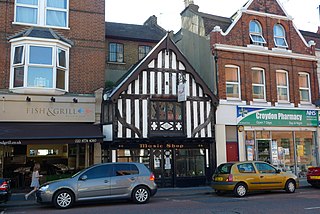
Mayfield and Five Ashes is a civil parish in the High Weald of East Sussex, England. The two villages making up the principal part of the parish lie on the A267 road between Royal Tunbridge Wells and Eastbourne: Mayfield, the larger of the two villages is ten miles (16 km) south of Royal Tunbridge Wells; with Five Ashes being 2.5 miles (4 km) further south.

Braemar Hill is a hill with a height of 200 metres (660 ft) south of Braemar Point on Hong Kong Island, Hong Kong. The hill was likely named after the Scottish village of Braemar by British officials.

Bristow is an unincorporated community of Prince William County in Northern Virginia about 30 miles (48 km) from Washington, D.C. In 2014, Bristow's postal area population was 29,346, a 287% increase since 2000; however, the Bristow community is formally included in the Linton Hall, Virginia census-designated place (CDP).
Mayfield Park is a residential area in East Bristol, with a large adjoining park known as the Ridgeway Rd Playing Fields.
Mayfield is a neighbourhood in west Edmonton, Alberta, Canada named for famed Canadian aviator and bush pilot Wop May.

Ottewell is a large residential neighbourhood in east Edmonton, Alberta, Canada. "The area is named for the Ottewell family, who were among the first settlers south of the river in the 1880s".

Green Point is an affluent suburb on the Atlantic Seaboard of Cape Town, South Africa located to the north west of the central business district. It is a popular residential area for young professionals and for the Cape Town gay and lesbian community, alongside the gay village of De Waterkant. Many new mid-rise apartment and mixed-use developments have gone up in recent years. Somerset Road forms the main thoroughfare lined by restaurants, cafés, delis, boutiques and nightclubs.

Bel-Air Park is a neighbourhood in College Ward in the west end of Ottawa, Ontario, Canada. It is bounded on the east by the Experimental Farm Pathway, on the south by Baseline Road, on the west by Woodroffe Avenue and on the north by the Queensway.
Braemar Park is a neighbourhood in College Ward in the west end of Ottawa, Ontario, Canada. It is bounded on the north by the Queensway, east on Maitland Drive, south by the Central Experimental Pathway and west by J. H. Putman Public School.
Kogan is a rural town and locality in the Western Downs Region, Queensland, Australia. In the 2016 census the locality of Kogan had a population of 190 people.

State Route 307 is a north–south state highway in McMinn and Monroe counties of East Tennessee.


