Hibberdene

Last updated

Hibberdene
South Africa KwaZulu-Natal location map.svg
Red pog.svg
Hibberdene
South Africa adm location map.svg
Red pog.svg
Hibberdene
Coordinates: 30°34′20″S30°34′20″E / 30.57222°S 30.57222°E / -30.57222; 30.57222
Country South Africa
Province KwaZulu-Natal
District Ugu
Municipality Ray Nkonyeni
Area
[1]
  Total14.26 km2 (5.51 sq mi)
Population
 (2011) [1]
  Total4,037
  Density280/km2 (730/sq mi)
Racial makeup (2011)
[1]
   Black African 67.1%
   Coloured 1.2%
   Indian/Asian 1.8%
   White 29.4%
  Other0.4%
First languages (2011)
[1]
   Zulu 60.9%
   English 18.1%
   Afrikaans 15.8%
   Xhosa 3.2%
  Other2.0%
Time zone UTC+2 (SAST)
Postal code (street)
4220
PO box
4220
Area code 039

Hibberdene is a small coastal town on the KwaZulu-Natal South Coast in South Africa, approximately 23 km (14 mi) north-east of Port Shepstone and 90 km (56 mi) south-west of Durban and halfway between coastal towns of Scottburgh and Margate.

Contents

Hibberdene is situated on a coastal hillside between the uMhlungwa River to the north and the uMzimayi River to the south, both of which drain into the Indian Ocean. The town was named after C. Maxwell-Hibberd, the former postmaster-general of Natal.

Law and government

Municipal administration

Previously an independent municipality and part of the defunct Hibiscus Coast Local Municipality, Hibberdene now forms part of the Ray Nkonyeni Local Municipality and the larger Ugu District Municipality.

Municipal re-demarcation

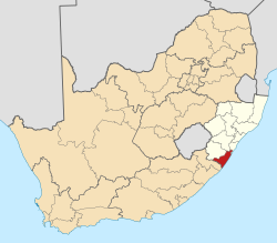
As the 2024 national government elections near, there have recently been several demarcation proposals made by the Municipal Demarcation Board (MDB) to relocate Ward 13 of the Ray Nkonyeni Local Municipality which includes Hibberdene and its neighbouring settlements of Woodgrange-on-Sea, Umzumbe (Umzumbe Village), Fairview/Fairview Mission and eNtaba to the adjoining Umzumbe Local Municipality.

However, Umzumbe Village and Fairview would still remain part of Ray Nkonyeni. It has also been highlighted that the relocation of most of Ward 13 to Umzumbe Municipality is in a bid to stimulate economic activity in the Greater Umzumbe area, a rural municipality plagued with administrative mismanagement, high levels of unemployment and little economic and social development. The reason for the relocation is also attributed to the fact that Hibberdene serves as the nearest urban service centre to the Greater Umzumbe area. A final decision on the demarcation proposals is yet to made regarding the relocation of Hibberdene to the Umzumbe Municipality. [2] [3]

Demographics

The 2011 census divided the main area of Hibberdene into seven “sub places”: Hibberdene proper (pop. 790), the coastal areas of Catalina (pop. 455) to the north, Woodgrange-on-Sea (pop. 292) to the immediate south, Umzumbe (pop. 366) to the far south and the inland rural areas of Fairview (pop. 1,606) and Fairview Mission (pop. 527) to the west. [4]

Retail

Hibberdene serves as a shopping centre for the small settlements and countryside surrounding it such as Mthwalume and Mathulini. The town centre of Hibberdene located adjacent the R102 road includes a shopping centre, Hibberdene Village Mall, as well as a PicknPay store and a number of other retailers, hardware stores and local businesses.

Culture and comptemptory life

Tourism

Similarly to most towns along the South Coast, Hibberdene mostly depends on tourism for its small-scale economy. Situated at the gateway to the Hibiscus Coast, Hibberdene is popularly known as an affordable holiday destination and for its beaches. Hibberdene has five popular beaches, four of which are netted and thus are safe for swimming. Hibberdene's beaches are popular because of the warm Indian Ocean flowing across its shoreline, making diving, snorkelling and scuba diving very pleasant. Two of its beaches, Hibberdene Beach and Umzumbe Beach are accredited with the international Blue Flag beach status. [5] [6] [7]

Transport

The N2 is a toll freeway bypassing Hibberdene from Durban in the north to Port Shepstone in the south. The R102 is the main road through Hibberdene, passing through from Pennington in the north to Umzumbe in the south and provides access to the N2 at exit 72. The R102 between Hibberdene and Port Shepstone is commonly used by motorists wishing to avoid tolling on the N2 in Port Shepstone.

A twice daily shuttle bus stops in Hibberdene connecting the town with Margate, Port Shepstone, Durban and King Shaka International Airport.

Related Research Articles

<span class="mw-page-title-main">Margate, South Africa</span> Resort town in KwaZulu-Natal, South Africa

Margate is a coastal resort town in the KwaZulu-Natal province, about 20 kilometres south-west of Port Shepstone and 127 kilometres south-west of Durban. The river which flows into the sea at Margate is called "Nkhongweni" (place of entreaty) as the original inhabitants of the area were reputed to be so mean resulting in travellers begging for hospitality.

<span class="mw-page-title-main">Port Shepstone</span> Coastal town in KwaZulu-Natal, South Africa

Port Shepstone is a large town situated on the mouth of the Mzimkhulu River, the largest river on the KwaZulu-Natal South Coast of South Africa. It is located halfway between Hibberdene and Margate and is positioned 120 km south of Durban. It serves as the administrative, educational, industrial and commercial centre for southern Natal.

<span class="mw-page-title-main">Port Edward, South Africa</span> Seaside town in KwaZulu-Natal, South Africa

Port Edward is a small resort town situated on the south coast of KwaZulu-Natal in South Africa and lies on the border between KwaZulu-Natal and the Eastern Cape. It is situated on the R61 road between Port Shepstone and Lusikisiki.

Park Rynie is a small resort town on the South Coast of KwaZulu-Natal in South Africa. It was established in 1857 and possibly named after Renetta Hoets, wife of one of the John Phillip Hoffman, partner in the firm Nosworthy & Co. that bought the original farm for development. There was a whaling station here built during World War I, Park Rynie Whales Ltd. A breakwater, Rocky Bar Pier and a landing ramp were also built.

Umtentweni is a small coastal resort on the South Coast of KwaZulu-Natal, South Africa, between the Mzimkulu River (the great home of all rivers) and the Mtentweni River. It forms part of the coastal town of Port Shepstone in the Ray Nkonyeni Local Municipality, KwaZulu-Natal, South Africa. It is a relatively clean and quiet residential resort; it has become an attractive destination for people aiming to get away from city life. Most of the village is filled with complexes, flats, bed and breakfasts and suburban-style houses. Twenty years ago the whole of Umtentweni consisted of a lot of greenery and wildlife. All this has changed due to the growing popularity of this small resort and the constant clearing for new housing.

<span class="mw-page-title-main">Umzumbe</span> Seaside town in KwaZulu-Natal, South Africa

Umzumbe is a seaside resort situated at the mouth of the Mzumbe River (bad kraal) in KwaZulu-Natal, South Africa. The name of the river is derived from a band of Hlongwa cannibals who occupied the valley. The Hlongwa was almost wiped out by the Zulu king Shaka in 1828.

Winklespruit is a small seaside resort on the South Coast of KwaZulu-Natal in South Africa and now forms part of the coastal town of Kingsburgh and the eThekwini Metropolitan Municipality, the Greater Durban metropolitan area.

<span class="mw-page-title-main">R102 (South Africa)</span> Regional Route in South Africa

The R102 is a Regional Route in South Africa. It is the route designation for all old sections of the N2, thus it is a discontinuous road that resumes in areas where a new N2 has been constructed.

<span class="mw-page-title-main">N2 (South Africa)</span> National road in South Africa

The N2 is a national route in South Africa that runs from Cape Town through George, Gqeberha, East London, Mthatha, Port Shepstone and Durban to Ermelo. It is the main highway along the Indian Ocean coast of the country. Its current length of 2,255 kilometres (1,401 mi) makes it the longest numbered route in South Africa.

<span class="mw-page-title-main">Ugu District Municipality</span> District municipality in KwaZulu-Natal, South Africa

The Ugu District Municipality is one of the 11 districts of the KwaZulu-Natal province of South Africa. Ugu is isiZulu for "coast". It governs the KZN South Coast and its seat is Port Shepstone. The majority of its 722,484 inhabitants spoke isiZulu as of 2011. The district code is DC21.

<span class="mw-page-title-main">Hibiscus Coast Local Municipality</span> Former local municipality in KwaZulu-Natal, South Africa

Hibiscus Coast Local Municipality was a local municipality in the province of KwaZulu-Natal in South Africa. It governed the Hibiscus Coast on the KwaZulu-Natal South Coast which attracts tourists from the province and other provinces as well as international tourists.

Marburg is a settlement in the Ugu District Municipality in the KwaZulu-Natal province of South Africa, situated approximately 112 kilometres south-west of the city of Durban. Marburg was a Norwegian settlement given the name Marburg for a nearby German mission. The Norwegian founders played a significant role in the development of Marburg and Port Shepstone, which it forms part of today. The British colonial government gave the settlers a free voyage to South Africa and also houses and 100 acres of land. Marburg was the only successful Scandinavian settlement in South Africa.

<span class="mw-page-title-main">Mthwalume</span> Place in KwaZulu-Natal, South Africa

Mtwalume, also known as Umtalumi, is a settlement in Ugu District Municipality in the KwaZulu-Natal province of South Africa.

Izingolweni or eZinqoleni is a town in Ugu District Municipality in the KwaZulu-Natal province of South Africa. It was founded in the 1870s as a police and administration post. The name comes from the Zulu language word for "place with very shallow holes." Izingolweni also consists of a school called Izingolweni Primary which is rumored that it was built by the community. This very school is the center of excellence in the place. It is very exceptional and produces very fine learners each year.

St Faith’s is a village in the Umzumbe Local Municipality in the KwaZulu-Natal province of South Africa.

<span class="mw-page-title-main">South Coast (KwaZulu-Natal)</span> Coastal region in KwaZulu-Natal, South Africa

KwaZulu-Natal South Coast is a region along the southern stretch of coastline of KwaZulu-Natal, South Africa, south of the coastal city of Durban.

Boboyi, or Bhobhoyi, is a rural settlement in KwaZulu-Natal, South Africa. It is located 8 km west of Port Shepstone and is named after the Boboyi River which runs through the area.

Oslo Beach is a small coastal village located along the South Coast of KwaZulu-Natal, South Africa and forms part of the coastal town of Port Shepstone.

Melville is a seaside resort village situated along the South Coast of KwaZulu-Natal, South Africa.

References

  1. 1 2 3 4 "Main Place Hibberdene". Census 2011.
  2. https://www.iol.co.za/news/politics/kwazulu-natal-could-have-a-new-municipality-by-2026-municipal-elections-66d16f25-5e28-46c7-b177-43c00b3f04b0
  3. "OPINION: New demarcation plans will impact existing ratepayers – South Coast Herald". southcoastherald.co.za. Retrieved 6 June 2023.
  4. "Census 2011: Main Place: Hibberdene". census2011.adrianfrith.com. Retrieved 6 June 2023.
  5. "These are South Africa's Blue Flag Beaches of 2022". Good Things Guy. 6 January 2022. Retrieved 2 December 2022.
  6. "Hibberdene Beach in Hibberdene, KwaZulu Natal". www.sa-venues.com. Retrieved 2 December 2022.
  7. "Umzumbe Beach in Umzumbe, KwaZulu Natal". www.sa-venues.com. Retrieved 2 December 2022.