
The Drakensberg is the eastern portion of the Great Escarpment, which encloses the central Southern African plateau. The Great Escarpment reaches its greatest elevation – 2,000 to 3,482 metres within the border region of South Africa and Lesotho.
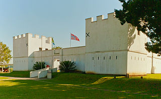
Eshowe is the oldest town of European settlement in Zululand, historically also known as Eziqwaqweni, Ekowe or kwaMondi. Eshowe's name is said to be inspired by the sound of wind blowing through the more than 4 km2 of the indigenous Dlinza Forest, the most important and striking feature of the town. Although the name is most likely to be derived from the Zulu word for the Xysmalobium shrubs, showe or shongwe.
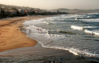
Scottburgh is a coastal resort town located along the south coast of KwaZulu-Natal, South Africa. It situated south of the mouth of the Mpambanyoni River (confuser of birds).

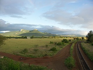
Newcastle is the third-largest city in the province of KwaZulu-Natal, South Africa and is the province's industrial centre. The city has four industrial areas. The majority of its citizens reside in Newcastle East in the main townships of Madadeni and Osizweni, with the balance residing in Newcastle West. Set at the foothills of the northern KwaZulu-Natal Drakensberg Mountains, Newcastle is located in the northwest corner of the province along the Ncandu River.
Utrecht is a town in the foothills of the Balele Mountains, in the northwestern corner of KwaZulu-Natal, South Africa. Newcastle, Kwazulu-Natal's third-largest urban centre, is 50 km from Utrecht. Utrecht has a population of approximately 32,000.
Weenen is the second oldest European settlement in KwaZulu-Natal, South Africa. It is situated on the banks of the Bushman River. The farms around the town grow vegetables, lucerne, groundnuts, and citrus fruit.
Harding is a town situated in the Mzimkulwana River valley, Ugu District Municipality of KwaZulu-Natal, South Africa
Hluhluwe is a small town in northern KwaZulu-Natal, South Africa. It is situated between iSimangaliso Wetland Park and Hluhluwe–iMfolozi Park on the banks of the Hluhluwe River. Hluhluwe is situated on the elephant coast, an area known for its national parks, natural diversity and cultural heritage. Although relatively undeveloped the area is of growing interest to international tourists and travelers. Several local and international movies have been filmed in Hluhluwe, such as I Dreamed of Africa,Ghost Son, and documentaries filmed in the surrounding national parks.
Mkuze, also named Mkhuze or uMkhuze is a small town in Northern KwaZulu-Natal, South Africa. It is located approximately 350 km from the city of Durban. It is along the N2 road en route to Johannesburg, Eswatini and Mozambique; between the Mkuze River and Intaba Yemikhovu. Mkuze is some distance from other small towns such as Hluhluwe (50 km), Nongoma (76 km), Pongola (65 km), and Jozini (25 km). Mkuze is the seat of Umkhanyakude District Municipality.
Mtunzini is a small coastal town that is situated almost exactly halfway along KwaZulu-Natal's coastline in South Africa approximately 140 km north of Durban. In 2011, the town's population was 2,199.
The Umlalazi Nature Reserve is a coastal reserve situated 1 km (0.62 mi) from Mtunzini on the KwaZulu-Natal North Coast. Umlalazi was established as a protected area in 1948 and is 10.28 km2 (3.97 sq mi) in extent. Home of the palm-nut vulture, which is one of the rarest birds of prey in South Africa.

The Tsitsikamma National Park is a protected area on the Garden Route, Western Cape and Eastern Cape, South Africa. It is a coastal reserve well known for its indigenous forests, dramatic coastline, and the Otter Trail. On 6 March 2009 it was amalgamated with the Wilderness National Park and various other areas of land to form the Garden Route National Park.

The Umtamvuna Nature Reserve is situated in South Africa on the KwaZulu-Natal side of the Mtamvuna River, and is managed by Ezemvelo KZN Wildlife. The reserve is 3,257 hectares in extent and was established on 25 July 1971.
Umdoni Bird Sanctuary is situated in Amanzimtoti, KwaZulu-Natal in South Africa. The sanctuary is often simply referred to as The Bird Park by locals or as Amanzimtoti Bird Sanctuary. The area is roughly 4 ha of land including a dam on a tributary of the Amanzimtoti River. There are picnic areas and forest trails.
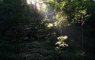
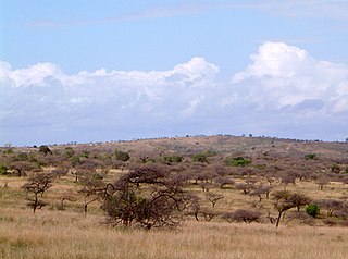
Areas of forest which grow in KwaZulu-Natal, South Africa mostly on south facing slopes in higher rainfall areas, and along the humid coastal areas. Different types of forest can be identified by their species composition which depends mostly on the altitude, latitude and substrate in which they grow. South facing slopes are favourable for the development of forest as they are more shaded, and therefore cooler and retain more moisture than the northern slopes. The extra moisture on the south slopes is not only favoured by forest trees, but also helps to prevent or subdue wildfires. Fires can also be blocked by cliff faces and rocks or boulders on these slopes, and by streams or rivers at the base of the slopes. The coastal regions are conducive to forest formation, because of high rainfall and humidity which are favoured by forest trees and also help to prevent or subdue fires. The rivers of the coastal areas are also broader than further inland, which may often prevent fires from spreading long distances, and fires generally burn uphill and therefore more often away from areas at low altitude.
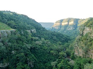
The Weza Forest is also known as the Weza-Ngele Forest and is situated near Harding, KwaZulu-Natal, South Africa. This is a large Mistbelt Forest which has long been exploited for timber. The forest has been fragmented and reduced in size over many decades.

Port St. Johns is a town of about 6,500 people on the Wild Coast in the Eastern Cape province of South Africa. It is situated at the mouth of the Umzimvubu River, 220 kilometres (140 mi) northeast of East London and 70 kilometres (40 mi) east of Mthatha. Port St. Johns was the birthplace of Capital Radio 604.
Hlabeni is a town in Harry Gwala District Municipality in the KwaZulu-Natal province of South Africa.
The Krantzkloof Nature Reserve, managed by Ezemvelo KZN Wildlife, conserves 668 ha of the Molweni and Nkutu River gorges that incise the sandstone Kloof plateau in KwaZulu-Natal, South Africa. The reserve conserves coastal scarp forest, sourveld grassland, a cliff face biotope, and aquatic environments along its rivers. Scarp forest is a threatened forest type, protected by South Africa's forests act of 1998, while the grassland is classified as KwaZulu-Natal sandstone sourveld, the most threatened terrestrial habitat in the Durban metropole. The reserve was established in 1950 and was augmented by land donations as late as 1999.

The KwaZulu-Natal South Coast is a region along the southern stretch of coastline of KwaZulu-Natal, South Africa, south of the coastal city of Durban.


