Uvongo

Last updated

Uvongo
Uvongo Beach, KZN.jpg
Uvongo Beach
South Africa KwaZulu-Natal location map.svg
Red pog.svg
Uvongo
South Africa adm location map.svg
Red pog.svg
Uvongo
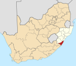
Coordinates: 30°49′S30°23′E / 30.817°S 30.383°E / -30.817; 30.383
Country South Africa
Province KwaZulu-Natal
District Ugu
Municipality Ray Nkonyeni
Main Place Margate
Area
[1]
  Total4.52 km2 (1.75 sq mi)
Population
 (2011) [1]
  Total4,288
  Density950/km2 (2,500/sq mi)
Racial makeup (2011)
[1]
   Black African 21.6%
   Coloured 2.0%
   Indian/Asian 4.4%
   White 71.8%
  Other0.3%
First languages (2011)
[1]
   English 57.7%
   Afrikaans 25.5%
   Zulu 8.1%
   Xhosa 5.6%
  Other3.2%
Time zone UTC+2 (SAST)
Postal code (street)
4270
PO box
4270

Uvongo is a seaside resort town situated along the KwaZulu-Natal South Coast at the mouth of the Vungu River in KwaZulu-Natal, South Africa. Situated 4 kilometres (2.5 mi) north of Margate, Uvongo is the largest upmarket residential area on the Lower South Coast.

Contents

Uvongo beach lost its "Blue Flag" title due to storms damaging it in April 2007 but has managed to regain a clean and prestigious beach front. Uvongo still remains the playground of the rich,[ citation needed ] with multimillion rand properties in the area. Uvongo is one of South Africa's favourite holiday destinations and attracts local and foreign tourists.[ citation needed ]

Etymology

The town is named after the main river flowing through the area, the Vungu River, [2] which is derived from the Zulu word that describes the sound of a waterfall or the wind in a gorge.

Geography

The geographical position of Uvongo is between the coastal towns of St Michael’s-on-Sea and Shelly Beach to the north and Manaba Beach and Margate to the south. It is situated south of the Mhlangeni River and is bisected by the Vungu River, which forms a 23-metre high waterfall known as the Uvongo Falls above the lagoon that flows into a small gorge at the river mouth. [3]

The Greater Uvongo area consists of three smaller suburbs, namely Uvongo proper, situated inland from the coastline, Uvongo Beach, situated along the coastline north of the Vungu River, and Beacon Rocks, situated along the coastline south of the Vungu River. [4]

Industries

The Uvongo industrial area, situated to the west of the R61, is the second largest industrial area on the Lower South Coast after Marburg in Port Shepstone. The industrial area encompasses a variety of small to medium local businesses, however the most notable economic activity in the area is the NPC Quarry. The area is mainly accessed via Quarry Road from Wingate Road just opposite the R61/Margate/Uvongo off-ramp. [5]

Transport

Roads

Uvongo is bisected by the R620 (Marine Drive) connecting Shelly Beach to the north with Margate to the south and lies just off the R61 highway (future N2 Wild Coast Toll Route) between Port Shepstone to the north and Port Edward to the south. The area can also be reached via Knoxgore Road from Gamalakhe in the north-west and Seaslopes Avenue, which provides access to the R61.

See also

Related Research Articles

<span class="mw-page-title-main">Margate, South Africa</span> Resort town in KwaZulu-Natal, South Africa

Margate is a coastal resort town in the KwaZulu-Natal province, about 20 kilometres south-west of Port Shepstone and 127 kilometres south-west of Durban. The river which flows into the sea at Margate is called "Nkhongweni" (place of entreaty) as the original inhabitants of the area were reputed to be so mean resulting in travellers begging for hospitality.

<span class="mw-page-title-main">Port Shepstone</span> Coastal town in KwaZulu-Natal, South Africa

Port Shepstone is a large town situated on the mouth of the Mzimkhulu River, the largest river on the KwaZulu-Natal South Coast of South Africa. It is located halfway between Hibberdene and Margate and is positioned 120 km south of Durban. It serves as the administrative, educational, industrial and commercial centre for southern Natal.
<span class="mw-page-title-main">Port Edward, South Africa</span> Seaside town in KwaZulu-Natal, South Africa

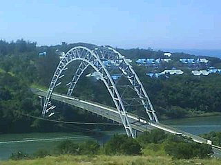
Port Edward is a small resort town situated on the south coast of KwaZulu-Natal in South Africa and lies on the border between KwaZulu-Natal and the Eastern Cape. It is situated on the R61 road between Port Shepstone and Lusikisiki.

Hibberdene is a small coastal town on the KwaZulu-Natal South Coast in South Africa, approximately 23 km north-east of Port Shepstone and 90 km south-west of Durban and halfway between coastal towns of Scottburgh and Margate.

<span class="mw-page-title-main">Umzumbe</span> Seaside town in KwaZulu-Natal, South Africa

Umzumbe is a seaside resort situated at the mouth of the Mzumbe River (bad kraal) in KwaZulu-Natal, South Africa. The name of the river is derived from a band of Hlongwa cannibals who occupied the valley. The Hlongwa was almost wiped out by the Zulu king Shaka in 1828.

<span class="mw-page-title-main">R61 (South Africa)</span> Road in South Africa

The R61 is a long provincial route in South Africa that connects Beaufort West with Port Shepstone via Graaff-Reinet, Komani, Mthatha and Port Edward.

Marburg is a settlement in the Ugu District Municipality in the KwaZulu-Natal province of South Africa, situated approximately 112 kilometres south-west of the city of Durban. Marburg was a Norwegian settlement given the name Marburg for a nearby German mission. The Norwegian founders played a significant role in the development of Marburg and Port Shepstone, which it forms part of today. The British colonial government gave the settlers a free voyage to South Africa and also houses and 100 acres of land. Marburg was the only successful Scandinavian settlement in South Africa.

<span class="mw-page-title-main">Mthwalume</span> Place in KwaZulu-Natal, South Africa

Mtwalume, also known as Umtalumi, is a settlement in Ugu District Municipality in the KwaZulu-Natal province of South Africa.

<span class="mw-page-title-main">Southbroom</span> Coastal village in KwaZulu-Natal, South Africa

Southbroom is a coastal village on the South Coast of the KwaZulu-Natal province of South Africa situated approximately halfway between Port Shepstone – 23 km (14 mi) and Port Edward – 18 km (11 mi).
<span class="mw-page-title-main">Shelly Beach, South Africa</span> Place in KwaZulu-Natal, South Africa

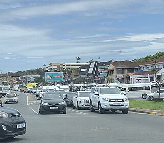
Shelly Beach is a coastal resort town on the South Coast of the KwaZulu-Natal province of South Africa, located approximately halfway between Margate and Port Shepstone.

Munster is a quiet coastal village on the South Coast of KwaZulu-Natal, South Africa.

The R620 is a regional route in KwaZulu-Natal, South Africa that connects the coastal towns of Southbroom and Port Shepstone via Ramsgate, Margate, Uvongo and Shelly Beach. It is often termed the ‘beach road’ of the Lower South Coast, considering that it mostly runs near the coastline.

Gamalakhe is a township situated about 6 km (4 mi) inland on the South Coast of KwaZulu-Natal Province, South Africa.

<span class="mw-page-title-main">South Coast (KwaZulu-Natal)</span> Coastal region in Southern KwaZulu-Natal, South Africa

The KwaZulu-Natal South Coast is a region along the southern stretch of coastline of KwaZulu-Natal, South Africa, south of the coastal city of Durban.

Oslo Beach is a small coastal village located along the South Coast of KwaZulu-Natal, South Africa and forms part of the coastal town of Port Shepstone.

Manaba Beach is a small coastal town on the South Coast of the KwaZulu-Natal province of South Africa, located approximately 2 kilometres north of the Margate CBD and 13 kilometres south of Port Shepstone. The name ‘Manaba’ translates to 'ease and relaxation' in the Zulu language.

Leisure Bay is a small coastal village located on the Lower South Coast of KwaZulu-Natal in South Africa.

St Michael's-on-Sea is a small seaside village located on the South Coast of KwaZulu-Natal, South Africa, between Uvongo and Shelly Beach.

<span class="mw-page-title-main">Izotsha</span> Place in KwaZulu-Natal, South Africa

Izotsha is a small rural settlement on the South Coast of the KwaZulu-Natal province of South Africa, just inland from Shelly Beach and approximately 7 kilometres south-west of Port Shepstone. The name ‘Izotsha’ translates to 'it will burn’ in the Zulu language.

References

  1. 1 2 3 4 "Sub Place Uvongo". Census 2011.
  2. Jenkins, Elwyn (2007), Falling into place: the story of modern South African place names, David Philip Publishers, p. 76
  3. "Uvongo". www.sa-venues.com. Retrieved 5 July 2023.
  4. "Census 2011: Main Place: Margate". census2011.adrianfrith.com. Retrieved 4 November 2022.
  5. "N P C Aggregate | Concrete | Brabys". www.brabys.com. Retrieved 8 September 2024.