Izingolweni eZinqoleni | |
|---|---|
 Izingolweni  Izingolweni | |
| Coordinates: 30°46′30″S30°07′37″E / 30.775°S 30.127°E | |
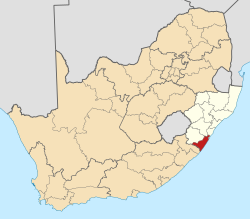
| Country | South Africa |
| Province | KwaZulu-Natal |
| District | Ugu |
| Municipality | Ray Nkonyeni |
| Area | |
• Total | 6.43 km2 (2.48 sq mi) |
| Population (2011) [1] | |
• Total | 5,294 |
| • Density | 823/km2 (2,130/sq mi) |
| Racial makeup (2011) | |
| • Black African | 100.0% |
| First languages (2011) | |
| • Zulu | 97.7% |
| • Other | 2.3% |
| Time zone | UTC+2 (SAST) |
| PO box | 4260 |
| Area code | 039 |
Izingolweni or eZinqoleni is a town in Ugu District Municipality in the KwaZulu-Natal province of South Africa. It was founded in the 1870s as a police and administration post. The name comes from the Zulu language word for "place with very shallow holes." Izingolweni also consists of a school called Izingolweni Primary which is rumored that it was built by the community.