Meads, Kentucky

Last updated

Meads
USA Kentucky location map.svg
Red pog.svg
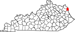
Meads
Location within the state of Kentucky
Usa edcp location map.svg
Red pog.svg
Meads
Meads (the United States)
Coordinates: 38°24′45″N82°42′33″W / 38.41250°N 82.70917°W / 38.41250; -82.70917
Country United States
State Kentucky
County Boyd
Time zone UTC-5 (Eastern (EST))
  Summer (DST) UTC-4 (EDT)

Meads is an unincorporated community in Boyd County, Kentucky, United States. It is located along the U.S. Highway 60 corridor south of Ashland.

Meads is centered on the junction of U.S. Route 60, Kentucky Route 538 and Mead-Springer Road. It was named for the long closed Mead's station, a train station and general store located on the C&O(now CSX) railroad that still runs through the community. Very little if anything remains of the original community besides the railroad and a few homes. With the upgrading of U.S. 60 beginning in the early 1970s, new growth began to happen at Meads, as it was reborn as a suburb of Ashland. In 1974 a large subdivision named Rockdale was developed on the hills above Meads, with several hundred tract homes. In 1991, Mead Station Plaza was constructed with over 20 commercial units and serves the nearby communities along U.S. 60. Several other commercial units have followed suit in recent years. Meads is a part of the Huntington-Ashland Metropolitan Statistical Area (MSA). As of the 2010 census, the MSA had a population of 287,702. New definitions from February 28, 2013, placed the population at 363,000. [1]

Related Research Articles

<span class="mw-page-title-main">Ashland, Kentucky</span> City in Kentucky, United States

Ashland is a home rule-class city in Boyd County, Kentucky, United States. The largest city in Boyd County, Ashland is located upon a southern bank of the Ohio River at the state border with Ohio and near West Virginia. The population was 21,625 at the 2020 census. Ashland is a principal city of the Huntington–Ashland metropolitan area, referred to locally as the "Tri-State area", home to 376,155 residents as of 2020. Ashland serves as an important economic and medical center for northeastern Kentucky.

<span class="mw-page-title-main">Catlettsburg, Kentucky</span> City in Kentucky, United States

Catlettsburg is a home rule-class city in and the county seat of Boyd County, Kentucky, United States. The city population was 1,780 at the 2020 census. It is part of the Huntington–Ashland metropolitan area.

<span class="mw-page-title-main">Grayson, Kentucky</span> City in Kentucky, United States

Grayson is a home rule-class city in and the county seat of Carter County, Kentucky, United States, on U.S. Route 60 and Interstate 64 in the state's northeastern region. It is approximately 21 miles west of Ashland. Within the city limits, the population was 4,217 at the 2010 census. Along with Carter County, the city is closely associated with the nearby Huntington-Ashland, WV-KY-OH Metropolitan Statistical Area and is often erroneously included in the MSA being just 9 miles west of the M.S.A's western boundary.

<span class="mw-page-title-main">Bellefonte, Kentucky</span> City in Kentucky, United States

Bellefonte is a home rule-class city in Greenup County, Kentucky, United States. The population was 888 at the 2010 census. Bellefonte is a part of the Huntington-Ashland, WV-KY-OH Metropolitan Statistical Area (MSA). In 2013, according to new boundary definitions, the MSA had a population of 361,580.

<span class="mw-page-title-main">Greenup, Kentucky</span> City in Kentucky, United States

Greenup is a home rule-class city located at the confluence of the Little Sandy River with the Ohio River in Greenup County, Kentucky, United States. The population was 1,188 at the 2010 census. Greenup is one of three county seats in the Commonwealth of Kentucky to share its name with its county; the other two being Harlan and Henderson.

<span class="mw-page-title-main">Russell, Kentucky</span> City in Kentucky, United States

Russell is a home rule-class city on the south bank of the Ohio River in Greenup County, Kentucky, United States. The population was 3,380 as of the 2010 census, down from 3,645 in 2000. Russell is a suburb of Ashland and part of the Huntington-Ashland-Ironton metropolitan area. It has close economic affiliations with its neighbors, Ashland and Flatwoods in Kentucky and Ironton, Ohio.

<span class="mw-page-title-main">South Shore, Kentucky</span> City in Kentucky, United States

South Shore is a home rule-class city in Greenup County, Kentucky, United States. The population was 1,122 at the 2010 census, down from 1,226 in 2000. It is located along the Ohio River across from Portsmouth, Ohio, at the mouth of Tygarts Creek. South Shore is a part of the Huntington-Ashland, WV-KY-OH, Metropolitan Statistical Area (MSA).

<span class="mw-page-title-main">Wurtland, Kentucky</span> City in Kentucky, United States

Wurtland is a home rule-class city in Greenup County, Kentucky, United States, along the Ohio River. The population was 995 at the 2010 census. Wurtland is a part of the Huntington-Ashland, WV-KY-OH, Metropolitan Statistical Area (MSA). As of the 2010 census, the MSA had a population of 287,702.

<span class="mw-page-title-main">Greater Richmond Region</span> Metropolitan statistical area in the United States

The Greater Richmond Region, the Richmond metropolitan area or Central Virginia, is a region and metropolitan area in the U.S. state of Virginia, centered on Richmond. The U.S. Office of Management and Budget (OMB) defines the area as the Richmond, VA Metropolitan Statistical Area, a Metropolitan Statistical Area (MSA) used by the U.S. Census Bureau and other entities. The OMB defines the area as comprising 17 county-level jurisdictions, including the independent cities of Richmond, Petersburg, Hopewell, and Colonial Heights. As of 2020, it had a population of 1,314,434, making it the 44th largest MSA in the country.

Cannonsburg is a census-designated place (CDP) in Boyd County, Kentucky, United States. As of the 2010 census, it had a population of 856. Cannonsburg is located 8 miles (13 km) southwest of the city of Ashland, a major urban center in northeastern Kentucky. Most of Cannonsburg shares its ZIP code with Ashland; however, parts are within the Catlettsburg ZIP code. The Cannonsburg post office closed in 1929. Cannonsburg is a part of the Huntington-Ashland Metropolitan Statistical Area (MSA). As of the 2010 census, the MSA had a population of 287,702. New definitions from February 28, 2013, placed the population at 363,000.

<span class="mw-page-title-main">East Lynn, West Virginia</span> Unincorporated community in West Virginia, United States

East Lynn is an unincorporated community in Wayne County, West Virginia, United States, located along the banks of Twelvepole Creek, approximately eight miles south of the county seat, Wayne. It was also known as Mouth of Little Lynn. East Lynn is a part of the Huntington-Ashland Metropolitan Statistical Area (MSA). As of the 2010 census, the MSA had a population of 287,702. New definitions from February 28, 2013 placed the population at 363,000.

<span class="mw-page-title-main">Summit, Kentucky</span> Unincorporated community in Kentucky, United States

Summit is an unincorporated community in Boyd County, Kentucky, United States on US 60 just west of Ashland. Summit serves as a suburb to the city of Ashland and shares the city's ZIP code. Summit is sometimes spelled with two "T's" at the end, although the most common spelling contains only one "T" but either variation is accepted as correct.

Princess is a small unincorporated community in Boyd County, Kentucky, United States.

<span class="mw-page-title-main">Coalton, Kentucky</span> Unincorporated community in Kentucky, United States

Coalton is an unincorporated community situated along U.S. Route 60, which was formerly known as the Midland Trail in western Boyd County, Kentucky, United States. U.S. Route 60 between Rush and Cannonsburg. Coalton is a part of the Huntington-Ashland Metropolitan Statistical Area (MSA). As of the 2010 census, the MSA had a population of 287,702. New definitions from February 28, 2013, placed the population at 361,500. Coalton is located within both the Ashland and Rush postal zip codes.

The Charleston Metropolitan Statistical Area, as defined by the United States Census Bureau, is an area consisting of three counties in West Virginia, anchored by the city of Charleston. It is the largest metropolitan area entirely within the state of West Virginia. While the Huntington Metro Area is more populous, it spans three states, and the core county of the Charleston area, Kanawha County, is more populous than the West Virginia portion of the Huntington area.

<span class="mw-page-title-main">Kentucky Route 168</span> State highway in Kentucky, United States

Kentucky Route 168 is a two-lane route extending from US 23 in Westwood to the US 23/60 multiplex in Catlettsburg. Its southern end point in Catlettsburg was originally at the underpass where Walnut and Louisa Streets once split. In 1971, the former ending was truncated to its present location due to the re-routing of U.S. 23 around downtown Catlettsburg. Once inside the city of Ashland, it traverses three different surface streets known as Valley View Drive, Blackburn Avenue and South Belmont Street via a series of turns, mainly within the South Ashland residential district. In Ashland, it crosses 13th Street at an intersection locally known as Community.

Ironville is an unincorporated community in Boyd County, Kentucky, United States, near the intersection of Kentucky Route 5 and Kentucky Route 766. Due to its proximity to Ashland, Ironville is often considered to be a part of Ashland, although officially it is separate from the city and serves as a suburb to the city. It shares its ZIP code with Ashland as well.

Rockdale is an unincorporated community in Boyd County, Kentucky, United States, located south of Ashland. It is located on Midland Trail at its intersection of Kentucky Route 538 and corridor into the city of Ashland. It was mostly a rural area until the 1970s, when a large subdivision began development, with several hundred tract houses.

The Huntington–Ashland metropolitan area is a metropolitan area in the Appalachian Plateau region of the United States. Referred to locally as the "Tri-State area," and colloquially as "Kyova", the region spans seven counties in the three states of Kentucky, Ohio, and West Virginia. With a population of 361,580, the Tri-State area is nestled along the banks of the Ohio River. The region offers a diverse range of outdoor activities.

<span class="mw-page-title-main">Boyd County, Kentucky</span> County in Kentucky, United States

Boyd County is a county located in the U.S. state of Kentucky. As of the 2020 census, its population was 48,261. The county seat is Catlettsburg, and its largest city is Ashland. The county was formed in 1860. The county spans 160 square miles (410 km2), and is found at the northeastern edge of the state, near the Ohio River and Big Sandy River and situated in mountainous Appalachia. Boyd County is in the Huntington-Ashland, WV-KY-OH metropolitan statistical area.

References

  1. "OMB BULLETIN NO. 13-01 (Population statistics)" (PDF). Office of Management and Budget . February 28, 2013. Archived (PDF) from the original on January 21, 2017 via National Archives.