Ironville | |
|---|---|
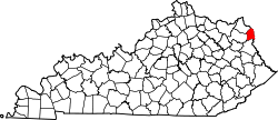
 Ironville Location within the state of Kentucky  Ironville Ironville (the United States) | |
| Coordinates: 38°27′23″N82°41′33″W / 38.45639°N 82.69250°W | |
| Country | United States |
| State | Kentucky |
| County | Boyd |
| Area | |
| 0.78 sq mi (2.02 km2) | |
| • Land | 0.78 sq mi (2.01 km2) |
| • Water | 0 sq mi (0.00 km2) |
| Population (2020) | |
| 782 | |
| • Density | 1,006/sq mi (388.4/km2) |
| • Metro | 288,649 |
| Time zone | UTC-5 (Eastern (EST)) |
| • Summer (DST) | UTC-4 (EDT) |
| ZIP codes | 41102 |
| FIPS code | 21-39592 |
| GNIS feature ID | 495012 [2] |
Ironville is an unincorporated community in Boyd County, Kentucky, United States, near the intersection of Kentucky Route 5 and Kentucky Route 766. Due to its proximity to Ashland, Ironville is often considered to be a part of Ashland, although officially it is separate from the city and serves as a suburb to the city. It shares its ZIP code with Ashland as well. As of the 2020 census, Ironville had a population of 782. [3]
Contents
Ironville is a part of the Huntington-Ashland, WV-KY-OH, Metropolitan Statistical Area (MSA).