
Johnson County is a county located in the U.S. state of Kentucky. As of the 2020 census, the population was 22,680. Its county seat is Paintsville. The county was formed in 1843 and named for Richard Mentor Johnson, a colonel of the War of 1812, United States Representative, Senator, and Vice President of the United States.

Prestonsburg is a small home rule-class city in and the county seat of Floyd County, Kentucky, United States. It is in the eastern part of the state in the valley of the Big Sandy River. The population was 3,255 at the time of the 2010 census, down from 3,612 at the 2000 census.

Chamblee is a city in northern DeKalb County, Georgia, United States, northeast of Atlanta. The population was 30,164 as of the 2020 census.

Arlington Heights is a village in Cook County, Illinois, United States. A northwestern suburb of Chicago, it lies about 25 miles (40 km) northwest of the city's downtown. As of the 2020 census, the village's population was 77,676, making it the 15th-most populous municipality in Illinois.

Ashland is a home rule-class city in Boyd County, Kentucky, United States. The most populous city in Boyd County, Ashland is located upon a southern bank of the Ohio River at the state border with Ohio and near West Virginia. The population was 21,625 at the 2020 census. Ashland is a principal city of the Huntington–Ashland metropolitan area, referred to locally as the "Tri-State area", home to 376,155 residents as of 2020. Ashland serves as an important economic and medical center for northeastern Kentucky.

Catlettsburg is a home rule-class city in and the county seat of Boyd County, Kentucky, United States. The city population was 1,780 at the 2020 census. It is part of the Huntington–Ashland metropolitan area.

Indian Hills is a home rule-class city along the Ohio River in Jefferson County, Kentucky, United States. The population was 2,860 as of the 2020 census. Indian Hills and the nearby cities of Mockingbird Valley, Glenview, and Anchorage have been cited as Louisville's most prosperous suburbs since the mid-20th century. Indian Hills was among the nation's highest-income places as of the 2000 U.S. census.
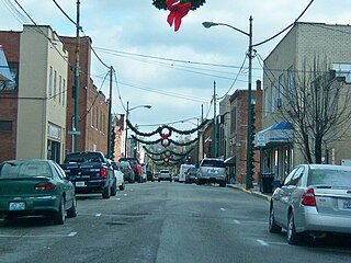
Paintsville is a home rule-class city along Paint Creek in Johnson County, Kentucky, in the United States. It is the seat of its county. The population was 3,459 during the 2010 U.S. Census.

U.S. Route 23 or U.S. Highway 23 (US 23) is a major north–south United States Numbered Highway between Jacksonville, Florida, and Mackinaw City, Michigan. It is an original 1926 route which originally reached only as far south as Portsmouth, Ohio, and has since been extended. It was formerly part of the major highway known as the Dixie Highway. The highway's southern terminus is in Jacksonville, Florida, at US 1/US 17. The northern terminus is at Interstate 75 (I-75) in Mackinaw City, Michigan.
Cannonsburg is a census-designated place (CDP) in Boyd County, Kentucky, United States. As of the 2010 census, it had a population of 856. Cannonsburg is located 8 miles (13 km) southwest of the city of Ashland, a major urban center in northeastern Kentucky. Most of Cannonsburg shares its ZIP code with Ashland; however, parts are within the Catlettsburg ZIP code. The Cannonsburg post office closed in 1929. Cannonsburg is a part of the Huntington-Ashland Metropolitan Statistical Area (MSA). As of the 2010 census, the MSA had a population of 287,702. New definitions from February 28, 2013, placed the population at 363,000.

Kentucky Route 3 is a 79.158-mile-long (127.392 km) state highway in the U.S. state of Kentucky.
U.S. Route 23 (US 23) is a 157.765-mile-long (253.898 km) United States Numbered Highway in the state of Kentucky. It travels from the Virginia state line near Jenkins to the Ohio state line west of South Shore via Jenkins, Pikeville, Coal Run Village, Prestonsburg, Paintsville, Louisa, Catlettsburg, Ashland, Russell, Flatwoods, Raceland, Wurtland, Greenup, and South Shore.

Runcorn is an outer southern suburb in the City of Brisbane, Queensland, Australia. In the 2021 census, Runcorn had a population of 14,199 people.

Boyd County is a county located in the U.S. Commonwealth of Kentucky. As of the 2020 census, its population was 48,261. The county seat is Catlettsburg, and its largest city is Ashland. The county was formed in 1860. The county spans 160 square miles (410 km2), and is found at the northeastern edge of the state, near the Ohio River and Big Sandy River and situated in mountainous Appalachia. Boyd County is in the Huntington-Ashland, WV-KY-OH metropolitan statistical area.

The Catlettsburg Refinery is an American oil refinery. It is located in northeastern Kentucky, at the intersection of Interstate 64 and U.S. Route 23 in Catlettsburg, Kentucky near the cities of Ashland, Kentucky and Huntington, West Virginia. The facility was built in 1916 by the Great Eastern Refining Company and purchased in 1924 by the Ashland Refining Company. The refinery now occupies a 650-acre (260 ha) plus site, producing more than 291,000 barrels per day (46,300 m3/d), and employing around 1,600 employees and contractors. Its location on the west banks of the Big Sandy River and only two miles south of the Ohio River, allows it to ship products by barge as well as pipeline. It is owned and operated by Marathon Petroleum Corporation.
Burnaugh, Kentucky is an unincorporated community located in Boyd County, Kentucky along U.S. Route 23. Being located between the Burgess Station, a former C&O Freight and passenger terminal and Kavanaugh, it takes its name from the combination of the two communities. It is located on both the former Mayo Trail and present-day U.S. Route 23. Burnaugh is located within the ZIP Code Tabulation Area for zip code 41129, which includes the nearby city of Catlettsburg.
Kavanaugh, Kentucky is an unincorporated community located in Boyd County, Kentucky, located along U.S. Route 23 directly north of the Lawrence County line. In 1984, the original alignment of U.S. 23 was replaced with a modern four-lane highway. CSX Transportation's Big Sandy Subdivision railroad tracks pass through the community. The railroad was formerly operated by the Chessie System and its predecessor the Chesapeake and Ohio Railway Company.
Lockwood is an unincorporated community located along U.S. Route 23 and the Big Sandy River in southern Boyd County, Kentucky, United States, approximately 7 mi south of Catlettsburg, the county seat.
Normal is a residential unincorporated community, located within the city of Ashland, Kentucky along U.S. Route 23 and U.S. Route 60 and the Ohio River. It was annexed by the City of Ashland in 1905. Previously, Normal was an independent community with post office. Normal Presbyterian Church, founded in 1890, is one of the last surviving remnants of the original community of Normal. The originally wooden church was razed in 1957 when the current brick structure was completed across 44th Street.


