Princess, Kentucky

Last updated
Princess
USA Kentucky location map.svg
Red pog.svg
Princess
Location within the state of Kentucky
Usa edcp location map.svg
Red pog.svg
Princess
Princess (the United States)
Coordinates: 38°23′15″N82°44′45″W / 38.38750°N 82.74583°W / 38.38750; -82.74583 Coordinates: 38°23′15″N82°44′45″W / 38.38750°N 82.74583°W / 38.38750; -82.74583
Country United States
State Kentucky
County Boyd
Time zone UTC-5 (Eastern (EST))
  Summer (DST) UTC-4 (EDT)
ZIP codes
41102
GNIS feature ID501349 [1]

Princess is a small unincorporated community in Boyd County, Kentucky, United States.

Contents

Location

Princess is located along Kentucky Route 5, near the intersection of U.S. Route 60 and Kentucky Route 5 (GPS 38.387494,-82.745017). Princess ends at or near the top of Princess Hill (GPS 38.387343,-82.734724). Princess Hill is located on US 60 between the community of Princess and the unincorporated community of Cannonsburg. Princess runs southwest from Princess Hill along US 60 and ends when the unincorporated community of Coalton is encountered (GPS 38.381322,-82.749798). And Princess runs along Kentucky Route 5 to the confluence of Straight Creek and William's Creek (near the intersection of Kentucky Route 5 and Straight Creek Road - GPS 38.400427,-82.760516).

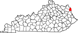
Princess is located within an Ashland postal zip code (41102). Princess is a part of the Huntington-Ashland, WV-KY-OH, Metropolitan Statistical Area (MSA). As of the 2000 census, the MSA had a population of 288,649.

History

The community is named after a late 19th-century iron furnace called "Princess", said to have been the pet name of a daughter of a furnace official. Initially the community may have been called "Princess Furnace". [2]

An imposing brown sandstone retaining wall of the Princess Furnace facility (GPS 38.394084,-82.758883) remains, but the actual Princess iron furnace was dismantled and relocated to Glen Wilton, Virginia (Botetourt County) in 1883–1884. [3]

This sandstone wall is located along Kentucky Route 5 approximately 0.98 miles from US 60 and just west of where Kentucky Route 5 crosses William's Creek. There is a Kentucky Historical marker (#1135) for Princess Furnace near the sandstone retaining wall along Kentucky Route 5. The actual furnace was very near this wall, since the furnace was loaded from its top with raw materials via a catwalk from the hill retained by the sandstone wall.

The iron ore used in Princess Furnace was mined locally and shallow ore diggings gouged along the faces of the local hills are still visible.

The population focus and activity of the community has steadily shifted to near the intersection of Kentucky Route 5 and US 60.

Much of this shift can likely be attributed to the industrial brick factory (GPS 38.38244,-82.746195), now largely dismantled, near Kentucky Route 5 and US 60. This brickyard facility maintained many "company" houses near the facility for employees. A few of these company houses remained until the early 1990s, but all are now gone and the land is now privately owned. And most recently, there has been continued development of the subdivision "Princeland" (GPS 38.383668,-82.749993) and commercial / industrial developments at the Paul Coffey Industrial Park (GPS 38.39344,-82.739543); both are very near this KY 5 / US 60 intersection focus.

A railroad runs parallel to US 60 in the Princess area with a tunnel that goes under Princess Hill. At one point this was a major rail line of the C & O running from Ashland, Kentucky to Louisville, Kentucky, but now it is only a spur line that terminates at the steel mill in Coalton, the unincorporated community adjacent to Princess.

Points of interest

Education

Boyd County Public Schools

Related Research Articles

Ashland, Kentucky City in Kentucky, United States

Ashland is a home rule-class city in Boyd County, Kentucky, in the United States. Ashland, the largest city in Boyd County, is located upon a southern bank of the Ohio River. The population was 21,684 at the 2010 census. Ashland is the smaller of two primary cities in the Huntington-Ashland metropolitan area, which is referred to locally as the "Tri-State area" and had a population of 361,487 in 2017, while the Kentucky portion was home to 110,641 in 2017. Ashland serves as an important economic and medical center for northeastern Kentucky and is part of the fifth-largest metropolitan area in Kentucky.

Westwood, Boyd County, Kentucky Census-designated place in Kentucky, United States

Westwood is a census-designated place (CDP) in Boyd County, Kentucky, United States. The population was 4,746 at the 2010 census. It serves as a suburb of the city of Ashland. Westwood is closely affiliated with Ashland, as it shares its ZIP code and bus system with the city. Westwood is located on a flat to hilly elevation just west of the Ohio River. The flat hilltop is unusual to eastern Kentucky and was created by the preglacial Teays River which existed in ancient times and flowed in the opposite direction of the Ohio River.

Bellefonte, Kentucky City in Kentucky, United States

Bellefonte is a home rule-class city in Greenup County, Kentucky, United States. The population was 888 at the 2010 census. Bellefonte is a part of the Huntington-Ashland, WV-KY-OH Metropolitan Statistical Area (MSA). In 2013, according to new boundary definitions, the MSA had a population of 361,580.

Russell, Kentucky City in Kentucky, United States

Russell is a home rule-class city on the south bank of the Ohio River in Greenup County, Kentucky, United States. The population was 3,380 as of the 2010 census, down from 3,645 in 2000. Russell is a suburb of Ashland and part of the Huntington-Ashland-Ironton metropolitan area. It has close economic affiliations with its neighbors, Ashland and Flatwoods in Kentucky and Ironton, Ohio.

Wurtland, Kentucky City in Kentucky, United States

Wurtland is a home rule-class city in Greenup County, Kentucky, United States, along the Ohio River. The population was 995 at the 2010 census. Wurtland is a part of the Huntington-Ashland, WV-KY-OH, Metropolitan Statistical Area (MSA). As of the 2010 census, the MSA had a population of 287,702.

Cannonsburg, Kentucky Census-designated place in Kentucky, United States

Cannonsburg is a census-designated place (CDP) in Boyd County, Kentucky, United States. As of the 2010 census, it had a population of 856. Cannonsburg is located 8 miles (13 km) southwest of the city of Ashland, a major urban center in northeastern Kentucky. Most of Cannonsburg shares its ZIP code with Ashland; however, parts are within the Catlettsburg ZIP code. The Cannonsburg post office closed in 1929. Cannonsburg is a part of the Huntington-Ashland Metropolitan Statistical Area (MSA). As of the 2010 census, the MSA had a population of 287,702. New definitions from February 28, 2013 placed the population at 363,000.

EastPark is a 1000-acre (4 km²) industrial park located in the state of Kentucky, United States, at the junction of Boyd, Greenup, and Carter counties, although most of the park resides in Greenup County. The park is operated by the Northeast Kentucky Regional Industrial Park Authority. The site of the park was donated to the state of Kentucky by Addington Enterprises from reclaimed land that had once been used as a strip mine. The state of Kentucky used the donated land to build the park and a two-lane highway, now known as the Industrial Parkway This proved to be beneficial to both Addington and the state, as the land was not able to be developed without the road and it provided a way to connect US 23 in Greenup County to Interstate 64. The park has a convenient location, as it is located where Interstate 64 and KY 67 intersect. EastPark is also connected to a port on the Ohio River in Wurtland, Kentucky, via KY 67.

Summit, Kentucky Unincorporated community in Kentucky, United States

Summit is an unincorporated community in Boyd County, Kentucky, United States on US 60 just west of Ashland. Summit serves as a suburb to the city of Ashland and shares the city's ZIP code. Summit is sometimes spelled with two "T's" at the end, although the most common spelling contains only one "T" but either variation is accepted as correct.

Coalton, Kentucky Unincorporated community in Kentucky, United States

Coalton is an unincorporated community situated along U.S. Route 60, which was formerly known as the Midland Trail in western Boyd County, Kentucky, United States. U.S. Route 60 between Rush and Cannonsburg. Coalton is a part of the Huntington-Ashland Metropolitan Statistical Area (MSA). As of the 2010 census, the MSA had a population of 287,702. New definitions from February 28, 2013 placed the population at 361,500. Coalton is located within both the Ashland and Rush postal zip codes.

Kentucky Route 168 is a two-lane route extending from US 23 in Westwood to the US 23/60 multiplex in Catlettsburg. Its southern end point in Catlettsburg was originally at the underpass where Walnut and Louisa Streets once split. In 1971, the former ending was truncated to its present location due to the re-routing of U.S. 23 around downtown Catlettsburg. Once inside the city of Ashland, it traverses three different surface streets known as Valley View Drive, Blackburn Avenue and South Belmont Street via a series of turns, mainly within the South Ashland residential district. In Ashland, it crosses 13th Street at an intersection locally known as Community.

Ironville, Kentucky Unincorporated community in Kentucky, United States

Ironville is an unincorporated community in Boyd County, Kentucky, United States, near the intersection of Kentucky Route 5 and Kentucky Route 766. Due to its proximity to Ashland, Ironville is often considered to be a part of Ashland, although officially it is separate from the city and serves as a suburb to the city. It shares its ZIP code with Ashland as well.

The Huntington–Ashland metropolitan area is a metropolitan area in the Appalachian Plateau region of the United States. Referred to locally as the “Tri-State area”, the region spans seven counties in the three states of West Virginia, Kentucky, and Ohio. With a population of 361,580, the Tri-State area is nestled along the banks of the Ohio River. The region offers a diverse range of outdoor activities.

Boyd County, Kentucky County in Kentucky

Boyd County is a county located in the U.S. state of Kentucky. As of the 2010 census, the population was 49,542. The county seat is Catlettsburg, and its largest city is Ashland. The county was formed in 1860. Its 160 square miles (410 km2) are found at the northeastern edge of the state near the Ohio River and Big Sandy River, nestled in the verdant rolling hills of Appalachia.

Ashland is a city in north-eastern Kentucky. Prior to European colonization, it was home to the Adena Culture, Hopewell Culture, Armstrong Culture, and Fort Ancient Native American groups, and later the Shawnee. European settlement by Scots-Irish Americans began in 1783. In 1800, iron deposits were discovered in Ashland, which would lead to an influx of industry over the next two centuries. In the 21st century, city growth has spilled into neighboring areas, technically outside of city-limits, and the industrial economy has shrunk alongside expansions in the services sector.

Kentucky Route 766 is a state maintained highway located near Ashland, Kentucky. It is used as a connector route between KY 5 and U.S. Route 60 (US 60) and runs for a distance of two miles (3.2 km). It is the primary route through the unincorporated community of Ironville, which is a suburb of Ashland.

Roundhill, Kentucky Unincorporated community in Kentucky, United States

Roundhill is an unincorporated community in Butler County, Kentucky, United States, situated on Butler County's eastern boundary with Edmonson County.

References

  1. U.S. Geological Survey Geographic Names Information System: Princess, Kentucky
  2. Denslow, William R. (September 30, 2004). 10,000 Famous Freemasons from A to J. Kessinger Publishing. p. 42. ISBN   9781417975785 . Retrieved March 23, 2013.CS1 maint: discouraged parameter (link)
  3. Rist, Donald E. (1974), Kentucky Iron Furnaces of the Hanging Rock Iron Region, Hanging Rock Press, pp. 94–95