
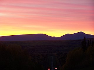
Inuvik is a town in the Northwest Territories of Canada, and is the administrative centre for the Inuvik Region. Inuvik is both a Gwich'in and an Inuvialuit community. The community, like Aklavik, is located in both the Gwich'in Settlement Area and the Inuvialuit Settlement Region.

Tulita, which in Slavey means "where the rivers or waters meet," is a hamlet in the Sahtu Region of the Northwest Territories, Canada. It was formerly known as Fort Norman, until 1 January 1996. It is located at the junction of the Great Bear River and the Mackenzie River; the Bear originates at Great Bear Lake adjacent to Deline.

The Slavey are a First Nations indigenous peoples of the Dene group, indigenous to the Great Slave Lake region, in Canada's Northwest Territories, and extending into northeastern British Columbia and northwestern Alberta.

Chipewyan or Denesuline is the language spoken by the Chipewyan people of northwestern Canada. It is categorized as part of the Northern Athabaskan language family. Dënësųłinë́ has nearly 12,000 speakers in Canada, mostly in Saskatchewan, Alberta, Manitoba and the Northwest Territories. It has official status only in the Northwest Territories, alongside 8 other aboriginal languages: Cree, Tlicho, Gwich'in, Inuktitut, Inuinnaqtun, Inuvialuktun, North Slavey and South Slavey.

Uranium City is a northern settlement in Saskatchewan, Canada. Located on the northern shores of Lake Athabasca near the border of the Northwest Territories, it is 230 m (750 ft) above sea level. The settlement is 760 km (470 mi) northwest of Prince Albert, 760 km (470 mi) northeast of Edmonton and 48 km (30 mi) south of the Northwest Territories-Saskatchewan boundary. For census purposes, it is located within the province's Division No. 18 territory.

Dawson Creek is a city in northeastern British Columbia, Canada. The municipality of 24.37 square kilometres (9.41 sq mi) had a population of 12,978 in 2016. Dawson Creek derives its name from the creek of the same name that runs through the community. The creek was named after George Mercer Dawson by a member of his land survey team when they passed through the area in August 1879. Once a small farming community, Dawson Creek became a regional centre after the western terminus of the Northern Alberta Railways was extended there in 1932. The community grew rapidly in 1942 as the US Army used the rail terminus as a transshipment point during construction of the Alaska Highway. In the 1950s, the city was connected to the interior of British Columbia via a highway and a railway through the Rocky Mountains. Since the 1960s, growth has slowed, but the area population has increased.

Hay River, known as "the Hub of the North," is a town in the Northwest Territories, Canada, located on the south shore of Great Slave Lake, at the mouth of the Hay River. The town is separated into two sections, a new town and an old town with the Hay River/Merlyn Carter Airport between them. The town is in the South Slave Region, and along with Fort Smith is one of the two regional centres.

Sioux Lookout is a town in Northwestern Ontario, Canada. Located approximately 350 km (220 mi) northwest of Thunder Bay, it has a population of 5,272 people, an elevation of 390 m (1,280 ft), and its boundaries cover an area of 536 km2 (207 sq mi), of which 157 km2 (61 sq mi) is lake and wetlands. Known locally as the "Hub of the North", it is serviced by the Sioux Lookout Airport, Highway 72, and the Sioux Lookout railway station. According to a 2011 study commissioned by the municipality, health care and social services ranked as the largest sources of employment, followed by the retail trade, public administration, transportation and warehousing, manufacturing, accommodation and food services, and education.

Peace River, originally named Peace River Crossing and known as Rivière-la-Paix in French, is a town in northwest Alberta, Canada. It is along the banks of the Peace River at its confluence with the Smoky River, the Heart River and Pat's Creek. It is approximately 486 kilometres (302 mi) northwest of Edmonton and 198 kilometres (123 mi) northeast of Grande Prairie on Highway 2. It was known as the Village of Peace River Crossing between 1914 and 1916.

High Level is a town in northern Alberta, Canada. It is located at the intersection of the Mackenzie Highway and Highway 58, approximately 733 kilometres (455 mi) north of Edmonton and 725 kilometres (450 mi) south of Yellowknife, Northwest Territories. High Level is located within Mackenzie County and was founded in 1947. The town serves a trading area of approximately 20,000 people.

Fort Resolution is a hamlet in the South Slave Region of the Northwest Territories, Canada. The community is situated at the mouth of the Slave River, on the shores of Great Slave Lake, and at the end of the Fort Resolution Highway. It is the headquarters of the Deninu Kųę́ First Nation, whose Chief is Louis Balsillie.
Fort Providence is a hamlet in the South Slave Region of the Northwest Territories, Canada. Located west of Great Slave Lake, it has all-weather road connections by way of the Yellowknife Highway branch off the Mackenzie Highway, and the Deh Cho Bridge opened November 30, 2012, near Fort Providence over the Mackenzie. The bridge replaced the ice bridge and ferry, enabling year-round crossing of the river.
Fort Liard is a hamlet in the Dehcho Region of the Northwest Territories, Canada. It is located 37 km (23 mi) north of the British Columbia border. It became accessible by road in 1984 with the completion of the Liard Highway.
La Loche is a village in northwest Saskatchewan. It is located at the end of Highway 155 on the eastern shore of Lac La Loche in Canada's boreal forest. La Loche had a population of 2,827 in 2016 and is within the Northern Saskatchewan Administration District.

The Dene TháFirst Nation is a First Nations government of the South Slavey in Northern Alberta, Canada. The people call themselves Dene Dháa or 'Ordinary People' in the Dene Dháh language. Its population is centered primarily in three communities: Bushe River, Meander River, and Chateh, but approximately 600 members who live off-reserve. Dene Thá First Nation is a member of the North Peace Tribal Council.
Hay River Reserve is one of only two Indian reserves in Canada's Northwest Territories. Located in the South Slave Region, it is a Slavey community with a population of 309, of which the majority are First Nations and some Métis, at the 2016 census, a 5.8% increase from the 2011 census. The main languages on the reserve are South Slavey, and English. In 2017 the Government of the Northwest Territories reported that the population was 329, resulting in an average annual growth rate of 0.4% between 2007 and 2017.

Hay Lake 209 is an Indian reserve of the Dene Tha' First Nation in Alberta, located within Mackenzie County. It is 100 km (62 mi) northwest of High Level. In the 2016 Canadian Census, it recorded a population of 883 living in 247 of its 277 total private dwellings.
The Palliser Region is an area in the southeast corner of the province of Alberta, Canada that has been delineated and is serviced by the Palliser Economic Partnership. It borders the Canadian province of Saskatchewan to the east, and the US state of Montana to the south. It covers an area of 43,504 km2 (16,797 sq mi) The total population of the area stood at 112,314 in 2009. The city of Medicine Hat, with a population of 61,097, is the area’s largest urban centre.

The Buffalo River Dene Nation is a Dene First Nations band government in Saskatchewan, Canada. The band's main community, Dillon, is located on the western shore of Peter Pond Lake at the mouth of the Dillon River, and is accessed by Highway 925 from Highway 155.

Upper Hay River 212 is an Indian reserve of the Dene Tha' First Nation in Alberta, located within Mackenzie County. It is 80 kilometres northwest of High Level. In the 2016 Canadian Census, it recorded a population of 294 living in 98 of its 115 total private dwellings.

