
The Strait of Juan de Fuca is a large body of water about 154 kilometres (96 mi) long that is the Salish Sea's outlet to the Pacific Ocean. The international boundary between Canada and the United States runs down the center of the Strait.
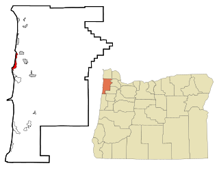
Cape Meares is a census-designated place (CDP) and unincorporated community in Tillamook County, Oregon, United States. The population was 110 at the 2000 census.

Cape Meares is a small headland on the Pacific coast in Tillamook County, Oregon, United States. The cape forms a high steep bluff on the south end of Tillamook Bay, approximately five miles (8 km) northwest of the city of Tillamook. Much of the cape is part of the Oregon Parks and Recreation Department-administered Cape Meares State Scenic Viewpoint with three miles of hiking trails, which includes the Cape Meares Lighthouse. The cape is named after John Meares, a British explorer.

Anna Maree Devenish Meares is an Australian retired track cyclist. She currently resides in Adelaide in South Australia where the Australian Institute of Sport's Track Cycling program has its headquarters at the Adelaide Super-Drome.

John Meares was a navigator, explorer, and maritime fur trader, best known for his role in the Nootka Crisis, which brought Britain and Spain to the brink of war.
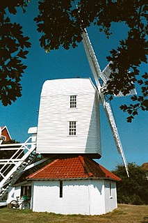
Thorpeness is a village in the county of Suffolk, England. It belongs to the parish of Aldringham cum Thorpe and lies within the Suffolk Coast and Heaths AONB.

Cape Disappointment State Park is a public recreation area located southwest of Ilwaco, Washington, on the bottom end of Long Beach Peninsula, the northern headlands where the Columbia River meets the Pacific Ocean. The state park's 2,023 acres (819 ha) encompass a diverse landscape of old-growth forest, freshwater lakes, freshwater and saltwater marshes, and oceanside tidelands. Park sights include the Lewis and Clark Interpretive Center, North Head Lighthouse, and Cape Disappointment Lighthouse. Cape Disappointment is one of several state parks and sites in Washington and Oregon that make up the Lewis and Clark National and State Historical Parks.

Cape Kiwanda State Natural Area is a state park in Pacific City, Oregon, United States. Cape Kiwanda is on the Three Capes Scenic Route, which includes Cape Meares and Cape Lookout. Hiking to the top of Cape Kiwanda allows views of Nestucca Bay to the south and Cape Lookout to the north.

Yuquot, also known as Fort San Miguel or Friendly Cove, is a small settlement of around six people - The Williams family of the Mowachaht band, plus two full-time lighthouse keepers, located on Nootka Island in Nootka Sound, just west of Vancouver Island, British Columbia, Canada. It was the summer home of Chief Maquinna and the Mowachaht/Muchalaht (Nuu-chah-nulth) people for generations, housing approximately 1,500 natives in 20 traditional wooden longhouses. The name means "Wind comes from all directions" in Nuu-chah-nulth.

Jodhi Meares is an Australian glamour model, television personality and fashion designer.
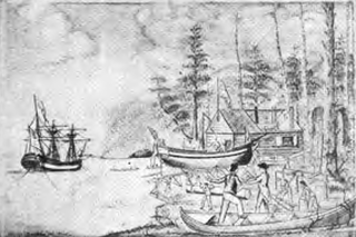
Fort Defiance was a small outpost built by the crew of the Columbia Rediviva for use as winter quarters during 1791-1792 on Meares Island in present-day British Columbia, Canada. They were under the command of American merchant and maritime fur trader Captain Robert Gray.

Patton State Hospital is a forensic psychiatric hospital in San Bernardino, California, United States. Though the hospital has a Patton, California address, it lies entirely within the San Bernardino city limits. Operated by the California Department of State Hospitals, Patton State Hospital is a forensic hospital with a licensed bed capacity of 1287 for people who have been committed by the judicial system for treatment.
Charles William Barkley was a ship captain and maritime fur trader. He was born in Hertford, England, son of Charles Barkley.
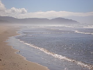
Cape Meares National Wildlife Refuge is a National Wildlife Refuge of the Oregon Coast. It is one of six National Wildlife Refuges in the Oregon Coast National Wildlife Refuge Complex. Located on Cape Meares, the refuge was established in 1938 to protect a remnant of coastal old-growth forest and the surrounding habitat used by breeding seabirds. The area provides a home for a threatened bird species, the marbled murrelets. Peregrine falcons, once at the brink of extinction, have nested here since 1987. The refuge, with the exception of the Oregon Coast Trail, was designated a Research Natural Area in 1987.
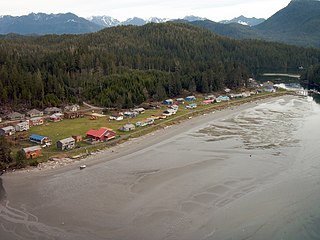
Opitsaht, spelled also as Opitsat and Opitsitah, is a community of the Tla-o-qui-aht people of the Nuu-chah-nulth nation, located at the SW end of Meares Island in Clayoquot Sound. During the era of the Maritime Fur Trade, Opitsaht was the seat of Wickaninnish, chief of the Tla-o-qui-aht, and contained 200 ornately carved buildings typical of Nuu-chah-nulth villages. This original village was destroyed by cannon fire by Captain Robert Gray of the Columbia Rediviva as part of a falling-out with the Tla-o-qui-aht when Gray evacuated his erstwhile "fort" nearby on Meares Island, known as Fort Defiance. Today Opitsaht is one of the main villages governed by the Tla-o-qui-aht First Nations, the band government of the Tla-o-qui-aht people.

The Abbot's Fish House in Meare, Somerset, England, was built in the 14th century and has been designated as a Grade I listed building and Scheduled Ancient Monument. It is the only surviving monastic fishery building in England.
Glass Mountain is a former settlement in Modoc County, California. It was located on the former Great Northern Railway Bieber Line 6 miles (9.7 km) west-southwest of Meares.
Meares Cliff is an angular coastal cliff that rises to 600 metres (2,000 ft), located 5.5 nautical miles (10 km) west-northwest of Nelson Cliff along the north coast of Victoria Land, Antarctica. It was first charted by the Northern Party, led by Victor Campbell, of the British Antarctic Expedition, 1910–13, and was named by Campbell for Cecil H. Meares who had charge of the dogs on this expedition.
William Douglas was a Scottish ship captain and a oceanographer maritime fur trader during the late 18th century. He worked with the British trader and Captain John Meares, commanding the ship Iphigenia Nubiana. He was involved in the Nootka Crisis of 1789, which brought Britain and Spain to the brink of war. A few years later he was captain of the American ship Grace. In 1791 he partnered with Captain John Kendrick in an attempt to open trade with Japan.


