Midfield, Texas

Last updated

A sign in the community of Midfield Midfield, TX, The Town Too Tough to Die.JPG
A sign in the community of Midfield

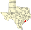
Midfield is an unincorporated community and census-designated place in Matagorda County, Texas, United States. [1] Midfield has a post office, with the ZIP code 77458. [2] The population as of 2022 is 408 residents.

Contents

It is also part of the Tidehaven Independent School District. The designated community college for Tidehaven ISD is Wharton County Junior College. [3]

Demographics

Historical population
CensusPop.Note
2020 356
U.S. Decennial Census [4]
1850–1900 [5] 1910 [6]
1920 [7] 1930 [8] 1940 [9]
1950 [10] 1960 [11] 1970 [12]
1980 [13] 1990 [14] 2000 [15]
2010 [16]

Midfield first appeared as a census designated place in the 2020 U.S. Census. [17] [16]

2020 census

Midfield CDP, Texas – Racial and ethnic composition
Note: the US Census treats Hispanic/Latino as an ethnic category. This table excludes Latinos from the racial categories and assigns them to a separate category. Hispanics/Latinos may be of any race.
Race / Ethnicity (NH = Non-Hispanic)Pop 2020 [17] % 2020
White alone (NH)13237.08%
Black or African American alone (NH)20.56%
Native American or Alaska Native alone (NH)00.00%
Asian alone (NH)20.56%
Pacific Islander alone (NH)00.00%
Other race alone (NH)00.00%
Mixed race or Multiracial (NH)10.28%
Hispanic or Latino (any race)21961.52%
Total356100.00%

Related Research Articles

<span class="mw-page-title-main">Cumings, Texas</span> Census-designated place in Texas, United States

Cumings is an unincorporated community and census-designated place (CDP) in Fort Bend County, Texas, United States. The population was 2,207 at the 2020 census, significantly up from 981 at the 2010 census.

<span class="mw-page-title-main">Channelview, Texas</span> Census-designated place in Texas, United States

Channelview is a census-designated place (CDP) in the U.S. state of Texas on the east side of Houston in Harris County. Its population was 45,688 at the 2020 U.S. census.

<span class="mw-page-title-main">Cloverleaf, Texas</span> Census-designated place in Texas, United States

Cloverleaf is a census-designated place (CDP) in east central Harris County, Texas, United States. The population was 24,100 at the 2020 census.

<span class="mw-page-title-main">Vanderbilt, Texas</span> Census-designated place in Texas

Vanderbilt is an unincorporated community and census-designated place (CDP) in Jackson County, Texas, United States. The population was 409 at the 2020 census.

<span class="mw-page-title-main">Blessing, Texas</span> CDP in Texas, United States

Blessing is a census-designated place (CDP) in Matagorda County, Texas, United States. The population was 856 at the 2020 census.

<span class="mw-page-title-main">Markham, Texas</span> CDP in Texas, United States

Markham is a census-designated place (CDP) in Matagorda County, Texas, United States. Named in 1903 for Charles H. Markham, a railroad engineer for Southern Pacific, the town was founded in 1901 as Cortes. In 1914, it was a designated stop on the Texas and New Orleans Railroad. As of the 2020 census, the population was 908.

Sheridan is an unincorporated community and census designated place in Colorado County, Texas, United States.

Wadsworth is an unincorporated community in Matagorda County, Texas, United States. According to the Handbook of Texas, the community had an estimated population of 180 in 2000.

<span class="mw-page-title-main">Matagorda, Texas</span> Town in Texas, United States

Matagorda is a census-designated place in Matagorda County, Texas, United States. It is located near the mouth of the Colorado River on the upper Texas coast in the United States. In 2020, its population was 313. Matagorda is primarily a tourist town, with commercial and recreational fishing being the top industries. Approximately 23 miles (37 km) of the beach are accessible by vehicle and 35 additional miles are accessible only by boat. Matagorda is at the end of State Highway 60 and the beginning of Farm to Market Road 2031, which runs over the Intracoastal Waterway and south to the Gulf of Mexico.

Myra is an unincorporated community and census designated place (CDP) in western Cooke County, Texas, United States. It lies just off U.S. Route 82, west of the city of Gainesville, the county seat of Cooke County. Its elevation is 935 feet (285 m). it had a post office, with the ZIP code 76253 until early 2013. It is now closed.

Delmita is a census-designated place in Starr County, Texas, United States. Its elevation is 272 feet (83 m). Although Delmita is unincorporated, it has a post office, with the ZIP code of 78536. This CDP was new for the 2010 census, with a population of 216.

Carlsbad is a census-designated place and unincorporated community in northwestern Tom Green County, Texas, United States. It lies along U.S. Route 87, northwest of the city of San Angelo, the county seat of Tom Green County. Its elevation is 2,024 feet (617 m). Although Carlsbad is unincorporated, it has a post office, with the ZIP code of 76934; the ZCTA for ZIP Code 76934 had a population of 1,332 at the 2000 census.

McCaulley is an unincorporated community and census designated place (CDP) in Fisher County, Texas, United States. According to the Handbook of Texas, the community had an estimated population of 96 in 2000.

<span class="mw-page-title-main">Rosanky, Texas</span> Unincorporated community in Texas, US

Rosanky is an unincorporated community and census designated place (CDP) located on Farm to Market Road 535 in southern Bastrop County, Texas, United States. Rosanky has a post office, with the ZIP code 78953. The town is named for Ed Rosanky, who emigrated from Prussia and settled in the area in 1854.

Lyons is an unincorporated community and census-designated place (CDP) in Burleson County, Texas, United States. It was first listed as a CDP in the 2020 census, with a population of 236. Lyons has a post office, with the ZIP code 77863.

<span class="mw-page-title-main">Deanville, Texas</span> Census-designated place in Texas, United States

Deanville is an unincorporated community and census-designated place (CDP) in Burleson County, Texas, United States. Deanville has a post office, with the ZIP code 77852. It was first listed as a CDP in the 2020 census with a population of 63.

Proctor is an unincorporated community and census-designated place (CDP) in Comanche County, Texas, United States. According to the Handbook of Texas, the community had an estimated population of 220 in 2000.

Burlington is an unincorporated community and census-designated place in Milam County, Texas, United States. It was first listed as a CDP in the 2020 census, with a population of 81. Burlington has a post office, with the postal ("ZIP") code 76519.

Garwood is an unincorporated community and census designated place (CDP) in Colorado County, Texas, United States. According to the Handbook of Texas, the community had a population of 975 in 2000.

Perezville is an unincorporated community and census-designated place in Hidalgo County, Texas, United States. Its population was 5,376 as of the 2010 census. Prior to 2010, the community was part of the Abram-Perezville census-designated place along with nearby Abram.

References

  1. U.S. Geological Survey Geographic Names Information System: Midfield, Texas
  2. USPS – Cities by ZIP Code
  3. Texas Education Code Sec. 130.211. WHARTON COUNTY JUNIOR COLLEGE DISTRICT SERVICE AREA.
  4. "Decennial Census by Decade". United States Census Bureau .
  5. "1900 Census of Population - Population of Texas By Counties And Minor Civil Divisions" (PDF). United States Census Bureau .
  6. "1910 Census of Population - Supplement for Texas" (PDF). United States Census Bureau .
  7. "1920 Census of Population - Number of Inhabitants - Texas" (PDF). United States Census Bureau .
  8. "1930 Census of Population - Number of Inhabitants - Texas" (PDF). United States Census Bureau .
  9. "1940 Census of Population - Number of Inhabitants - Texas" (PDF). United States Census Bureau .
  10. "1950 Census of Population - Number of Inhabitants - Texas" (PDF). United States Census Bureau .
  11. "1960 Census of Population - Number of Inhabitants - Texas" (PDF). United States Census Bureau .
  12. "1970 Census of Population - Number of Inhabitants - Texas" (PDF). United States Census Bureau .
  13. "1980 Census of Population - Number of Inhabitants - Texas" (PDF). United States Census Bureau .
  14. "1990 Census of Population - Population and Housing Unit Counts - Texas" (PDF). United States Census Bureau .
  15. "2000 Census of Population - Population and Housing Unit Counts - Texas" (PDF). United States Census Bureau .
  16. 1 2 "2010 Census of Population - Population and Housing Unit Counts - Texas" (PDF). United States Census Bureau .
  17. 1 2 "P2: Hispanic or Latino, and Not Hispanic or Latino by Race – 2020: DEC Redistricting Data (PL 94-171) – Midfield CDP, Texas". United States Census Bureau.

28°56′25″N96°12′47″W / 28.94028°N 96.21306°W / 28.94028; -96.21306