Montana is a landlocked state in the Mountain West subregion of the Western United States. It borders Idaho to the west, North Dakota to the east, South Dakota to the southeast, Wyoming to the south, and the Canadian provinces of Alberta, British Columbia, and Saskatchewan to the north. It is the fourth-largest state by area, but the eighth-least populous state and the third-least densely populated state. Its capital is Helena, while the most populous city is Billings. The western half of the state contains numerous mountain ranges, while the eastern half is characterized by western prairie terrain and badlands, with smaller mountain ranges found throughout the state.

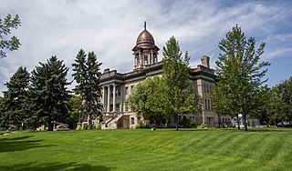
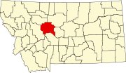
Cascade County is a county located in the U.S. state of Montana. As of the 2020 census, the population was 84,414, making it the fifth-most populous county in Montana. Its county seat is Great Falls.

Big Horn County is a county located in the U.S. state of Montana. As of the 2020 census, the population was 13,124. The county seat is Hardin. The county, like the river and the mountain range, is named after the bighorn sheep in the Rocky Mountains. The county was founded in 1913.

Belt is a town in Cascade County, Montana, United States. The population was 510 according to the 2020 census. It is part of the Great Falls, Montana metropolitan area.

Black Eagle is a census-designated place (CDP) in Cascade County, Montana, United States. The population was 904 at the 2010 census. It is a suburb of Great Falls.

Cascade is a town in Cascade County, Montana, United States. The population was 600 at the 2020 census. It is part of the Great Falls, Montana Metropolitan Statistical Area, which in 2020 had a population of 84,414. Cascade was incorporated in 1911.

Great Falls is the third most populous city in the U.S. state of Montana and the county seat of Cascade County. The population was 60,442 according to the 2020 census. The city covers an area of 22.9 square miles (59 km2) and is the principal city of the Great Falls, Montana, Metropolitan Statistical Area, which encompasses all of Cascade County. The Great Falls MSA's population was 84,414 according to the 2020 census.

Neihart is a town in Cascade County, Montana, United States. It is located in the center of Little Belt Mountains. The population was 43 at the 2020 census. It is part of the Great Falls, Montana, Metropolitan Statistical Area.

Simms is a census-designated place (CDP) in Cascade County, Montana, United States. The population was 354 at the 2010 census. It is part of the Great Falls, Montana Metropolitan Statistical Area.

Ulm is a census-designated place (CDP) in Cascade County, Montana, United States. It was originally a large ranch owned by Indiana-born cattleman William Ulm. The population was 738 at the 2010 census. It is part of the Great Falls, Montana Metropolitan Statistical Area.

Stanford is a town in and the county seat of Judith Basin County, Montana, United States. The population was at 403 as of the 2020 census.

Smith River is a tributary of the Missouri River, in central Montana, in the United States. It rises in southern Meagher County in the Castle Mountains and flows northwest in the valley between the Big Belt and Little Belt mountains, past White Sulphur Springs and past Smith River State Park. It turns north-northwest (NNW), and is joined by Hound Creek in Cascade County, and joins the Missouri approximately 9 miles (14 km) southwest of Great Falls.
Lewis and Clark National Forest is located in west central Montana, United States. Spanning 2,912 square miles (7,500 km2). The region was inhabited by various cultures of Native Americans for a period of at least 8,000–10,000 years. When the Lewis and Clark Expedition came to this area, different areas of the large forest territory were used by members of the Blackfeet, Sioux, Cheyenne, Flathead and Crow nations for hunting and as an area for their seasonal winter camps. The forests provided shelter from the winter.

Montana is one of the eight Mountain States, located in the north of the region known as the Western United States. It borders North Dakota and South Dakota to the east. Wyoming is to the south, Idaho is to the west and southwest, and the Canadian provinces of British Columbia, Alberta, and Saskatchewan are to the north, making it the only state to border three Canadian provinces.

The Regional designations of Montana vary widely within the U.S state of Montana. The state is a large geographical area that is split by the Continental Divide, resulting in watersheds draining into the Pacific Ocean, Gulf of Mexico and Hudson's Bay. The state is approximately 545 miles (877 km) east to west along the Canada–United States border and 320 miles (510 km) north to south. The fourth largest state in land area, it has been divided up in official and unofficial ways into a variety of regions. Additionally, Montana is part of a number of larger federal government administrative regions.
Geyser is a small, unincorporated rural village in Judith Basin County, Montana, United States, southeast of Great Falls along U.S. Route 87.
Stockett is a census-designated place and unincorporated community in Cascade County, Montana, United States. Its population was 169 as of the 2010 census. Stockett has a post office with ZIP code 59480.

Tower Rock State Park is a state park near the community of Cascade in the U.S. state of Montana in the United States. The centerpiece of the park is Tower Rock, a 424-foot (129 m)-high rock formation which marks the entrance to the Missouri River Canyon in the Adel Mountains Volcanic Field. It was well known to Native Americans, and considered a sacred place by the Piegan Blackfeet. Tower Rock received its current name when Meriwether Lewis of the Lewis and Clark Expedition visited the site in 1805. Railroad and highway development in the late 1800s and 1900s skirted Tower Rock, but the landform itself remained pristine. The 87.2 acres (0.353 km2) encompassing Tower Rock was added to the National Register of Historic Places on March 18, 2002. The 140-acre (0.57 km2) Tower Rock State Park was created around the National Historic Site in 2004.
Pleasant Valley Colony is a Hutterite community and census-designated place (CDP) in Cascade County, Montana, United States. It is in the eastern part of the county, 11 miles (18 km) southwest of Belt and 19 miles (31 km) southeast of Great Falls.
Riceville is an unincorporated community and census-designated place (CDP) in Cascade County, Montana, United States. It is in the southeastern part of the county, along U.S. Route 89 in the valley of Belt Creek, at the northern edge of the Little Belt Mountains. Via US-89, Riceville is 13 miles (21 km) south of Belt, 34 miles (55 km) southeast of Great Falls, and 64 miles (103 km) north of White Sulphur Springs.


