Mont-Ormel

Last updated • a couple of secsFrom Wikipedia, The Free Encyclopedia

Mont-Ormel
FranceNormandieMontOrmelEglise.jpg
The church in Mont-Ormel
Location of Mont-Ormel
Mont-Ormel
France location map-Regions and departements-2016.svg
Red pog.svg
Mont-Ormel
Normandie region location map.svg
Red pog.svg
Mont-Ormel
Coordinates: 48°50′26″N0°09′24″E / 48.8406°N 0.1567°E / 48.8406; 0.1567
Country France
Region Normandy
Department Orne
Arrondissement Argentan
Canton Argentan-2
Intercommunality Argentan Intercom
Government
  Mayor (20202026) Patricia Le Feuvrier [1]
Area
1
3.73 km2 (1.44 sq mi)
Population
 (2021) [2]
47
  Density13/km2 (33/sq mi)
Time zone UTC+01:00 (CET)
  Summer (DST) UTC+02:00 (CEST)
INSEE/Postal code
61289 /61160
Elevation177–263 m (581–863 ft)
(avg. 262 m or 860 ft)
1 French Land Register data, which excludes lakes, ponds, glaciers > 1 km2 (0.386 sq mi or 247 acres) and river estuaries.

Mont-Ormel (French pronunciation: [mɔ̃.t‿ɔʁmɛl] ) is a commune in the Orne department in north-western France.

Contents

Geography

The commune is made up of the following collection of villages and hamlets, La Panthelière and Mont-Ormel. [3]

The commune has one streamsrunning through its borders, the Mont-Ormel.

Notable buildings and places


Memorial de Montormel is a memorial and museum on the site of battle of Falaise pocket between Chambois and Vimoutiers. [4]

See also

Related Research Articles

<span class="mw-page-title-main">Amayé-sur-Orne</span> Commune in Normandy, France

Amayé-sur-Orne is a commune in the Calvados department in the Normandy region of northwestern France.

<span class="mw-page-title-main">Amfreville, Calvados</span> Commune in Normandy, France

Amfreville is a commune in the Calvados department in the Normandy region of north-western France.

<span class="mw-page-title-main">Arrondissement of Argentan</span> Arrondissement in Normandy, France

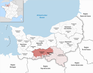
The arrondissement of Argentan is an arrondissement of France, located in the Orne department, region of Normandy. It has 123 communes. Its population is 110,239 (2016), and its area is 1,904.1 km2 (735.2 sq mi).

<span class="mw-page-title-main">Chambois, Orne</span> Part of Gouffern en Auge in Normandy, France

Chambois is a former commune in the Orne département in north-western France. On 1 January 2017, it was merged into the new commune Gouffern en Auge. Its population was 385 in 2019. The town is remarkable for its 12th-century Norman keep and was involved in the closure of the Falaise pocket in 1944 during the Battle of Normandy.

<span class="mw-page-title-main">Ménil-Hubert-sur-Orne</span> Commune in Normandy, France

Ménil-Hubert-sur-Orne is a commune in the Orne department in north-western France.

<span class="mw-page-title-main">Aubry-le-Panthou</span> Commune in Normandy, France

Aubry-le-Panthou is a commune in the Orne department in north-western France.

<span class="mw-page-title-main">Merri, Orne</span> Commune in Normandy, France

Merri is a commune in the Orne department in north-western France.

<span class="mw-page-title-main">Neauphe-sur-Dive</span> Commune in Normandy, France

Neauphe-sur-Dive is a commune in the Orne department in north-western France.

<span class="mw-page-title-main">Saint-Philbert-sur-Orne</span> Commune in Normandy, France

Saint-Philbert-sur-Orne is a commune in the Orne department in north-western France.

<span class="mw-page-title-main">Saint-Pierre-du-Regard</span> Commune in Normandy, France

Saint-Pierre-du-Regard is a commune in the Orne department in north-western France.

<span class="mw-page-title-main">Valframbert</span> Commune in Normandy, France

Valframbert is a commune in the Orne department in north-western France.

<span class="mw-page-title-main">La Lande-Saint-Siméon</span> Commune in Normandy, France

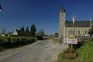
La Lande-Saint-Siméon is a commune in the Orne department in north-western France.

<span class="mw-page-title-main">Berjou</span> Commune in Normandy, France

Berjou is a commune in the Orne department in northwestern France.

<span class="mw-page-title-main">Cahan, Orne</span> Commune in Normandy, France

Cahan is a commune in the Orne department in north-western France.

<span class="mw-page-title-main">Cerisé</span> Commune in Normandy, France

Cerisé is a commune in the Orne department in north-western France.

<span class="mw-page-title-main">Ceton</span> Commune in Normandy, France

Ceton is a commune in the Orne department in north-western France. It is the southernmost municipality in Normandy. The commune has the largest surface area of the communes based in the Orne, at 59.39 km ²

<span class="mw-page-title-main">Coudehard</span> Commune in Normandy, France

Coudehard is a commune in the Orne department in north-western France.

<span class="mw-page-title-main">Coulonces, Orne</span> Commune in Normandy, France

Coulonces is a commune in the Orne department in north-western France.

The Coudehard-Montormel Memorial is a historical museum in Mont-Ormel in France, dedicated to the battle of the Falaise pocket, the last episode in the battle of Normandy. It is sited on the summit of Hill 262, where the pocket was officially closed on 21 August 1944, with two sites – an open-air monument at the hill's summit, which was inaugurated in 1965 on the battle's twentieth anniversary, and the museum itself, in the side of the hill, opened in 1994 on the battle's fiftieth anniversary.

<span class="mw-page-title-main">Monts-sur-Orne</span> Commune in Normandy, France

Monts-sur-Orne is a commune in the department of Orne, northwestern France. The municipality was established on 1 January 2018 by merger of the former communes of Goulet, Montgaroult and Sentilly.

References

  1. "Répertoire national des élus: les maires". data.gouv.fr, Plateforme ouverte des données publiques françaises (in French). 9 August 2021.
  2. "Populations légales 2021" (in French). The National Institute of Statistics and Economic Studies. 28 December 2023.
  3. 1 2 "Google Maps". Google Maps.
  4. "Memorial de Montormel". Normandy War guide.