Montclus, Gard

Last updated

Montclus
Montclus (Gard).JPG
Distant view of Montclus with vineyards
Blason de la ville de Montclus (30).svg
Location of Montclus
Montclus, Gard
France location map-Regions and departements-2016.svg
Red pog.svg
Montclus
Languedoc-Roussillon-Midi-Pyrenees region location map.svg
Red pog.svg
Montclus
Coordinates: 44°15′41″N4°25′14″E / 44.2614°N 4.4205°E / 44.2614; 4.4205
Country France
Region Occitania
Department Gard
Arrondissement Nîmes
Canton Pont-Saint-Esprit
Intercommunality CA Gard Rhodanien
Government
  Mayor (20202026) Benoit Trichot [1]
Area
1
21.88 km2 (8.45 sq mi)
Population
 (2021) [2]
181
  Density8.3/km2 (21/sq mi)
Time zone UTC+01:00 (CET)
  Summer (DST) UTC+02:00 (CEST)
INSEE/Postal code
30175 /30630
Elevation76–329 m (249–1,079 ft)
(avg. 80 m or 260 ft)
1 French Land Register data, which excludes lakes, ponds, glaciers > 1 km2 (0.386 sq mi or 247 acres) and river estuaries.

Montclus is a commune in the Gard department in southern France. It is a member of Les Plus Beaux Villages de France (The Most Beautiful Villages of France) Association.

Contents

Geography

Climate

Montclus has a hot-summer Mediterranean climate (Köppen climate classification Csa). The average annual temperature in Montclus is 13.7 °C (56.7 °F). The average annual rainfall is 951.2 mm (37.45 in) with November as the wettest month. The temperatures are highest on average in July, at around 23.2 °C (73.8 °F), and lowest in January, at around 5.2 °C (41.4 °F). The highest temperature ever recorded in Montclus was 43.8 °C (110.8 °F) on 27 June 2019; the coldest temperature ever recorded was −14.0 °C (6.8 °F) on 16 January 1985.

Climate data for Montclus (1991−2020 normals, extremes 1978−present)
MonthJanFebMarAprMayJunJulAugSepOctNovDecYear
Record high °C (°F)23.9
(75.0)
25.9
(78.6)
28.0
(82.4)
31.2
(88.2)
36.3
(97.3)
43.8
(110.8)
41.3
(106.3)
42.9
(109.2)
37.7
(99.9)
32.0
(89.6)
24.6
(76.3)
21.0
(69.8)
43.8
(110.8)
Mean daily maximum °C (°F)10.3
(50.5)
12.2
(54.0)
16.6
(61.9)
19.6
(67.3)
23.7
(74.7)
28.3
(82.9)
31.6
(88.9)
31.2
(88.2)
25.8
(78.4)
20.0
(68.0)
14.2
(57.6)
10.7
(51.3)
20.4
(68.7)
Daily mean °C (°F)5.2
(41.4)
6.2
(43.2)
9.7
(49.5)
12.5
(54.5)
16.4
(61.5)
20.5
(68.9)
23.2
(73.8)
22.9
(73.2)
18.6
(65.5)
14.3
(57.7)
9.1
(48.4)
5.8
(42.4)
13.7
(56.7)
Mean daily minimum °C (°F)0.0
(32.0)
0.2
(32.4)
2.8
(37.0)
5.5
(41.9)
9.1
(48.4)
12.8
(55.0)
14.9
(58.8)
14.7
(58.5)
11.4
(52.5)
8.6
(47.5)
4.0
(39.2)
0.9
(33.6)
7.1
(44.8)
Record low °C (°F)−14.0
(6.8)
−10.9
(12.4)
−13.1
(8.4)
−5.5
(22.1)
−2.0
(28.4)
3.0
(37.4)
6.0
(42.8)
5.0
(41.0)
1.0
(33.8)
−4.0
(24.8)
−9.0
(15.8)
−11.4
(11.5)
−14.0
(6.8)
Average precipitation mm (inches)76.8
(3.02)
48.8
(1.92)
54.9
(2.16)
75.4
(2.97)
75.2
(2.96)
49.9
(1.96)
44.4
(1.75)
59.8
(2.35)
132.4
(5.21)
131.6
(5.18)
134.1
(5.28)
67.9
(2.67)
951.2
(37.45)
Average precipitation days (≥ 1.0 mm)6.55.25.27.47.55.44.14.86.07.98.26.775.0
Source: Météo-France [3]

Population

Historical population
YearPop.±%
196292    
1968124+34.8%
1975115−7.3%
1982139+20.9%
1990135−2.9%
1999134−0.7%
2008151+12.7%

See also

Related Research Articles

<span class="mw-page-title-main">Chusclan</span> Commune in Occitanie, France

Chusclan is a commune in the Gard department in southern France.

<span class="mw-page-title-main">Arphy</span> Commune in Occitanie, France

Arphy is a commune in the Gard department in southern France.

<span class="mw-page-title-main">Alzon</span> Commune in Occitanie, France

Alzon is a commune in the Gard department in southern France.

<span class="mw-page-title-main">Vic-le-Fesq</span> Commune in Occitania, France

Vic-le-Fesq is a commune in the Gard department in southern France.

<span class="mw-page-title-main">Méjannes-le-Clap</span> Commune in Occitania, France

Méjannes-le-Clap is a commune in the Gard department in southern France. It is located 30 km north east of Alès, close to the river Cèze. It is a centre for outdoor activities and environmental tourism.
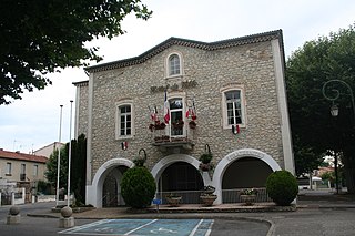
<span class="mw-page-title-main">Salindres</span> Commune in Occitania, France

Salindres is a commune in the Gard department in southern France. The composer and conductor Roger Dumas (1897–1951) was born, in Salindres.

<span class="mw-page-title-main">Génolhac</span> Commune in Occitania, France

Génolhac is a commune in the Gard department in southern France.

<span class="mw-page-title-main">Brouzet-lès-Alès</span> Commune in Occitanie, France

Brouzet-lès-Alès is a commune in the Gard department in southern France.

<span class="mw-page-title-main">Générargues</span> Commune in Occitania, France

Générargues is a commune in the Gard department in southern France, around 10 km southwest of Alès.
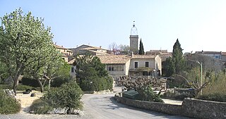
<span class="mw-page-title-main">Deaux</span> Commune in Occitania, France

Deaux is a small, wooded commune in the Gard department in southern France.

<span class="mw-page-title-main">Cavillargues</span> Commune in Occitanie, France

Cavillargues is a commune in the Gard department in southern France.

<span class="mw-page-title-main">Sumène</span> Commune in Occitania, France

Sumène is a commune in the Gard department in southern France.

Vestric-et-Candiac is a commune in the Gard department in southern France.

<span class="mw-page-title-main">Sabran</span> Commune in Occitania, France

Sabran is a commune in the Gard department in southern France.

La Rouvière is a commune in the Gard department in southern France.

<span class="mw-page-title-main">Mandagout</span> Commune in Occitania, France

Mandagout is a commune in the Gard department in southern France. The 18th-century French pharmacist, chemist and encyclopediste Jacques Montet (1722-1782) was born in Mandagout.
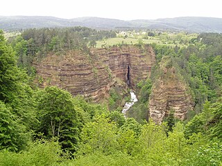
<span class="mw-page-title-main">Saint-Sauveur-Camprieu</span> Commune in Occitania, France

Saint-Sauveur-Camprieu is a commune in the Gard department in southern France.

<span class="mw-page-title-main">Pujaut</span> Commune in Occitania, France

Pujaut is a commune in the Gard department in southern France. The village is situated on the south side of a small hill overlooking a flat plain that once formed the bed of a lake. The lake was drained at the beginning of the 17th century. The village is located 3.5 km west of the Rhône, 4.5 km north of Villeneuve-lès-Avignon and 5 km south of Roquemaure. In 2017 the commune had a population of 4,136.
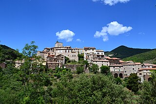
<span class="mw-page-title-main">Saint-Martial, Gard</span> Commune in Occitania, France

Saint-Martial is a commune in the Gard department in southern France.

<span class="mw-page-title-main">Val-d'Aigoual</span> Commune in Occitania, France

Val-d'Aigoual is a commune in the Gard department in southern France. It was established on 1 January 2019 by merger of the former communes of Valleraugue and Notre-Dame-de-la-Rouvière.

References

  1. "Répertoire national des élus: les maires". data.gouv.fr, Plateforme ouverte des données publiques françaises (in French). 9 August 2021.
  2. "Populations légales 2021" (in French). The National Institute of Statistics and Economic Studies. 28 December 2023.
  3. "Fiche Climatologique Statistiques 1991-2020 et records" (PDF) (in French). Météo-France . Retrieved 3 September 2022.