"},"prominence_m":{"wt":"202"},"prominence_ref":{"wt":"Italian official map 1:25.00 of ''[[Istituto Geografico Militare]]'' (on-line on [http://www.pcn.minambiente.it/viewer/ www.pcn.minambiente.it])[[key col]]:Colle della Bassetta (945 m)"},"range":{"wt":"[[Graian Alps]]"},"parent_peak":{"wt":""},"listing":{"wt":""},"location":{"wt":"[[Metropolitan City of Turin]],[[Piedmont]],[[Italy]]"},"map":{"wt":"Alps"},"map_caption":{"wt":"Location in the Alps"},"label_position":{"wt":"left"},"coordinates":{"wt":"{{coord|45|06|50|N|07|27|16|E|type:mountain_scale:100000|format=dms|display=inline,title}}"},"geology":{"wt":"[[Peridotites]]{{Cite journal | title = Structural and compositional features of the Mt. Musinèperidotites (Lanzo Massif,Western Alps,Italy) | url = https://www.researchgate.net/publication/248392853 | journal = Ofioliti | date = December 2005 | issue = 30 | pages = 161–173 | author = Franco M. Elter,Giovanni B. Piccardo,Riccardo Polino,Alberto Zanetti,Gianluca Spagnolo,Eugenio Poggi and Pietro Balbi | access-date = 2019-02-07}}"},"first_ascent":{"wt":""},"easiest_route":{"wt":"South-East ridge from [[Caselette]]"}},"i":0}}]}" id="mwBA">.mw-parser-output .infobox-subbox{padding:0;border:none;margin:-3px;width:auto;min-width:100%;font-size:100%;clear:none;float:none;background-color:transparent}.mw-parser-output .infobox-3cols-child{margin:auto}.mw-parser-output .infobox .navbar{font-size:100%}body.skin-minerva .mw-parser-output .infobox-header,body.skin-minerva .mw-parser-output .infobox-subheader,body.skin-minerva .mw-parser-output .infobox-above,body.skin-minerva .mw-parser-output .infobox-title,body.skin-minerva .mw-parser-output .infobox-image,body.skin-minerva .mw-parser-output .infobox-full-data,body.skin-minerva .mw-parser-output .infobox-below{text-align:center}
Monte Musinè | |
---|---|
![]() The mountain seen from Casternone (San Gillio) | |
Highest point | |
Elevation | 1,150 m (3,770 ft) [1] |
Prominence | 202 m (663 ft) [1] [2] |
Isolation | 3.6 km (2.2 mi) ![]() |
Coordinates | 45°06′50″N07°27′16″E / 45.11389°N 7.45444°E Coordinates: 45°06′50″N07°27′16″E / 45.11389°N 7.45444°E |
Geography | |
Location | Metropolitan City of Turin, Piedmont, Italy |
Parent range | Graian Alps |
Geology | |
Type of rock | Peridotites [3] |
Climbing | |
Easiest route | South-East ridge from Caselette |
Monte Musinè or simply Musinè (in Piedmontese mont Musinè) is a mountain in the Graian Alps in the Metropolitan City of Turin, Piedmont, north Italy. Musinè is well known for the high cross on its peak, as well as for being the mountain closest to Turin. It is visible from the Piedmontese plateau and from the mountains in the provinces of Biella and Vercelli.
Mount Musinè is the easternmost mountain of the long ridge which, starting from Rocciamelone, divides the valleys of Susa and Lanzo.
Its main summit has a subsummit called Truc dell'Eremita (Hermit's hill, 1.101 m), and is surrounded by several minor hills. To the east on a 535 m high hill stands Saint Abaco's sanctuary, and to the northeast on Monte Calvo, 551 m high, there is a Via Crucis leading to a chapel.
Mount Musinè is connected to the neighbouring Mount Curto (1.323 m) by a broad wooded ridge, the lowest point of which is the Colle della Bassetta (Bassetta's pass, 945 m).
Mount Musinè's summit is a tripoint at which the borders of the municipalities of Caselette, Almese and Val della Torre meet.
According to SOIUSA (International Standardized Mountain Subdivision of the Alps) Mount Musinè can be classified in the following way: [4]
A number of prehistoric and protohistoric archaeological sites have been discovered in the area. These include traces of a hut dating to the early Bronze Age (ca 1700 BC) found in Caselette, [5] and several finds from the late Iron Age in the vicinity of Almese (Truc Randolera). [6]
Two Roman buildings from the imperial period are located near the mountain: a villa rustica in Caselette and a large residential villa in Almese (Grange di Rivera). [7]
A local tradition states that it was near Mount Musinè (and therefore not during the Battle of the Milvian Bridge) that the emperor Constantine I saw a flaming cross and the words In hoc signo vinces shortly before the Battle of Turin (312) against his rival Maxentius, which he won.
In 1901 a 15 m high cross [8] was built on the top of the mountain using reinforced concrete. [9]
On the northeastern slopes of Mount Musinè several magnesite quarries were active between 1875 and the Second World War. [10]
Several encounters with UFOs have been reported around the mountain from the 1970s onward. [11]
Quite well known is the case of December 8, 1978, when two young hikers walking on the slopes of the Musinè saw a bright light; one of them, after approaching it, temporarily disappeared. His mate, with the help of some passers-by, searched for him and after a while found his friend in a state of shock and with a noticeable scald on one leg. After regaining consciousness the young man he reported having seen an elongated vehicle and that some strangely shaped beings descended from it, touching and hefting him. Both the young hikers suffered from conjunctivitis for some time. [12]
The mountain and its surrounding area are included in a SIC (Site of Community Importance) of 1,524.29 ha called Monte Musine' e Laghi di Caselette (code IT1110081). [13]
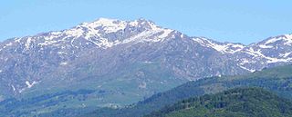
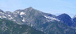
Rocciamelone is a 3,538 m high mountain in Piedmont, Italy, near the border between Italy and France.
The Susa Valley is a valley in the Metropolitan City of Turin, Piedmont region of northern Italy, located between the Graian Alps in the north and the Cottian Alps in the south. It is one of the longest valleys of the Italian Alps. It extends over 50 kilometres (31 mi) in an east-west direction from the French border to the outskirts of Turin. The valley takes its name from the city of Susa which lies in the valley. The Dora Riparia river, a tributary of the Po, flows through the valley.
The Geography of Piedmont is that of a territory predominantly mountainous, 43.3%, but with extensive areas of hills which represent 30.3% of the territory, and of plains (26.4%).
Monte Lera is a mountain in the Alpi di Lanzo, a sub-group of the Graian Alps, with an elevation of 1,368 m. It is located between the Val Casternone and the Ceronda valley in the communes of Val della Torre, Varisella and Givoletto.
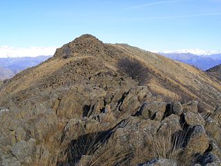
Monte Colombano is a mountain in the Alpi di Lanzo, a sub-group of the Graian Alps, with an elevation of 1,658 m.
Colma di Mombarone is a mountain of the Biellese Alps, a sub-range of Pennine Alps, in northern Italy. It visually marks, along with Monte Gregorio on the opposite side, the entrance of Aosta Valley from the Po plain. On its top in 1900 was built a huge statue, still located there, of Jesus Christ.
Monte Barone is a mountain of the Alpi Biellesi, a sub-range of the Pennine Alps. Due to its isolation it offers a noteworthy point of view towards the Po plain and can be seen from quite a long distance away.
Monte Orsiera is a mountain in the Cottian Alps belonging to the Province of Turin (Italy).
Monte Cresto (2,548 m) is the third highest peak of the Province of Biella after Monte Mars (2,600 m) and Monte Bo (2,556 m).
Punta Sulè is a 3,384 m a.s.l.mountain of the Graian Alps, located in Italy.
Monte Politri or Bric Rosso is a 3,026 m a.s.l. mountain of the Cottian Alps, located in Italy.
Carmo di Brocchi is a 1,610-metre (5,282 ft) mountain of the Ligurian Alps, in Italy.
Monte Spinarda is a 1,357-metre (4,452 ft) mountain of the Ligurian Prealps in Italy.
The Punta Nera is a mountain of Savoie (France) and of the Province of Turin (Italy). It lies in the Cottian Alps range. It has an elevation of 3,047 metres above sea level.
The Monte Civrari is a mountain of the Graian Alps, with an elevation of 2,302 m.
The Punta Lunella is a mountain of the Graian Alps, with an elevation of 2,772 m.
The Punta Mirauda is a mountain of the Ligurian Alps located in Piedmont.
Monte Cianea is a 1,226-metre (4,022 ft) mountain of the Ligurian Prealps, in Italy.
The Monte Fantino is a mountain of the Ligurian Alps located in Piedmont.
The Ligurian Prealps are a mountain range in northwestern Italy. They belong to the Ligurian Alps and are located between the regions of Piemonte and Liguria. Their highest summit is the monte Armetta, at an elevation of 1,739 metres (5,705 ft).
{{cite journal}}
: CS1 maint: multiple names: authors list (link)