
Montpelier is the capital city of the U.S. state of Vermont and the seat of Washington County. The site of Vermont's state government, it is the least populous state capital in the United States. As of the 2020 census, the population was 8,074. However, the daytime population grows to about 21,000, due to the large number of jobs within city limits. The Vermont College of Fine Arts is located in the municipality. It was named after Montpellier, a city in the south of France.

Sacramento County is a county located in the U.S. state of California. As of the 2020 census, the population was 1,585,055. Its county seat is Sacramento, which has been the state capital of California since 1854.

Clay County is a county in the U.S. state of Mississippi. As of the 2010 census, the population was 20,634. Its county seat is West Point. Its name is in honor of American statesman Henry Clay, member of the United States Senate from Kentucky and United States Secretary of State in the 19th century. J. Wesley Caradine, an African American, was the first state representative for Clay County after it was established in 1871.

Clay County is located in the U.S. state of Missouri and is part of the Kansas City metropolitan area. As of the 2020 census, the county had a population of 253,335, making it the fifth-most populous county in Missouri. Its county seat is Liberty. The county was organized January 2, 1822, and named in honor of U.S. Representative Henry Clay from Kentucky, later a member of the United States Senate and United States Secretary of State.

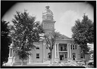
Oktibbeha County is a county in the east central portion of the U.S. state of Mississippi. As of the 2010 census the population was 47,671. The county seat is Starkville. The county's name is derived from a local Native American word meaning either "bloody water" or "icy creek". The Choctaw had long occupied much of this territory prior to European exploration and United States acquisition.
Neshoba County is located in the central part of the U.S. state of Mississippi. As of the 2020 census, the population was 29,087. Its county seat is Philadelphia. It was named after Nashoba, a Choctaw chief. His name means "wolf" in the Choctaw language.
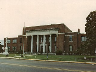
Lowndes County is a county on the eastern border of the U.S. state of Mississippi. As of the 2010 United States Census, the population was 59,779. Its county seat is Columbus. The county is named for U.S. Congressman and slave owner William Jones Lowndes.

Leake County is a county located in the center of the U.S. state of Mississippi. As of the 2010 census, the population was 23,805. Its county seat is Carthage. The county is named for Walter Leake, the Governor of Mississippi from 1822 to 1825.

Dakota County is the third-most populous county in the U.S. state of Minnesota, located in the east central portion of the state. As of the 2020 census, the population was 439,882. The population of Dakota County was estimated to be 442,038 in 2021. The county seat is Hastings. Dakota County is named for the Dakota Sioux tribal bands who inhabited the area. The name is recorded as "Dahkotah" in the United States Census records until 1851. Dakota County is included in the Minneapolis–St. Paul–Bloomington, MN–WI Metropolitan Statistical Area, the sixteenth largest metropolitan area in the United States with about 3.64 million residents. The largest city in Dakota County is the city of Lakeville, the eleventh-largest city in Minnesota and sixth-largest Twin Cities suburb. The county is bordered by the Minnesota and Mississippi Rivers on the north, and the state of Wisconsin on the east.

Blackford County is located in the east central portion of the U.S. state of Indiana. The county is named for Judge Isaac Blackford, who was the first speaker of the Indiana General Assembly and a long-time chief justice of the Indiana Supreme Court. Created in 1838, Blackford County is divided into four townships, and its county seat is Hartford City. Two incorporated cities and one incorporated town are located within the county. The county is also the site of numerous unincorporated communities and ghost towns. Occupying only 165.58 square miles (428.9 km2), Blackford County is the fourth smallest county in Indiana. As of the 2020 census, the county's population was 12,112. Based on population, the county is the 8th smallest county of the 92 in Indiana. Although no interstate highways are located in Blackford County, three Indiana state roads cross the county, and an additional state road is located along the county's southeast border. The county has two railroad lines. A north–south route crosses the county, and intersects with a second railroad line that connects Hartford City with communities to the west.

Carmel is a suburban city in Indiana immediately north of Indianapolis. With a population of 100,777, the city spans 49 square miles (130 km2) across Clay Township in Hamilton County, Indiana, and is bordered by the White River to the east; the Hamilton-Boone county line to the west; 96th Street to the south and 146th Street to the north. Although Carmel was home to one of the first electronic automated traffic signals in the state, the city has constructed 141 roundabouts since 1998, earning its moniker as the "Roundabout Capital of the U.S."

Soso is a town in Jones County, Mississippi, United States. The population was 418 at the 2020 census.

Cleveland is a city in Bolivar County, Mississippi, United States. The population was 11,199 as of the 2020 United States Census.

Minter City is an unincorporated community in Leflore County and Tallahatchie County, Mississippi. It is part of the Greenwood, Mississippi micropolitan area, and is within the Mississippi Delta.

Notre Dame is a census-designated place and unincorporated community north of the city of South Bend in St. Joseph County, in the U.S. state of Indiana. It includes the campuses of three colleges: the University of Notre Dame, Saint Mary's College, and Holy Cross College. Notre Dame is split between Clay and Portage Townships. As of the 2020 census, its population was 7,234.

Walls is a town located in northern DeSoto County, Mississippi, United States, near the Mississippi River, part of the larger region known as "The Delta", and known for its rich, dark soil. As it is in the upper northwest corner of Mississippi, it is in the Memphis, Tennessee metropolitan area. Its ZIP code is 38680. As of the 2010 census it had a population of 1,162, with an estimated population of 1,463 in 2018.
Oak Grove is a census-designated place and unincorporated community located in Lamar County, Mississippi, United States. The settlement is a suburb located immediately west of Hattiesburg.
Montpelier is an unincorporated community in eastern Muscatine County, Iowa, United States. Located along Iowa Highway 22, it lies on the Mississippi River above the city of Muscatine, the county seat of Muscatine County. Its elevation is 568 feet (173 m). The community is part of the Muscatine Micropolitan Statistical Area.
Stanton is an unincorporated community in New Castle County, Delaware, United States, near the confluence of the Red Clay and White Clay Creeks. It is located in the southern end of Mill Creek Hundred.
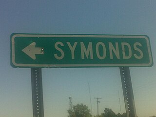
Symonds is a census-designated place and unincorporated community located in Bolivar County, Mississippi, United States. Symonds is approximately 3 miles (4.8 km) southeast of Malvina and approximately 4 miles (6.4 km) northwest of Pace. Symonds is located on the former Yazoo and Mississippi Valley Railroad.


