Clay County is a county in the U.S. state of Mississippi. As of the 2020 census, the population was 18,636. Its county seat is West Point. Its name is in honor of American statesman Henry Clay, member of the United States Senate from Kentucky and United States Secretary of State in the 19th century. J. Wesley Caradine, an African American, was the first state representative for Clay County after it was established in 1871.
Waggaman is a census-designated place and unincorporated community in Jefferson Parish, Louisiana, United States. Waggaman is on the West Bank of the Mississippi River, within the New Orleans–Metairie–Kenner metropolitan statistical area. The population was 9,835 at the 2020 census. The area was named for U.S. Senator George Augustus Waggaman (1782–1843).
Redwood is a census-designated place and unincorporated community located southeast of Twin Lake in Warren County, Mississippi, United States. The town is located near the junction of U.S. Route 61 and Mississippi Highway 3, approximately 10 miles north of Vicksburg. Its zip code is 39156.

Winterville is a census-designated place and unincorporated community located in Washington County, Mississippi, near Mississippi Highway 1. Winterville is approximately 3 miles (4.8 km) north of Greenville, the county seat, and approximately 4 miles (6.4 km) south of Lamont.
Delta City is a census-designated place and unincorporated community located on Mississippi Highway 434 in Sharkey County, Mississippi. Delta City is approximately 6 miles (9.7 km) east of Panther Burn and approximately 5 miles (8.0 km) north of Nitta Yuma. Although an unincorporated community, Delta City has a zip code of 39061.
Ovett is a census-designated place and unincorporated community in southeastern Jones County, Mississippi. Ovett is part of the Laurel Micropolitan Statistical Area.

Moselle is a census-designated place and unincorporated community in southern Jones County, Mississippi. The community is part of the Laurel micropolitan area.

Eastabuchie is a census-designated place and unincorporated community in southwestern Jones County, Mississippi. It is located along U.S. Route 11, just north of the Forrest County line. the community has a post office with the ZIP code 39436. Eastabuchie is part of the Laurel Micropolitan Statistical Area.
Lamar is a census-designated place and unincorporated community in Benton County, Mississippi, United States. It is located along Mississippi Highway 7 in western Benton County. Lamar has a post office with the ZIP code 38642. The nearly abandoned Mississippi Central Railroad runs through Lamar, and is only used rarely for freight trafficking. Lamar shares its ZIP code with the nearby community of Slayden.

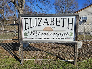
Elizabeth is a census-designated place and unincorporated community located in Washington County, Mississippi. Elizabeth is approximately 1 mile (1.6 km) north of Leland and 2 miles (3.2 km) east of Stoneville.
Van Vleet is a census-designated place and unincorporated community in Chickasaw County, Mississippi, United States. Van Vleet is located at the junction of Mississippi Highway 32 and Mississippi Highway 385, 8 miles (13 km) northeast of Houston. Van Vleet has a post office with ZIP code 38877.

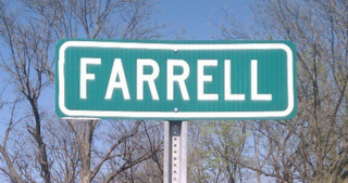
Farrell is an unincorporated community and census-designated place in Coahoma County, Mississippi, United States. Per the 2020 census, the population was 200. Farrell is located approximately 4 miles (6 km) south of Stovall and 4 miles (6 km) north of Sherard on Mississippi Highway 1. It is approximately 9 miles (14 km) northwest of Clarksdale, the county seat.

Dennis is a census-designated place and unincorporated community located at the intersection of Mississippi Highway 25 and Mississippi Highway 4 in Tishomingo County, Mississippi, United States. Dennis is approximately 6 miles (9.7 km) south of Tishomingo and 3 miles (4.8 km) north of Belmont.

Evansville is an unincorporated community and census-designated place (CDP) in southwest Washington County, Arkansas, United States. It was first listed as a CDP in the 2020 census with a population of 102.
Board Camp is an unincorporated community and census-designated place (CDP) in Polk County, Arkansas, United States. Board Camp is located on Arkansas Highway 8, 8.5 miles (13.7 km) east-southeast of Mena. Board Camp has a post office with ZIP code 71932.

Waterford is a census-designated place and unincorporated community in Marshall County, Mississippi, United States. It is a small town located between Holly Springs and Oxford on Highway 7.
Mount Pleasant is a census-designated place and unincorporated community in Marshall County, Mississippi, United States, located along U.S. Highway 72 at State Highway 311. The community has a volunteer fire department on Boswell Road, and a K-12 school located off Highway 72.
Paris is a census-designated place and unincorporated community in Lafayette County, Mississippi, United States. Paris is located at the junction of Mississippi Highway 9W and Mississippi Highway 315 10 miles (16 km) east of Water Valley.
Harperville is a census-designated place and unincorporated community in rural Scott County, Mississippi, United States. Harperville is located on Mississippi Highway 35, 9 miles (14 km) north of Forest. Harperville has a post office with ZIP code 39080. It was first named as a CDP in the 2020 Census which listed a population of 250.
Bethlehem is a census-designated place and unincorporated community in Marshall County, Mississippi, United States. Its ZIP code is 38659.


