Washington County is a county located in the southwestern part of the U.S. state of Alabama. As of the 2010 census, the population was 17,581. The county seat is Chatom. The county was named in honor of George Washington, the first President of the United States. It is a dry county, with the exception of Chatom.

Jefferson County, Arkansas is a county located in the U.S. state of Arkansas in the area known as the Arkansas Delta, that extends west of the Mississippi River. As of the 2010 census, the population was 77,435. Its county seat and largest city is Pine Bluff. Jefferson County is Arkansas's 21st county, formed on November 2, 1829, from portions of Arkansas and Pulaski counties, and named for Thomas Jefferson, third President of the United States. Jefferson County is included in the Pine Bluff, Arkansas Metropolitan Statistical Area. The county is bisected by the Arkansas River, which was critical to its development and long the chief transportation byway.

Arkansas County is a county located in the U.S. state of Arkansas. As of the 2010 census, the population was 19,019. Located in the Arkansas Delta, the county has two county seats, De Witt and Stuttgart.
Epes is a town in Sumter County, Alabama, United States. Initially called Epes Station, it was incorporated as Epes in 1899. At the 2010 census the population was 192, down from 206 in 2000.

Columbus is a city in and the county seat of Lowndes County, on the eastern border of Mississippi, United States, located primarily east, but also north and northeast of the Tombigbee River, which is also referred to as the Tennessee-Tombigbee Waterway. It is approximately 146 miles (235 km) northeast of Jackson, 92 miles (148 km) north of Meridian, 63 miles (101 km) south of Tupelo, 60 miles (97 km) northwest of Tuscaloosa, Alabama, and 120 miles (193 km) west of Birmingham, Alabama.

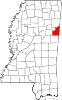
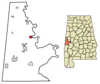
Aberdeen is the county seat of Monroe County, Mississippi, United States. As of the 2010 census, the population was 5,612.

Cotton Gin Port is a ghost town in Monroe County, Mississippi, United States.
The Gaines Trace was a road in the Mississippi Territory. It was constructed in 1811 and 1812 from the Tennessee River to Cotton Gin Port on the upper Tombigbee River and on to Fort Stoddert on the lower Tombigbee. The portion from the Tennessee River to Cotton Gin Port was surveyed in 1807 and 1808 by Edmund P. Gaines, the road's namesake.
Mississippi Highway 364 is a state highway in northeastern Mississippi, separated in two segments. The route starts at MS 30 southeast of Booneville and travels northeastward. The road travels through Altitude and ends at MS 365 in Cairo. The other segment begins in Holcut and travels eastward to its terminus at MS 25 at Midway. The route was designated in 1950, from a former segment of MS 30 between MS 365 and MS 25. The route was extended southwestwards to MS 30 around 1960, and the highway was completely paved by 1984. The section of MS 364 near the Tennessee–Tombigbee Waterway were removed by the same year, and another section from MS 365 to the waterway was removed ten years later.
Goshen Road was an early road that ran from Old Shawneetown, Illinois, on the Ohio River, northwest to the Goshen Settlement, near Glen Carbon, Illinois, near the Mississippi River. In the early 19th century, this was the main east/west road in Illinois.
The Village of Holly Bluff is a small unincorporated community in Yazoo County, Mississippi, in the Mississippi Delta.

Randolph is a rural unincorporated community in Tipton County, Tennessee, United States, located on the banks of the Mississippi River. Randolph was founded in the 1820s and in 1827, the Randolph post office was established. In the 1830s, the town became an early center of river commerce in West Tennessee. Randolph shipped more cotton annually than Memphis until 1840. In 1834, the first pastor of the Methodist congregation was appointed. The fortunes of the community began to decline in the late 1840s due to failed railroad development, an unfavorable mail route and other factors. The first Confederate States Army fort in Tennessee was built at Randolph early in the Civil War in 1861, a second fortification at Randolph was constructed later that same year. During the Civil War, the town was burned down twice by Union Army forces.

Randolph is an unincorporated rural community in Tipton County, Tennessee, United States, located on the banks of the Mississippi River. The lands of the Mississippi River Basin were inhabited by Paleo-Indians and later Native American tribes of the Mississippian culture for thousands of years. The Tipton Phase people and the Chickasaw Indian tribe populated the Mississippi River valley near Randolph during the Mississippian period. In 1541, Spanish explorer Hernando de Soto crossed the Mississippi River at or near Randolph. French explorer Cavelier de La Salle built the first French fortification at or near Randolph on his 1682 canoe expedition of the Mississippi River.

Claiborne is a ghost town on a bluff above the Alabama River in Monroe County, Alabama.

The Tombigbee District, also known as the Tombigbee settlements, was one of two areas, the other being the Natchez District, that were the first in what was West Florida to be colonized by British subjects from the Thirteen Colonies and elsewhere. This later became the Mississippi Territory as part of the United States. The district was also the first area to be opened to white settlement in what would become the state of Alabama, outside of the French colonial outpost of Mobile on the Gulf Coast. The Tombigbee and Natchez districts were the only areas populated by whites in the Mississippi Territory when it was formed by the United States in 1798.
Van Buren is a ghost town located in Itawamba County, Mississippi.
Agency is a ghost town located in Oktibbeha County, Mississippi, United States.
Bigbee Valley is an unincorporated community in Noxubee County, Mississippi, United States. Variant names are "Bigbeevale", "Nances Mill", and "Whitehall".
Nashville is a ghost town in Lowndes County, Mississippi, United States.
Riverton is a ghost town in Bolivar County, Mississippi, United States.