Lowndes County is a county on the eastern border of the U.S. state of Mississippi. As of the 2020 United States Census, the population was 58,879. Its county seat is Columbus. The county is named for U.S. Congressman William Jones Lowndes.

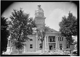
Columbus is a city in and the county seat of Lowndes County, on the eastern border of Mississippi, United States, located primarily east, but also north and northeast of the Tombigbee River, which is also part of the Tennessee-Tombigbee Waterway. It is approximately 146 miles (235 km) northeast of Jackson, 92 miles (148 km) north of Meridian, 63 miles (101 km) south of Tupelo, 60 miles (97 km) northwest of Tuscaloosa, Alabama, and 120 miles (193 km) west of Birmingham, Alabama.

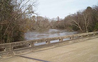
The Tombigbee River is a tributary of the Mobile River, approximately 200 mi (325 km) long, in the U.S. states of Mississippi and Alabama. Together with the Alabama, it merges to form the short Mobile River before the latter empties into Mobile Bay on the Gulf of Mexico. The Tombigbee watershed encompasses much of the rural coastal plain of western Alabama and northeastern Mississippi, flowing generally southward. The river provides one of the principal routes of commercial navigation in the southern United States, as it is navigable along much of its length through locks and connected in its upper reaches to the Tennessee River via the Tennessee-Tombigbee Waterway.
Cotton Gin Port is a ghost town in Monroe County, Mississippi, United States.

Mississippi Highway 50 is a state highway in Mississippi. It generally follows an east/west track for 60 miles (97 km) and runs from MS 9 in Walthall, Mississippi, east to the Alabama state line east of Columbus. MS 50 serves the following Mississippi counties: Lowndes, Clay, and Webster.

Fort Stoddert, also known as Fort Stoddard, was a stockade fort in the U.S. Mississippi Territory, in what is today Alabama. It was located on a bluff of the Mobile River, near modern Mount Vernon, close to the confluence of the Tombigbee and Alabama Rivers. It served as the western terminus of the Federal Road which ran through Creek lands to Fort Wilkinson in Georgia. The fort, built in 1799, was named for Benjamin Stoddert, the secretary to the Continental Board of War during the American Revolution and Secretary of the Navy during the Quasi War. Fort Stoddert was built by the United States to keep the peace by preventing its own settlers in the Tombigbee District from attacking the Spanish in the Mobile District. It also served as a port of entry and was the site of a Court of Admiralty. While under the command of Captain Edmund P. Gaines, Aaron Burr was held as a prisoner at the fort after his arrest at McIntosh in 1807 for treason against the United States. In July 1813, General Ferdinand Claiborne brought the Mississippi Militia to Fort Stoddert as part of the Creek War. The 3rd Infantry Regiment was commanded by General Thomas Flournoy to Fort Stoddert following the Fort Mims massacre. The site declined rapidly in importance after the capture of Mobile by the United States in 1813 and the establishment of the Mount Vernon Arsenal in 1828.
Hamilton is a census-designated place and unincorporated community in Monroe County, Mississippi, United States. As of the 2020 census, it had a population of 404.
The Buttahatchee River is a tributary of the Tombigbee River, about 125 miles (201 km) long, in northwestern Alabama and northeastern Mississippi in the United States. Via the Tombigbee River, it is part of the watershed of the Mobile River, which flows to the Gulf of Mexico.
Billups is an unincorporated community in Lowndes County, Mississippi.
Steens, also known as Jamisons Mill, is an unincorporated community in Lowndes County, Mississippi. Steens is located northeast of Columbus. The ZIP Code for Steens is 39766.
Bent Oak is an unincorporated community in Lowndes County, Mississippi. According to the United States Geological Survey, variant names are Cobbs Switch, Bentoak, and Cobbs.
Trinity is an unincorporated community in Lowndes County, Mississippi. Trinity is located south of Columbus. According to the United States Geological Survey, a variant name is Bryans Store.

Fort Tombecbe, also spelled Tombecbee and Tombeché, was a stockade fort located on the Tombigbee River near the border of French Louisiana, in what is now Sumter County, Alabama. It was constructed under the leadership of Jean-Baptiste Le Moyne, Sieur de Bienville in 1736–1737 as trading post about 270 miles (430 km) upriver from Mobile, on an 80-foot (24 m) limestone bluff. Fort Tombecbe was built in Choctaw lands and would play a major role in colonial France's efforts to stop British intrusions into the area. Bienville claimed that the new fort was to protect the Choctaw from the Chickasaw. In May of 1736, Bienville, along with a force of 600 soldiers combined with a force of 600 Choctaw warriors, set out from Fort Tombecbe and attacked the Chickasaw near present-day Tupelo, Mississippi at the Battle of Ackia. Tombecbe was a major French outpost and trade depot among the Choctaw, the largest Native American group in the colony.
John Pitchlynn served as the official U.S. Interpreter at the Choctaw Agency during the early federal period. Of Scottish-American descent, he had been raised among the Choctaw people. He facilitated relations between the government of the United States and the Choctaw Nation. He was appointed by President George Washington after the United States achieved independence, and served through the administration of Andrew Jackson.
Van Buren is a ghost town located in Itawamba County, Mississippi.
Moores Bluff is a ghost town in Lowndes County, Mississippi, United States.
Nashville is a ghost town in Lowndes County, Mississippi, United States.
Waverly is an unincorporated community in Clay County, Mississippi, United States.
Fort Carney was a stockade fort built in 1813 in present-day Clarke County, Alabama, during the Creek War.

Fort Stonewall was a fort built by the state of Alabama in 1862 in present-day Clarke County, Alabama, during the American Civil War. Fort Stonewall was constructed on the Alabama River by enslaved Africans to protect the interior of Alabama in the event that Mobile was captured by Union forces. Additional forts were concurrently constructed to defend against Union advances up the Tombigbee River and to protect nearby salt works. The fort never saw any military action and was destroyed at the close of the American Civil War. Earthworks and a cannon are all that exist at the site today, which is located on private property.