Morong (district)

Last updated
Morong
Distrito de Morong (Spanish)
San Mateo (1853-1857)
Former district of the Philippines
1853–1901
District of Morong in the Philippines.svg
Location of the historical district of Morong
Capital Morong
Area 
 1898
1,093 km2 (422 sq mi)
Historical era Colonial period
 Established
February 23, 1853
 Disestablished
June 11, 1901
Preceded by
Succeeded by
Flag of Spain (1785-1873, 1875-1931).svg Tondo
Flag of Spain (1785-1873, 1875-1931).svg Laguna
Rizal Flag of the United States (1896-1908).svg

Morong was an administrative division of the Philippines that existed as a politico-military district created out of parts of the provinces of Tondo and Laguna on February 23, 1853, by a decree of the Superior Gobierno, composing Morong, Pililla, Tanay, Baras, Binangonan, Jalajala, Angono and Cardona from Laguna; and Antipolo, Boso-Boso, Cainta and Taytay from Tondo. [1] The offices were housed at a building now known as Comandancia. Its first military governor was Francisco Turrentigue. [2]

Contents

Creation of the District

Three years after the issuance of Royal Decree of Spain in 1844, provincial organizations were reclassified into provinces, districts, and politico-military units. At that time, the province of Tondo had religious jurisdiction over Pueblo de Morong and Laguna over all governmental, commercial, industrial and social affairs. In 1853, the district was created out of such provinces as the Distrito Politico-Militar de los Montes de San Mateo (transl.Politico-Military District of the San Mateo Mountains). [1] In order to debunk the misconception that its capital was the town of San Mateo in the province of Tondo, [3] it was later renamed to Distrito de Morong in 1857, [4] after its capital town of Morong, located at the shore of Laguna de Bay, with villages under the supervision of the Franciscans. [2]

Pueblos of Distrito de Morong

The following is a list of the pueblos or towns comprising Distrito de Morong. [2] [5]

  •  Capital town
PuebloYear CreatedPopulation (1898)
Morong15839,430
Pililla15832,000
Baras15951,217
Tanay16064,609
Antipolo16503,500
Taytay16756,800
Bosoboso1700855
Binangonan17377,624
Cainta17602,275
Angono17661,955
Jalajala18231,735
Cardona18552,641
Teresa18794,250

On February 11, 1879, the creation of the town of Teresa was approved, merging the four former sitios of the town of Morong, namely, Santa Rosa, Prinza, Pantay and Buhangin. [2]

Katipuneros in Morong

The First Official Philippine Flag Philippines flag 1st official.png
The First Official Philippine Flag

Before the outbreak of the Philippine Revolution, a branch of the Katipunan was created in Morong, the capital of the district. Many leaders of the Katipunan were from Distrito de Morong. Among the first initiates of the Katipunan was Aurelio Tolentino who hailed from Morong. He and his brother Jacinto were Andres Bonifacio's agents. Teodoro Plata, one of original founding members, was a clerk in the Court of Justice of the Peace of Morong. [2]

There were a number of attacks made by the Katipuneros and Spaniards who took their stand in the Commandancia and Morong Church and convent. The last stronghold of Spain in Distrito de Morong happened when the Spaniards, holed out in the convent surrendered to the Katipuneros on August 19, 1898. [2]

After the surrender of the Spaniards in Morong, Antipolo became the capital of the revolutionary army, removing the title of Morong as capital of the district. [2]

Distrito de Morong earned the distinction to be represented as one of the eight rays of the sun in the Filipino flag, symbolic of the eight provinces who held uprisings against the Spaniards in 1896 which were Manila, Bulacan, Pampanga, Nueva Ecija, Morong, Laguna, Batangas, and Cavite. [2]

Commander Hilarion Raymundo and the Morong Defenders

Major Hilarion Raymundo was the leader of the Morong defenders who fought the Americans during the Philippine–American War. Under his leadership, the Americans were forced to retreat after killing and wounding many of them in February 1900. Many Morongueños were still fighting the Americans even after the surrender of Manila and capture of Emilio Aguinaldo at Palanan, Isabela on March 23, 1901. However, through Don Juan Sumulong, General Miguel Malvar advised the Morongueños to surrender to the American flag. [2]

Creation of Rizal province

To hasten the establishment of the civil government in the Philippines, former United States President William McKinley sent the Second Philippine Commission. It conducted public meetings with the people regarding the reorganization of the provinces. On June 5, 1901, 221 delegates from the Distrito de Morong and a portion of Manila Province had an assembly at Pasig Church. Judge William Howard Taft stated that it was suggested to the commission to unite Manila and Morong. [2]

Hilarion Raymundo and Jose Tupas, two of the Morong delegates, argued against the fusion of Manila and Morong while Jose Oliveros and Juan Sumulong, delegates of Antipolo, were in favor of it. [2]

After the deliberation, Trinidad Pardo de Tavera suggested that the merged provinces be named Rizal "...in memory of the most illustrious Filipino and the most illustrious Tagalog the islands had ever known...", referring to José Rizal. [2]

Related Research Articles

<span class="mw-page-title-main">Katipunan</span> 1892–1897 Philippine revolutionary society against Spanish rule

The Katipunan, officially the Kataastaasan, Kagalanggalang na Katipunan ng mga Anak ng Bayan or Kataastaasan Kagalang-galang na Katipunan ng mga Anak ng Bayan, was a Philippine revolutionary society founded by anti-Spanish colonialist Filipinos in Manila in 1892; its primary goal was to gain independence from Spain through a revolution.

<span class="mw-page-title-main">Rizal (province)</span> Province in Calabarzon, Philippines

Rizal, officially the Province of Rizal, is a province in the Philippines located in the Calabarzon region in Luzon. Its capital is the city of Antipolo. It is about 16 kilometers (9.9 mi) east of Manila. The province is named after José Rizal, one of the main national heroes of the Philippines. It is bordered by Metro Manila to the west, Bulacan to the north, Quezon to the east and Laguna to the southeast. The province also lies on the northern shores of Laguna de Bay, the largest lake in the country. Rizal is a mountainous province perched on the western slopes of the southern portion of the Sierra Madre mountain range.

<span class="mw-page-title-main">Antipolo</span> Capital of Rizal, Philippines

Antipolo, officially the City of Antipolo, is a 1st class component city and capital of the province of Rizal, Philippines. According to the 2020 census, it has a population of 887,399 people. It is the most populous city in the Calabarzon region, and the seventh most-populous city in the Philippines. And also, it is the most populated city under the component city status.

<span class="mw-page-title-main">Taytay, Rizal</span> Municipality in Rizal, Philippines

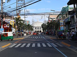
Taytay, officially the Municipality of Taytay, is a 1st class urban municipality in the province of Rizal, Philippines. It is also known as the Garments Capital of the Philippines. Most occupation of the residents are related to supplying different types of garments related things like blouses, pants, dresses and the garment itself at a very low cost.

<span class="mw-page-title-main">Tanay, Rizal</span> Municipality in Rizal, Philippines

Tanay, officially the Municipality of Tanay, is a 1st class municipality in the province of Rizal, Philippines. According to the 2020 census, it has a population of 139,420 people.

<span class="mw-page-title-main">Baras, Rizal</span> Municipality in Rizal, Philippines

Baras, officially the Municipality of Baras, is a 4th class municipality in the province of Rizal, Philippines. According to the 2020 census, it has a population of 87,637 people.

<span class="mw-page-title-main">Morong, Rizal</span> Municipality in Rizal, Philippines

Morong, officially the Municipality of Morong, is a 2nd class municipality located in the province of Rizal, Philippines. As per the 2020 census, Morong has a population of 71,151 people.

<span class="mw-page-title-main">Pililla</span> Municipality in Rizal, Philippines

Pililla, officially the Municipality of Pililla, is a 1st class municipality in the province of Rizal, Philippines. According to the 2020 census, it has a population of 71,535 people. It is surrounded by farms, small mountains, plains, and trees. Pililla is known as the Green Field Municipality of Rizal.

<span class="mw-page-title-main">University of Rizal System</span> Public university in Rizal, Philippines

The University of Rizal System (URS) is a network of colleges located in the Rizal province, Philippines. It operates multiple campuses, with the main campus being in Tanay, Rizal.

<span class="mw-page-title-main">Marikina–Infanta Highway</span> Scenic road in the Philippines

The Marikina–Infanta Highway, also known as Marcos Highway, Marilaque Highway, Marilaque Road or Marikina-Infanta Road, is a scenic mountain 117.5-kilometer (73.0 mi) highway that connects Metro Manila with Infanta, Quezon in the Philippines. Motorists colloquially refer to the road as Marilaque Highway.

The geography of the City of Manila is characterized by its coastal position at the estuary of the Pasig River that flows to Manila Bay. The city is located on a naturally protected harbor, regarded as one of the finest harbors in Asia. The scarce availability of land is a contributing factor that makes Manila the densest populated city in the world.

<span class="mw-page-title-main">Juan Sumulong</span>

Juan Marquez Sumulong Sr. was a Filipino former revolutionary, journalist, lawyer, educator and politician from the province of Rizal. He was the president of the opposition party which ran against Manuel L. Quezon's Nacionalista Party in the 1941 presidential election of the Philippine Commonwealth. He is also the maternal great-grandfather of former President Benigno Aquino III.

<span class="mw-page-title-main">Manila (province)</span> Philippine province (1571–1901)

Manila, also known as Tondo until 1859, was a province of the Philippines that encompassed the former pre-Hispanic polities of Tondo, Maynila, and Namayan. In 1898, it included the City of Manila and 23 other municipalities. Alongside the District of Morong, it was incorporated into the Province of Rizal in 1901.

Eastern Metropolitan Bus Corporation or EMBC is one of the largest bus companies in the Philippines. The city operation plies routes from Antipolo, Rizal to Divisoria, Manila via Shaw Boulevard Ortigas Avenue. This bus company also offers tourist chartered and shuttle services.
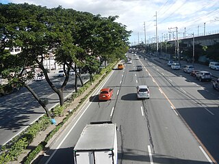
<span class="mw-page-title-main">Battle of Binakayan–Dalahican</span> Part of the Philippine Revolution

The Battle of Binakayan–Dalahican was a simultaneous battle during the Philippine Revolution that was fought on November 9–11, 1896 that led to a decisive Filipino victory. The twin battle took place at the shores of Binakayan, in the town of Cavite Viejo ; Dalahican and Dagatan in Noveleta; and, to minimal extent, in Imus and Bacoor towns in Cavite, Philippines that lasted for two days before the Spanish army retreated demoralized and in disarray. The result of the battle was the first significant Filipino victory in the country's history.

<span class="mw-page-title-main">Battle of Kakarong de Sili</span>

The Battle of Kakarong de Sili was fought on January 1, 1897, at Pandi, Bulacan, in the Philippines. The Kakarong Republic, based in the little fort in Pandi, was attacked by a force of Spaniards who massacred the Katipuneros there. At the end of the battle, General Eusebio Roque was captured by the Spaniards. The Kakarong republic was considered the first republic formed in Bulacan and in the Philippines.

The Battle of Pateros refers to a series of skirmishes between Spanish troops and revolutionary forces in the towns of Las Piñas, Taguig and Pateros in Manila. These skirmishes occurred shortly after the execution of José Rizal and are considered the renewal of hostilities in Luzon after a period of ceasefire from the Battle of Binakayan to the Rizal execution.

The Battle of San Mateo and Montalban was a battle fought between the remaining Katipuneros under the command of Andres Bonifacio and Emilio Jacinto and the Spanish government after a failed attempt to capture the El Deposito water works at San Juan del Monte.

<span class="mw-page-title-main">Morong Church</span> Roman Catholic church in Rizal, Philippines

St. Jerome Parish Church is a Roman Catholic church located in Morong, Rizal, Philippines. It was built during the Spanish period in the country, with stones from a hill called Kay Ngaya; lime from the stones of the mountain Kay Maputi; and sand and gravel from Morong River.

<span class="mw-page-title-main">Battle of Sambat</span>

The Battle of Sambat was the culminating battle of the first revolts of the Katipunan in Laguna. The battle was the final major action for the Katipunan chapter of "Maluningning" ending in the defeat of the rebels and martial law in Laguna province.

References

  1. 1 2 "Journey to the Past". Rizal Provincial Government. Retrieved June 18, 2022.
  2. 1 2 3 4 5 6 7 8 9 10 11 12 Pascual, Timoteo; Guillermo, Liwayway (1978). Morong's 400 Years. Manila: UST Press.
  3. "Journey to the Past". Rizal Provincial Government. Retrieved June 19, 2022.
  4. "Brief Profile". ANGONO | The Art Capital of the Philippines. September 15, 2017. Retrieved June 18, 2022.
  5. United States. Adjutant-General's Office. Military Information Division (1898). Military notes on the Philippines: September 1898. Washington: Government Printing Office. Retrieved August 15, 2022.