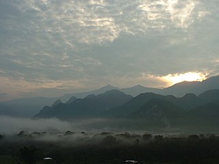
The Gunung Mulu National Park, also known simply as the Mulu National Park is a national park in Miri Division, Sarawak, Malaysia. It is a UNESCO World Heritage Site that encompasses caves and karst formations in a mountainous equatorial rainforest setting. The park is famous for its caves and the expeditions that have been mounted to explore them and their surrounding rainforest, most notably the Royal Geographical Society Expedition of 1977–1978, which saw over 100 scientists in the field for 15 months. This initiated a series of over 20 expeditions now named the Mulu Caves Project.
Sarawak Chamber is the largest known cave chamber in the world by area and the second largest by volume after the Miao Room in China. It is in Gua Nasib Bagus, which is located in Gunung Mulu National Park in the Malaysian territory of Sarawak on the island of Borneo.

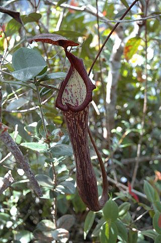
Nepenthes hurrelliana is a tropical pitcher plant endemic to Borneo, where it has been recorded from northern Sarawak, southwestern Sabah, and Brunei. It is of putative hybrid origin; its two original parent species are thought to be N. fusca and N. veitchii. A thick indumentum of rusty-brown hairs covers the entire plant, a characteristic presumably inherited from the latter.
Gunung Buda National Park is a national park located in Limbang Division, Sarawak, Malaysia. It is located to the north of Gunung Mulu National Park. Gunung Buda National Park was gazetted in 2001. As in September 2017, the national park was in the planning stage for tourism activities. Roads were also planned to connect Gunung Buda with Gunung Mulu National Park. Gunung Buda meaning White Hill in Lun Bawang language.

Nepenthes campanulata, the bell-shaped pitcher-plant, is a tropical pitcher plant native to Borneo. It has also been reported from Palawan, the Philippines, though further field work is needed to confirm this identification.

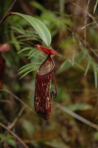
Nepenthes faizaliana is a tropical pitcher plant endemic to the limestone cliffs of Gunung Mulu National Park in Sarawak, Borneo. It is thought to be most closely related to N. boschiana.

Nepenthes muluensis, or the Mulu pitcher-plant, is a tropical pitcher plant endemic to Borneo. It grows in highland habitats at elevations of 1700 to 2400 m above sea level.

Nepenthes vogelii is a tropical pitcher plant endemic to Borneo. It is thought to be most closely related to N. fusca.
The Pinnacles may refer to different geological formations:
Mount Benarat is a mountain located in Gunung Mulu National Park in Sarawak, Malaysia, consisting of limestone on the western side which is overlain by gritstone on the eastern side. It contains many caves which have been discovered and explored by British and American cavers. The Benarat 2005 Caving Expedition discovered Moon Cave after climbing 60 m up the cliffs on the southern end of the mountain. On the eastern side, the Headhunter's Trail leads from the Melinau River to the mouth of the Terikan River at the Medalam River. Neighbouring Mount Buda and Mount Api are part of the same formation, separated from Mount Benarat by the Medalam and Melinau Rivers, respectively. It is also home to Benarat Cavern.

Api Chamber is a chamber in Whiterock Cave in Mount Api, Gunung Mulu National Park, Sarawak, Malaysia. Measuring 300 m by 200 m and with a surveyed circumference of 900 m it is the ninth largest cave chamber by area in the world. Its height is over 100 m and its plan area is 58,000 square metres. It is the second largest chamber in Malaysia after Sarawak Chamber.

Mount Mulu is a sandstone and shale mountain. At 2376 m, it is the second highest mountain in the state of Sarawak, after Mount Murud. It is located within the boundaries of Gunung Mulu National Park, which is named after it.

Mount Ilas Bungaan is a limestone hill near Berau, East Kalimantan, Borneo. It is also known as Flowering Rock, a literal translation of its Indonesian name. The hill is located "on a remote stretch of the Karangan River" and its base lies at an altitude of around 300 m.
Pelophryne api, also known as Api dwarf toad, is a species of toad in the family Bufonidae. It is endemic to Borneo and known from Gunung Mulu National Park in northern Sarawak and from Simpang Kuda in Bau District, western Sarawak. Its genetic divergence from Pelophryne guentheri is relatively low and these species could be conspecific.
Gua Nasib Bagus or Lubang Nasib Bagus is a cave located in the state of Sarawak in Malaysia. It is one of many caves found within Gunung Mulu National Park, a World Heritage Site on the island of Borneo.

Deer Cave, located near Miri, Sarawak, Malaysia, is a show cave attraction of Gunung Mulu National Park. It was surveyed in 1961 by G. E. Wilford of the British Borneo Geological Survey, who predicted that Mulu would yield many more caves in the future. The cave, which is also known as Gua Payau or Gua Rusa by the local Penan and Berawan people, is said to have received its name because of the deer that go there to lick salt-bearing rocks and shelter themselves.

The Borneo montane rain forests is an ecoregion on the island of Borneo in Southeast Asia. It includes montane tropical and subtropical moist broadleaf forests, also known as a cloud forests. The ecoregion is partly in East Malaysia and Indonesia (Kalimantan).

The Clearwater Cave System in Gunung Mulu National Park, Sarawak, Malaysia is believed to be one of the world's largest interconnected cave systems by volume and its 9th longest at 236.796 km (147.138 mi) (2020). The system lies mainly under the western margins of Gunung Api between the Melinau Gorge and Cave of the Winds.


