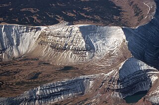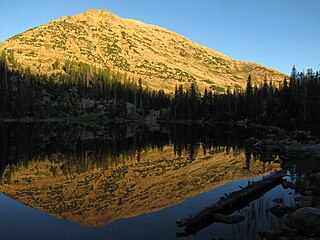
The Tushar Mountains are the third-highest mountain range in Utah after the Uinta Mountains and the La Sal Range. Located in the Fishlake National Forest, Delano Peak, 12,174 ft NAVD 88, is the highest point in both Beaver and Piute counties and has a prominence of 4,689 ft. Delano Peak is named for Columbus Delano (1809–1896), Secretary of the Interior, during the Grant administration. The Tushars receive an ample amount of snow annually even though they are situated within the rainshadow of the Sierra Nevada range in California and the Snake Range located in Nevada.

Mount Lovenia is a 13,219-foot elevation (4,029 m) mountain summit located on the common border that Duchesne County shares with Summit County in the U.S. state of Utah.

Explorer Peak is a 12,708-foot elevation (3,873 m) mountain summit located in Duchesne County, Utah, United States.

Dead Horse Peak is a 12,642-foot elevation (3,853 m) mountain summit located on the common border that Duchesne County shares with Summit County in the U.S. state of Utah.

The Cathedral is a 12,224-foot elevation (3,726 m) mountain summit located in Summit County, Utah, United States.

Mount Beulah is a 12,557-foot elevation (3,827 m) mountain summit located in Summit County, Utah, United States.

Wasatch Peak is a 13,156-foot elevation (4,010 m) mountain summit located in Summit County, Utah, United States.

Kweeyahgut Peak is a 12,855-foot-elevation (3,918-meter) mountain summit in Duchesne County, Utah, United States.

Mount Watson is an 11,521-foot-elevation (3,512-meter) mountain summit in Summit County, Utah, United States.

Mount Baldy is an 11,068-foot-elevation (3,374-meter) summit on the boundary that Salt Lake County shares with Utah County, in Utah, United States.

Clayton Peak, also known unofficially as Mount Majestic, is a 10,721-foot-elevation (3,268-meter) summit on the boundary that Salt Lake County shares with Wasatch County, in Utah, United States.

Mount Millicent is a 10,452-foot-elevation (3,186-meter) summit in Salt Lake County, Utah, United States.

Mount Wolverine is a 10,795-foot-elevation (3,290-meter) summit in Salt Lake County, Utah, United States.

Mount Marsell is an 11,340-foot-elevation (3,456-meter) mountain summit in Summit County, Utah, United States.

Reids Peak is an 11,724-foot-elevation (3,573-meter) mountain summit in Summit County, Utah, United States.

Notch Mountain is an 11,263-foot-elevation (3,433-meter) mountain summit in Summit County, Utah, United States.

Mount Brigham is an 11,770-foot-elevation (3,587-meter) mountain summit in Piute County, Utah, United States.

Sunset Peak is a 10,201-foot (3,109-metre) summit in Park County, Montana, United States.

Deer Trail Mountain is a 10,972-foot-elevation (3,344-meter) mountain summit in Piute County, Utah, United States.

Mount Humphreys is an 11,019-foot-elevation (3,359-meter) mountain summit in Park County, Wyoming, United States.


