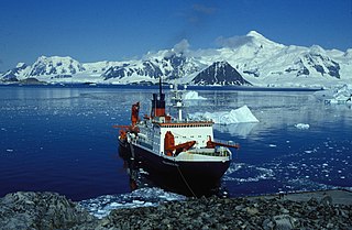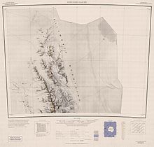
The Sentinel Range is a major mountain range situated northward of Minnesota Glacier and forming the northern half of the Ellsworth Mountains in Antarctica. The range trends NNW-SSE for about 185 km (115 mi) and is 24 to 48 km wide. Many peaks rise over 4,000 m (13,100 ft) and Vinson Massif (4892 m) in the southern part of the range is the highest elevation on the continent.

Mount Ulmer is a prominent peak situated 2 miles north of Mount Washburn in Gromshin Heights on the east side of northern Sentinel Range in Ellsworth Mountains, Antarctica. It surmounts the head of Vicha Glacier to the east and Newcomer Glacier to the west.

Mount Schmid is a mountain on the south side of Embree Glacier, rising 8 km east of Mount Goldthwait in Bangey Heights in the northern portion of the Sentinel Range, Antarctica. Mapped by USGS from surveys and US Navy air photos, 1957–59. Named by the US-ACAN for Captain Ernest A. Schmid, USAF, who participated in the establishment of the IGY South Pole Station during the 1956–57 season.

Mount Dalrymple is a mountain between Mount Alf and Mount Goldthwait in the northern part of the Sentinel Range, Antarctica. It surmounts Sabazios Glacier to the north-northeast and Embree Glacier to the southeast.

Allen Peak is a 1,880-metre (6,170 ft) peak in Antarctica, standing 5 nautical miles (9 km) west of Mount Wyatt Earp and forming the northern extremity of the main ridge of the Sentinel Range. It was discovered by Lincoln Ellsworth on his trans-Antarctic flight of 23 November 1935, and named by the Advisory Committee on Antarctic Names after Robert J. Allen Jr., a United States Geological Survey (USGS) cartographer and Antarctic specialist, 1950–79, a consultant to the USGS Branch of International Activities from 1980, and a member of the Branch of Special Maps, who helped prepare the 1962 map of this range.
Mount Bain is a mountain, 2,090 m, standing between Hopkins and Erskine Glaciers on the west coast of Graham Land. It was named by the United Kingdom Antarctic Place-Names Committee (UK-APC) in 1958 for James S. Bain of London, who specialized in the development of polar and high altitude rations, with special emphasis on plastic vacuum packaging, between 1948 and 1956.
The Gothic Mountains is a group of mountains, 20 nautical miles long, in the Queen Maud Mountains of Antarctica, located west of Watson Escarpment and bounded by Scott Glacier, Albanus Glacier, and Griffith Glacier.
Mount Bouvier is a massive, mainly ice-covered mountain, 2,250 metres (7,380 ft) high, immediately north of the head of Stonehouse Bay in the east part of Adelaide Island. It was discovered and roughly positioned by the French Antarctic Expedition, 1903–05, and named by Jean-Baptiste Charcot for Louis Bouvier, a prominent French naturalist. It was re-surveyed by the French Antarctic Expedition, 1908–10, and by the Falkland Islands Dependencies Survey in 1948–50.
Mount Bridgman is a prominent mountain which surmounts the central part of Liard Island in Hanusse Bay, which is a broad V-Shaped bay off the west coast of Graham Land, Antarctica. It was mapped from photos obtained by the Ronne Antarctic Research Expedition (1947–48) and the Falkland Islands and Dependencies Aerial Survey Expedition (1956–57). It was named by the UK Antarctic Place-Names Committee for Percy W. Bridgman, an American physicist who discovered the high-pressure forms of ice.
Mount Calais is a massive mountain, 2,360 metres (7,700 ft) high, at the northwest side of Schokalsky Bay in the northeast part of Alexander Island, Antarctica. It was first roughly surveyed in 1909 by the French Antarctic Expedition under Jean-Baptiste Charcot, who named it for the French city of Calais. The mountain was resurveyed in 1948 by the Falkland Islands Dependencies Survey. Mount Calais is the eighth-highest point of Alexander Island while Mount Stephenson remains the highest of all the peaks.
The Dorsey Mountains are a mountain range just east of Somigliana Glacier in the northern part of the Arrowsmith Peninsula in Graham Land. They were mapped by the Falkland Islands Dependencies Survey (FIDS) from surveys and air photos in 1956 to 1959 and named by the UK Antarctic Place-Names Committee (UK-APC) for Noah Ernest Dorsey, an American physicist.

Mount Gaudry is a mountain, 2,560 metres (8,400 ft) high, rising close southwest of Mount Barre and 5 nautical miles (9 km) north-northwest of Mount Liotard in the southern part of Adelaide Island, Antarctica. It was discovered by the French Antarctic Expedition, 1903–05, under Jean-Baptiste Charcot, who named it after Albert Gaudry, a prominent French paleontologist.
The Gonville and Caius Range is a range of peaks, 1,000 to 1,500 metres high, between Mackay Glacier and Debenham Glacier in Victoria Land, Antarctica.

Mount Reimer is a mountain, 2,430 m, in the northern portion of the Sentinel Range, standing on the south side of Newcomer Glacier 5 mi southwest of Mount Warren. It surmounts Skaklya Glacier to the southeast and Vidul Glacier to the north-northwest.

Mount Holmboe is a mountain, 1,730 metres (5,680 ft) high, standing 1 nautical mile (2 km) north of Mount Liavaag and 7 nautical miles (13 km) northwest of Mount Weems near the extreme north end of the Sentinel Range in the Ellsworth Mountains of Antarctica.
Mount Rendu is a mountain between Reid Glacier and Heim Glacier on Arrowsmith Peninsula in Graham Land. Mapped by Falkland Islands Dependencies Survey (FIDS) from surveys and air photos, 1948–59. Named by United Kingdom Antarctic Place-Names Committee (UK-APC) for Louis Rendu (1789–1859), French Bishop and scientist, author of Theorie des glaciers de la Savoie, an important book on the mechanism of glacier flow.

Mount Lymburner is a mountain, 1,940 metres (6,360 ft) high, standing 4 nautical miles (7 km) west-northwest of Mount Weems near the north end of the Sentinel Range in the Ellsworth Mountains of Antarctica. It was discovered by Lincoln Ellsworth on his trans-Antarctic flight of November 23, 1935, and was named by the Advisory Committee on Antarctic Names for J.H. Lymburner, an assistant pilot on Ellsworth's expedition.

Mount Liavaag is a mountain, 1,820 metres (5,970 ft) high, between Mount Holmboe and the Holth Peaks near the northern end of the Sentinel Range in the Ellsworth Mountains of Antarctica. It was discovered by Lincoln Ellsworth on his trans-Antarctic flight of November 23, 1935, and was named by the Advisory Committee on Antarctic Names for First Mate Liavaag of the Wyatt Earp in 1935–36, and also a member of Ellsworth's two earlier Antarctic expeditions.

Mount Dawson is a sharp, pyramidal mountain located 4 km (2.5 mi) northwest of Mount Reimer in the north part of the Sentinel Range, Antarctica. It surmounts Vidul Glacier to the east.
Table Mountain is a large flat mountain rising to over 2,000 metres (6,600 ft) immediately south of the junction of the Emmanuel Glacier and Ferrar Glacier in Victoria Land. Discovered and given this descriptive name by the BrNAE (1901–04) under Scott.


