Marie Byrd Land is the portion of West Antarctica lying east of the Ross Ice Shelf and the Ross Sea and south of the Pacific Ocean, extending eastward approximately to a line between the head of the Ross Ice Shelf and Eights Coast. It stretches between 158°W and 103°24'W. The inclusion of the area between the Rockefeller Plateau and Eights Coast is based upon the leading role of the American Rear Admiral Richard E. Byrd in the exploration of this area. The name was originally applied by Admiral Byrd in 1929, in honor of his wife, to the northwestern part of the area, the part that was explored in that year.

Mount Takahe is a large, snow-covered shield volcano standing 64 km SE of Toney Mountain in Marie Byrd Land, Antarctica. It is roughly circular, about 29 km across, and has a caldera up to 8 km wide. At 780 cubic km, it is a massive volcano. The volcano may have last erupted during the Holocene, and thus it is probably a potentially active volcano.

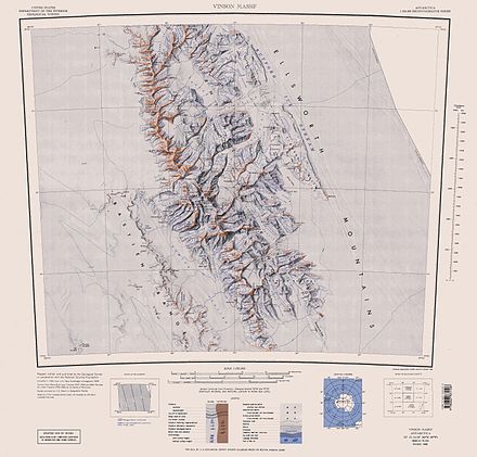
Mount Levack is the mountain rising to 2751 m in Sullivan Heights on the east side of Sentinel Range, Antarctica. It is located 21 km (13 mi) east of Mount Ostenso, and overlooks Pulpudeva Glacier to the southwest and lower Ellen Glacier to the north. Its ridge is separated from Mount Farrell to the south by Zmeevo Pass and overlooks Strinava Glacier to the east-southeast.
Mount Dalrymple is a mountain between Mount Alf and Mount Goldthwait in the northern part of the Sentinel Range, Antarctica. It surmounts Sabazios Glacier to the north-northeast and Embree Glacier to the southeast.
Mount Davis is a mountain located 1.6 km north of Mount Bentley and 2.4 km southeast of Mount Hale in the Sentinel Range, Antarctica. Discovered by the Marie Byrd Land Traverse party, 1957–58, and named for Leo E. Davis, geomagnetician and seismologist at Byrd Station in 1957.
Mount Shear is a mountain over 4,000 m, standing 4 miles (6 km) northwest of Mount Tyree in the Sentinel Range, Ellsworth Mountains, Antarctica. It surmounts Patton Glacier to the northeast. The peak was discovered by the Marie Byrd Land Traverse Party (1957–58) led by Charles R. Bentley, and was named for James A. Shear, a scientific leader at Hallett Station during the IGY in 1957.
Mount Axtell is a low but distinctive rock peak 1.5 nautical miles southeast of Mount Tidd in the Pirrit Hills, Antarctica. It was positioned by the U.S. Ellsworth–Byrd Traverse Party, December 7, 1958, and named for William R. Axtell, Jr., U.S. Navy, cook at Ellsworth Station in 1958 who volunteered to accompany the traverse party.
Mount Alf is a mountain rising over 3,200 m between Mount Sharp and Mount Dalrymple in the north part of the Sentinel Range, Antarctica. It surmounts Sabazios Glacier to the northeast.
Mount Bentley is a mountain (4,245 m) standing 2 nautical miles north of Mount Anderson in the main western ridge of the Sentinel Range, Antarctica. It was discovered by the Marie Byrd Land Traverse party, 1957–58, and named for Dr. Charles R. Bentley, leader of the traverse party and chief traverse seismologist at Byrd Station, 1957-59.
Mount Johns is a solitary nunatak rising 90 metres (300 ft) above the ice surface, about 50 nautical miles (93 km) west of the Heritage Range, in the Ellsworth Mountains of Antarctica. It was discovered by the Marie Byrd Land Traverse Party on January 27, 1958, and was named for Robert H. Johns (1932–58), an International Geophysical Year Byrd Station meteorologist in 1957 who died in the Arctic following his tour of duty at Byrd Station.
Johansen Peak is a prominent peak, 3,310 metres (10,860 ft) high, standing 3 nautical miles (6 km) east-southeast of Mount Grier in the La Gorce Mountains of the Queen Maud Mountains in Antarctica. It was discovered by Rear Admiral Richard E. Byrd on the South Pole Flight of November 28–29, 1929, and mapped in December 1934 by the Byrd Antarctic Expedition geological party under Quin Blackburn. The peak was so named in an attempt to reconcile Byrd's discoveries with the names applied by Roald Amundsen in 1911. Amundsen had named a peak in the general vicinity for Hjalmar Johansen, a member of the Eastern Sledge Party of his 1910–12 expedition.
Evans Peak is a prominent rock peak, 3,950 metres (12,960 ft) high, standing 3 nautical miles (6 km) east-northeast of Mount Ostenso in the Sentinel Range of the Ellsworth Mountains, Antarctica. It overlooks Rumyana Glacier to the north and Patton Glacier to the south. The peak was named by the University of Minnesota Geological Party to these mountains, 1963–64, for John Evans, a geologist with the party.
Patton Glacier is a broad tributary glacier in the Sentinel Range, Ellsworth Mountains. It drains the east slope of the main ridge between Mounts Ostenso and Tyree, flows east-northeastwards between Evans Peak and Versinikia Peak on the north and Mount Bearskin on the south, and enters Ellen Glacier northeast of Zalmoxis Peak and southeast of Mount Jumper.

Mount Gardner is a mountain, 4,587 metres (15,050 ft) high, standing 1.5 nautical miles (3 km) west of Mount Tyree in the west-central part of the Sentinel Range, in the Ellsworth Mountains of Antarctica. It surmounts Patton Glacier to the northeast.
Mount Goldthwait is a prominent mountain located 2.5 nautical miles (4.6 km) south of Mount Dalrymple in the north part of the Sentinel Range, Antarctica. Discovered by the Marie Byrd Land Traverse Party, 1957–58, and named for Richard P. Goldthwait, consultant, Technical Panel on Glaciology, U.S. National Committee for the IGY, and later Director, Institute of Polar Studies, Ohio State University.
Mount Morris is a steep, sharp mountain about 1 nautical mile (2 km) south of Mount Ostenso, in the main ridge of the Sentinel Range of the Ellsworth Mountains in Antarctica. It surmounts Patton Glacier to the eas-northeast.
The Long Gables are prominent twin peaks, with heights of 4,150 and 4,110 metres, joined by a col, with the lower rock exposures being in the form of steep buttresses. The peaks rise from the main ridge of the Sentinel Range, Ellsworth Mountains, Antarctica between Mount Anderson and Mount Viets. They surmount Burdenis Glacier to the southeast, Gerila Glacier to the east and Fonfon Glacier to the northeast.
Mount Hale is a mountain standing 1.5 mi NW of Mount Davis in the main ridge of the Sentinel Range, Antarctica. Discovered by the Marie Byrd Land Traverse party, 1957–58, under C.R. Bentley, and named for Daniel P. Hale, auroral physicist at Byrd Station and member of the traverse party.
Mount Dawson is a sharp, pyramidal mountain located 4 km (2.5 mi) northwest of Mount Reimer in the north part of the Sentinel Range, Antarctica. It surmounts Vidul Glacier to the east.