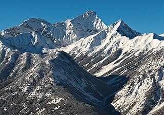
Mount Nelson is a prominent 3,313-metre (10,869-foot) mountain summit located in the Purcell Mountains of southeast British Columbia, Canada. It is situated on the west side of Rocky Mountain Trench, 23 km (14 mi) west of Invermere, and 8 km (5.0 mi) west of Panorama Mountain Resort. Sitting atop the peak is a 5 foot tall aluminum cross that marks the summit and acts as a storage unit for the summit register. It was built and erected in 1986 by the Kloos family out of Invermere, BC.

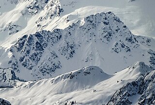
Mount Rohr is a 2,423-metre (7,949-foot) mountain summit located in the Cayoosh Range of the Lillooet Ranges, in southwestern British Columbia, Canada. It is situated 29 km (18 mi) east of Pemberton, 8.2 km (5 mi) east of Cayoosh Mountain, and 6.8 km (4 mi) northeast of Joffre Peak, its nearest higher peak. Highway 99 traverses the southern base of the mountain between Cayoosh Pass and the west end of Duffy Lake, while Mount Chief Pascall rises on the opposite (south) side of this highway. Mount Rohr forms the westernmost boundary of Duffey Lake Provincial Park as it also represents the park's highest point. The mountain's name was submitted by Rev. Damasus Payne, a mountaineer, to honor Rev. Victor Sebastian Rohr (1873-1965), who spent 40 years in British Columbia and was a missionary to the First Nations in the region between Skookumchuck and Williams Lake. The name was officially adopted on April 21, 1966, by the Geographical Names Board of Canada. Two established climbing routes are the West Ridge and via Rohr Lake, both of which can be skied in winter. Precipitation runoff from the peak drains north into headwaters of Haylmore Creek, or south into Cayoosh Creek.

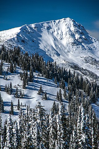
Indian Peak is a 2,992-metre (9,816-foot) mountain summit located in Mount Assiniboine Provincial Park of British Columbia, Canada.

Cloudraker Mountain is a 2,385-metre (7,825-foot) glaciated summit in British Columbia, Canada.

Mount Sir Richard is a 2,681-metre (8,796-foot) glaciated summit in British Columbia, Canada.

In-SHUCK-ch Mountain is a 2,386-metre (7,828-foot) summit in British Columbia, Canada.

Outlier Peak is a 2,422-metre (7,946-foot) mountain summit in British Columbia, Canada.

Mount Neal is a 2,552-metre (8,373-foot) glaciated summit in British Columbia, Canada.

Carcajou Peak is a 2,239-metre (7,346-foot) mountain summit in British Columbia, Canada.

Mount Moe is a 2,664-metre (8,740-foot) glaciated summit in British Columbia, Canada.

Old Glory Mountain is a 2,376-metre (7,795-foot) summit in British Columbia, Canada.

Record Mountain is a 2,113-metre (6,932-foot) summit in British Columbia, Canada.

Icecap Peak is a 2,435-metre (7,989-foot) glaciated summit in British Columbia, Canada.

Amicus Mountain is a 2,510-metre (8,235-foot) glaciated summit in British Columbia, Canada.

Mount Wilkie is a 2,699-metre (8,855-foot) summit in British Columbia, Canada.

Mount Evans is a 2,250-metre (7,382-foot) glaciated summit in British Columbia, Canada.

Tzoonie Mountain is a 2,123-metre (6,965-foot) summit in British Columbia, Canada.

Mount Pitt is a 2,487-metre (8,159-foot) summit in British Columbia, Canada.

Mount Kindersley is a 2,697-metre (8,848-foot) mountain in British Columbia, Canada.

Mount Sinclair is a 2,662-metre (8,734-foot) mountain in British Columbia, Canada.


