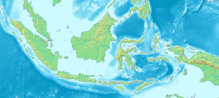
Indonesia is an archipelagic country located in Southeast Asia, lying between the Indian Ocean and the Pacific Ocean. It is located in a strategic location astride or along major sea lanes connecting East Asia, South Asia and Oceania. Indonesia is the largest archipelago in the world. Indonesia's various regional cultures have been shaped—although not specifically determined—by centuries of complex interactions with its physical environment.

The Special Region of Yogyakarta is a provincial-level autonomous region of Indonesia in the southern Java. It is bordered by the Indian Ocean to the south, as well as sharing all the land borders to the province of Central Java. Ruled by the Yogyakarta Sultanate, the region is the only officially recognized monarchy within the government of Indonesia. The city of Yogyakarta is a popular tourist destination and cultural center of the region.

The Ring of Fire is a region around much of the rim of the Pacific Ocean where many volcanic eruptions and earthquakes occur. The Ring of Fire is a horseshoe-shaped belt about 40,000 km (25,000 mi) long and up to about 500 km (310 mi) wide.

The Indonesian island of Java is almost entirely of volcanic origin, and contains numerous volcanoes, 45 of which are considered active volcanoes. As is the case for many other Indonesian islands, volcanoes have played a vital role in the geological and human history of Java. Indeed, land is created on Java as a result of lava flows, ash deposits, and mud flows (lahars). Volcanoes are a major contributor to the immense fertility of Java, as natural erosion transports volcanic material as alluvium to the island's plains, forming thick layers of fertile sediment. The benefit is not just in the immediate vicinity of the volcano, with fine ash emitted from eruptions being dispersed over wide areas.

Mount Kerinci is an active stratovolcano and the highest mountain in Sumatra, Indonesia. At 12,484 ft (3,805 m) above sea level, it provides Sumatra with the fifth-highest maximum elevation of any island in the world. It is surrounded by the lush forest of Kerinci Seblat National Park, home to several endangered species including the Sumatran tiger and Sumatran rhinoceros.

Mount Merapi, Gunung Merapi, is an active stratovolcano located on the border between Central Java and Special Region of Yogyakarta provinces, Indonesia. It is the most active volcano in Indonesia and has erupted regularly since 1548. It is located approximately 28 kilometres (17 mi) north of Yogyakarta city which has a population of 2.4 million, and thousands of people live on the flanks of the volcano, with villages as high as 1,700 metres (5,577 ft) above sea level.

The Ijen volcano complex is a group of composite volcanoes located on the border between Banyuwangi Regency and Bondowoso Regency of East Java, Indonesia.

A mud volcano or mud dome is a landform created by the eruption of mud or slurries, water and gases. Several geological processes may cause the formation of mud volcanoes. Mud volcanoes are not true igneous volcanoes as they do not produce lava and are not necessarily driven by magmatic activity. Mud volcanoes may range in size from merely 1 or 2 meters high and 1 or 2 meters wide, to 700 meters high and 10 kilometers wide. Smaller mud exudations are sometimes referred to as mud-pots.

Bandung Regency is an administrative regency located to the south, southeast, east and northeast of the city of Bandung. The northern parts of the Bandung Regency are effectively part of the Bandung Metropolitan Area, with the southern third being less urbanized and jutting upwards from the Valley, though not as sharply as the mountain range to the immediate north of Bandung. The Regency is part of the Indonesian province of West Java, and is situated about 75 miles southeast of Jakarta. The town of Soreang is the regency seat.

Mount Merbabu is a dormant stratovolcano in Central Java province on the Indonesian island of Java. The name Merbabu could be loosely translated as 'Mountain of Ash' from the Javanese combined words; Meru means "mountain" and awu or abu means "ash".

Kedu Plain, also known as Progo River valley, is the fertile volcanic plain that lies between the volcanoes, Mount Sumbing and Mount Sundoro to the west, and Mount Merbabu and Mount Merapi to the east, roughly corresponds to present-day Magelang and Temanggung Regency of Central Java, Indonesia.

Mount Patah is a heavily forested quaternary age volcano southeast of Mount Dempo on Sumatra island, Indonesia. On 1 May 1989, a fumarole activity was observed by a pilot near the summit. The exact location of the crater, the date of its formation and its geologic relationship is uncertain.

Ambarawa is a town located between the city of Semarang and Salatiga in Central Java, Indonesia. Administratively, it is bordered by the districts of Banyubiru to the south, Jambu to the east, Bandungan to the north, and Bawen to the east.

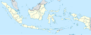
Semarang is a regency in Central Java province in Indonesia. It covers an area of 950.207 km2 and had a population of 930,727 at the 2010 Census and 999,817 at the 2015 Census; the latest official estimate is 1,040,629. These figures exclude the independent cities of Semarang and Salatiga, which are administratively separate from the regency. The Regency's capital is Ungaran, which lies immediately to the south of Semarang City.
Philautus jacobsoni is a species of frog in the family Rhacophoridae. It is endemic to Java, Indonesia. It is known only from Mount Ungaran, Central Java, Indonesia. There is only one preserved specimen held at the Naturalis Biodiversity Center in Leiden, Netherlands that was collected in the 1930s. Its status in the wild is currently unknown and could possibly be extinct, as it has not been recently found.
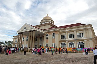
Ungaran is a town in Central Java, Indonesia and the administrative centre of the Semarang Regency in the province of Central Java. Ungaran is located at -7° 8' 17", 110° 24' 18" at an elevation of 319 metres. It encompasses two districts (kecamatan) within the Regency - Ungaran Barat and Ungaran Timur.
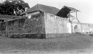
Fort Willem II of Ungaran is a late 18th-century Dutch-built fort located in Ungaran, in the Semarang Regency, Central Java, Indonesia. It was constructed to guard a trade route in central Java. The fort is the place where Prince Diponegoro was imprisoned while waiting for his judgment in Batavia and further exile to Makassar. The fort is currently used as a dormitory for the families of Indonesian police personnel.

Moung Andong is a shield type mountain in Magelang Regency, Central Java in Indonesia. This mountain has never had an erupting activity. Andong mountain is located between Ngablak and Tlogorjo, Grabag and has an altitude of around 1,463 meters. Andong Mountain is one of several mountains that encircle Magelang, adjacent to Mount Telomoyo. The mountain is on the border of the Salatiga, Semarang and Magelang regions.
A regency seat is an administrative centre or seat of government of a regency in Indonesia. It is roughly equivalent of county seat in the United States or county town in the United Kingdom. Legally, regency seats are not administrative subdivisions of Indonesia and have no official boundaries. A regency seat may occupy an entire district, a part of district, or several districts.

Kedungsepur is a commuter rail line in Central Java, Indonesia operated by Kereta Api Indonesia (KAI), serving Semarang Poncol Station to Ngrombo Station route and vice versa. The service name is taken from initials of cities and regencies forming Semarang metropolitan area: Kendal, Demak, Ungaran, Salatiga, Semarang, and Purwodadi.


