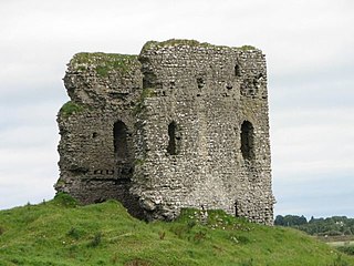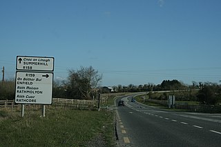
Moyvoughly (historically Moyvaghly, from Irish : Maigh Bhachla) [1] is a small village in the countryside of County Westmeath. It is about 5 km north of the town of Moate.
The village has a post office and old school.

Moyvoughly (historically Moyvaghly, from Irish : Maigh Bhachla) [1] is a small village in the countryside of County Westmeath. It is about 5 km north of the town of Moate.
The village has a post office and old school.
This is a list of the extreme points of Ireland – the points that are farthest north, south, east or west in Ireland. It includes the Republic of Ireland and Northern Ireland.

The River Maigue rises in the Milford area of north County Cork, Ireland. The River Maigue is 38.75 miles long. It drains an area of 1,000 km2

Moynalty is a village in the north-west of County Meath in Ireland. It is located at the junction of the R194 and R164 regional roads 8 km (5 mi) north of Kells, near the border with County Cavan. It was part of the Kells Poor Law Union. The Borora river flows through the village. Its population in 2011 was 116 people.
The city of Galway Ireland was built as a naval base and military fort by Tairrdelbach mac Ruaidri Ua Conchobair in 1124, refounded as a military outpost and town by Richard Mor de Burgh in 1230 - has been subjected to a number of battles, sacks and sieges. This article enumerates the history of military conflict in Galway.

Mayo or Mayo Abbey is a village in County Mayo, Ireland. Although it bears the same name as the county, it is not the county seat, which is Castlebar. Mayo Abbey is a small historic village in south Mayo approximately 16 km to the south of Castlebar and 10 km north west of Claremorris.

Moycullen is a Gaeltacht village in County Galway, Ireland, about 10 km (7 mi) northwest of Galway city. It is near Lough Corrib, on the N59 road to Oughterard and Clifden, in Connemara. Moycullen is now a satellite town of Galway with some residents commuting to the city for work, school, and business. Although Moycullen and its hinterland are classified as a ‘Gaeltacht’ area, the language has not been the local vernacular for many years. Moycullen falls under a Category C Gaeltacht Area due to its low percentage of daily Irish speakers.
Moyvane, also sometimes known as Newtownsandes, is a small village in County Kerry in the south west of Ireland. It is situated off the N69 road between Listowel to the South-West and Tarbert to the North. The village of Knockanure lies to the immediate South. The parish in which the village is located is now also known as the "Parish of Moyvane". It was originally called the parish of Murhur, which was part of the historic barony of Iraghticonnor.
Bartın is a city in northern Turkey and the central district of the province of Bartın.
Maghaberry or Magaberry is a village and townland in County Antrim, Northern Ireland. It is 9 kilometres (5.6 mi) west of Lisburn and 4 kilometres (2.5 mi) north of Moira. In the 2011 Census it had a population of 4,716 people. It is one of the biggest villages within the Lisburn and Castlereagh City Council area.

Moylagh is a civil parish and townland in the northwest of County Meath, Ireland. The townland Moylagh lies within the Roman Catholic parish of Oldcastle and Moylagh.
Founa is a town in the Sanaba Department of Banwa Province in western Burkina Faso. As of 2005 it had a population of 1,677.
Obodowo is a village in the administrative district of Gmina Sośno, within Sępólno County, Kuyavian-Pomeranian Voivodeship, in north-central Poland. It lies approximately 5 kilometres (3 mi) north of Sośno, 12 km (7 mi) east of Sępólno Krajeńskie, and 41 km (25 mi) north-west of Bydgoszcz.

Castleblakeney, historically Gallagh, is a village in County Galway, Ireland. It is at the crossroads of the R359 and R339 regional roads, 5km south of the town of Mountbellew.

Moylough is a small rural village located in County Galway in Ireland. It is located on the N63 national secondary road, and is served also by the R328 and R364 regional roads. It is 50 km from Galway, 30 km from Roscommon, and 5 km northwest of Mountbellew. It is twinned with Elliant in Brittany.
Sturgeon Lake 154 is an Indian reserve of the Sturgeon Lake Cree Nation in northern Alberta, Canada that is surrounded by the Municipal District of Greenview No. 16. It is 85 km (53 mi) east of the City of Grande Prairie at an elevation of 700 m (2,300 ft).

Laracor, in Irish Láithreach Cora, is a civil parish which is located in County Meath in Ireland, south of Trim. It overlaps with the electoral division of the same name.

Kilskeer or Kilskyre is a townland and small village in County Meath, Ireland, 10 kilometres southwest of the town of Kells.

Moyasta is a hamlet in County Clare, Ireland, situated between Kilkee and Kilrush on the N67. The hamlet is bordered by the Moyasta River, flowing from the bogs to Poulnasherry Bay.