Related Research Articles
County Roscommon is a county in Ireland. It is part of the province of Connacht and the Northern and Western Region. It is the 11th largest Irish county by area and 27th most populous. Its county town and largest town is Roscommon. Roscommon County Council is the local authority for the county. The population of the county was 69,995 as of the 2022 census.

County Laois is a county in Ireland. It is part of the Eastern and Midland Region and in the province of Leinster. It was known as Queen's County from 1556 to 1922. The modern county takes its name from Loígis, a medieval kingdom. Historically, it has also been known as County Leix.
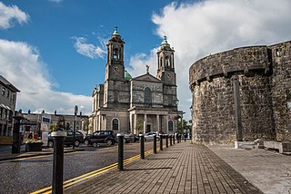
Athlone is a town on the border of County Roscommon and County Westmeath, Ireland. It is located on the River Shannon near the southern shore of Lough Ree. It is the second most populous town in the Midlands Region with a population of 21,349 in the 2016 census.
Adjala–Tosorontio is a township in south-central Ontario, Canada, in the County of Simcoe.

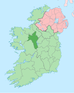
County Westmeath is a county in Ireland. It is in the province of Leinster and is part of the Eastern and Midland Region. It formed part of the historic Kingdom of Meath, which was named Mide because the kingdom was located in the geographical centre of Ireland. Westmeath County Council is the administrative body for the county, and the county town is Mullingar. At the 2022 census, the population of the county was 95,840.

County Offaly is a county in Ireland. It is part of the Eastern and Midland Region and the province of Leinster. It is named after the ancient Kingdom of Uí Failghe. It was formerly known as King's County, in honour of Philip II of Spain. Offaly County Council is the local authority for the county. The county population was 82,668 at the 2022 census.

County Cavan is a county in Ireland. It is in the province of Ulster and is part of the Border Region. It is named after the town of Cavan and is based on the historic Gaelic territory of East Breffny (Bréifne). Cavan County Council is the local authority for the county, which had a population of 76,176 at the 2016 census.

Edgeworthstown or Mostrim is a small town in County Longford, Ireland. The town is in the east of the county, near the border with County Westmeath. Nearby towns are Longford 12 km to the west, Mullingar 26 km to the east, Athlone 40 km to the south and Cavan 42 km to the north.
Kilconnell is a small rural village in County Galway, Ireland. The village gives its name to the barony of Kilconnell, formerly held by the Lords de Freyne. In 2006 David Tye purchased the original feudal Barony of Kilconnell created in 1170 from Lord de Freyne and is the present holder. The feudal Barony of Kilconnell is registered in Ireland. There is also a peerage title, Baron Kilconnel, created in 1797, and later a subsidiary title of the Earls of Clancarty.

Williamstown is a small village located on the R360 regional road in the townland of Corralough in northeast County Galway, Ireland. According to the census in April 2016, the population of the village was 148.
Aughrim is a small village in County Galway, Ireland. It is located between the towns of Loughrea and Ballinasloe, along the old N6 national primary road, now listed as R446 regional road that used to be the main road between Galway and Dublin. According to the Irish census of 2011, the division had a population of 595.

Tulrush is a small townland on the River Suck near Ballinasloe, Ireland. It is approximately 0.84 square kilometres (0.32 sq mi) in area and located in the historical barony of Moycarn in County Roscommon. As of the 2011 census, Tulrush townland had a population of 16 people.
Athlone Community College is a mixed gender school in the town of Athlone in the Irish Midlands. Athlone Community College consists of a student body of over 1,300 students and employs more than 120 teachers.
Kurcze is a village in the administrative district of Gmina Czersk, within Chojnice County, Pomeranian Voivodeship, in northern Poland. It lies approximately 6 kilometres (3.7 mi) south-east of Czersk, 32 kilometres (20 mi) east of Chojnice, and 80 kilometres (50 mi) south-west of the regional capital Gdańsk. The village has a population of 103.
Kozłowo is a village in the administrative district of Gmina Sorkwity, within Mrągowo County, Warmian-Masurian Voivodeship, in northern Poland. It lies approximately 11 kilometres (7 mi) south of Sorkwity, 16 km (10 mi) south-west of Mrągowo, and 45 km (28 mi) east of the regional capital Olsztyn.

Dumha Éige is a village in the south west of Achill Island on the west coast of Ireland in County Mayo. It is in the Gaeltacht and is the home of Coláiste Acla. It once had a National School. The scenic area is part of the Achill Atlantic Drive. Dumha Éige/Dooega has a Blue Flag beach, a church, a pub and guesthouse.

Brideswell is a village located in the south of County Roscommon, Ireland It lies 11km from the Centre of Athlone and 60km from Tuam Town.

Kilkenny West, previously Maherquirke or Dillons country, is a barony in west County Westmeath, Ireland. It was formed by 1542. It is bordered by County Longford to the west; it is also bordered by three other Westmeath baronies: Rathconrath, Brawny and Clonlonan. The largest centre of population in the barony is the village of Glassan.
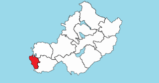
Brawny is a barony in south–west County Westmeath, Ireland. It was formed by 1672. It is bordered by County Roscommon to the west. It also borders two other Westmeath baronies: Kilkenny West and Clonlonan. The largest centre of population in the barony is the town of Athlone.
Friars Island is a small townland near Athlone, County Westmeath, Ireland. The townland, which is 0.39 square kilometres (0.15 sq mi) in area, is in the civil parish of St. Mary's. The townland stands to the north of Athlone town, on the shores of Killinure Lough. As of the 2011 census, the townland contained no houses and was unpopulated.
References
- ↑ "Population of each Province, County, City, urban area, rural area and Electoral Division, 2002 and 2006" (PDF). Census Statistics Office Ireland. 2006. Retrieved 25 July 2012.

Coordinates: 53°28′54″N7°45′00″W / 53.4817°N 7.7500°W
| | This article related to the geography of County Westmeath, Ireland is a stub. You can help Wikipedia by expanding it. |