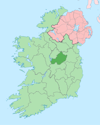
County Westmeath is a county in Ireland. It is in the province of Leinster and is part of the Eastern and Midland Region. It formed part of the historic Kingdom of Meath, which was named Mide because the kingdom was located in the geographical centre of Ireland. Westmeath County Council is the administrative body for the county, and the county town is Mullingar. At the 2022 census, the population of the county was 95,840.

Kilbeggan is a town in County Westmeath, Ireland. It is in the barony of Moycashel.

Castletown Geoghegan is a village in County Westmeath, Ireland, and lies south west of Lough Ennell near the county town of Mullingar. It is around 13 km south-west of Mullingar and 19 km north of Tullamore. Castletown was the seat of the Geoghegan family of the medieval Barony of Moycashel in County Westmeath.
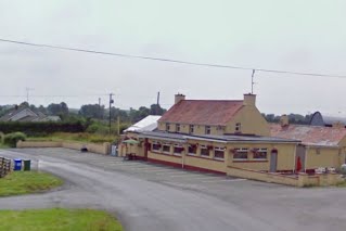
Rahugh or Ráith Aeda Meic Bric is an early Christian site founded by Áed mac Bricc in the 6th century, inside a ráth or ringfort. The site, located about 8 km north of Tullamore along the L1024.

Moygoish is a barony in north County Westmeath, in Ireland, formed by 1672. It is bordered by County Longford to the west and four other Westmeath baronies: Corkaree, Fore, Moyashel and Magheradernon and Rathconrath to the south–west.

Moyashel and Magheradernon is a barony in the centre of County Westmeath, in Ireland, formed by 1672. It is bordered by eight other baronies: Corkaree and Fore, Delvin and Farbill, Fartullagh and Moycashel and Rathconrath and Moygoish.
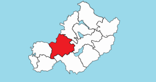
Rathconrath, previously the barony of Rathcomyrta, before that Daltons country, is a barony in the west of County Westmeath, in Ireland. It was formed by 1542. It is bordered by County Longford to the north–west and five other Westmeath baronies: Moygoish to the north, Moyashel and Magheradernon to the east, Moycashel and Clonlonan to the south and Kilkenny West to the west. Note that the village of Rathconrath is not synonymous with the barony of the same name.
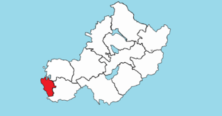
Brawny is a barony in south–west County Westmeath, Ireland. It was formed by 1672. It is bordered by County Roscommon to the west. It also borders two other Westmeath baronies: Kilkenny West and Clonlonan. The largest centre of population in the barony is the town of Athlone.

Clonlonan is a barony in south–west County Westmeath, Ireland. It was formed by 1672. It is bordered by County Offaly to the south and a small part of County Roscommon at Long Island on the River Shannon to the west. It also borders four other Westmeath baronies: Kilkenny West and Rathconrath, Moycashel and Brawny. The largest centre of population in the barony is the town of Moate.
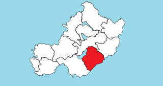
Fartullagh, previously Tyrrells country, is a barony in south–east County Westmeath, in Ireland. It was formed by 1542. It is bordered by County Offaly to the south and three other baronies: Moycashel, Moyashel and Magheradernon and Farbill.

Farbill is a barony in east County Westmeath, in Ireland. It was formed by 1672. It is bordered by County Meath to the south and east and three other baronies: Fartullagh, Moyashel and Magheradernon and Delvin. The largest centre of population in the barony is the town of Kinnegad.

Delvin is a barony in north-east County Westmeath, in Ireland. It was formed by 1672. It is bordered by County Meath to the east and three other baronies: Fore, Moyashel and Magheradernon and Farbill. The largest centre of population is Delvin.
Dysart is a civil parish in County Westmeath, Ireland. It is located about 8.5 kilometres (5 mi) south‑west of Mullingar.
Newtown is a civil parish in County Westmeath, Ireland. It is located about 16.02 kilometres (10 mi) south of Mullingar.
Kilbeggan is a civil parish in County Westmeath, Ireland. It is located about 19.86 kilometres (12 mi) south–south–west of Mullingar.
Kilcumreragh is a civil parish which spans the counties of Westmeath and Offaly in Ireland. It is located about 23 kilometres (14 mi) west–south–west of Mullingar and 18 kilometres (11 mi) north–north–west of Tullamore.
Castletownkindalen is a civil parish in County Westmeath, Ireland. It is located about 14.6 kilometres (9 mi) south–west of Mullingar.
Durrow is a civil parish situated in County Westmeath, Ireland. It is located about 22.89 kilometres (14 mi) to the south–south–west of Mullingar.
Rahugh is a civil parish in County Westmeath, Ireland. It is located about 20 kilometres (12 mi) south–south–west of Mullingar.
Ardnurcher is a civil parish in County Westmeath, Ireland. It is located about 19.89 kilometres (12 mi) south–west of Mullingar.


