Corkaree

Last updated

Corkaree
Corca Raoi
Corkaree barony, westmeath.png
Location of Corkaree on a map of Westmeath
Ireland adm location map.svg
Red pog.svg
Corkaree
Location in Ireland
Coordinates: 53°36′20″N7°22′24″W / 53.6055°N 7.3734°W / 53.6055; -7.3734 Coordinates: 53°36′20″N7°22′24″W / 53.6055°N 7.3734°W / 53.6055; -7.3734
Country Ireland
Province Leinster
County Westmeath
Area
  Total109.253 km2 (42.183 sq mi)
Time zone UTC+0 (WET)
  Summer (DST) UTC+1 (IST (WEST))
Irish Grid Reference N415619

Corkaree (Irish : Corca Raoi) [1] is a barony in north County Westmeath, Ireland. It was formed by 1672. [2] It is bordered by three other baronies: Fore (to the north), Moyashel and Magheradernon (to the south) and Moygoish (to the west).

Contents

Early history

In the Medieval period the area of Corcaree formed part of the lands held by the Ó Dálaigh (Daly) bardic family. Máel Íosa Ua Dálaigh, died 1185, was described as "Chief poet of Ireland and Scotland," he was also lord (ard taoiseach) of the 'minor midland kingdom' of Corca Raidhe (Corcaree). [3] The annals state that in 1185, Maelisa O'Daly, ollave (chief poet) of Ireland and Scotland, Lord of Corcaree and Corca-Adain, a man illustrious for his poetry, hospitality, and nobility, died while on a pilgrimage at Clonard. [4]

Geography

Corkaree has an area of 26,996.9 acres (109.253 km2). [2]

The barony contains two large lakes; Lough Derravaragh, shared with the barony of Fore, and home to the Irish legend of the Children of Lir and Lough Owel an internationally recognised Ramsar waterfowl habitat. In addition Lough Iron, a small lake, lies on the River Inny and is shared with the barony of Moygoish. The lake is not easily accessible as there is no road close to the lake or public access.

The River Inny, flows into Lough Derravaragh, then near the village of Ballinalack. The River Brosna, rises in Lough Owel [5] and, like the Inny, is a tributary of the River Shannon.

The N4, a national primary road passes to the north of Lough Owel, connecting Dublin with the north–west of Ireland and the coastal town of Sligo. A railway line carrying the national rail company Iarnród Éireann's Dublin to Longford commuter service and Dublin to Sligo intercity service [6] also passes through the barony.

Civil parishes of the barony

Lough Owel from Portnashangan Lough Owel Car Park - geograph.org.uk - 1005759.jpg
Lough Owel from Portnashangan

This table lists an historical geographical sub-division of the barony known as the civil parish (not to be confused with an Ecclesiastical parish). [7]

Name in EnglishName in Irish
Lackan Leacain
Leny Léine
Multyfarnham Muilte Farannáin
Portloman Port Lomáin
Portnashangan Port na Seangán
Stonehall Tigh Cloiche
Tyfarnham Tigh Farannáin
Taghmon Tigh Munna

Towns, villages and townlands

There are 77 townlands in the barony of Corkaree. [2]

Places of interest

Wilson's Hospital School Wilson's Hospital, Multyfarnham - geograph.org.uk - 166771.jpg
Wilson's Hospital School

Related Research Articles

<span class="mw-page-title-main">Multyfarnham</span> Village in County Westmeath, Ireland

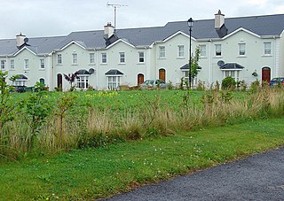
Multyfarnham or Multyfarnam is a village in County Westmeath, Ireland.

<span class="mw-page-title-main">River Inny (Leinster)</span> Tributary of the Shannon in central Ireland

The River Inny is a river within the Shannon River Basin in Ireland. It is 88.5 kilometres (55.0 mi) in length, and has a number of lakes along its course.

Lough Iron is a small lake on the River Inny, in County Westmeath, Ireland.

Máel Íosa Ua Dálaigh was an Irish poet. He died in 1185.

<span class="mw-page-title-main">Moygoish</span> Barony in Leinster, Ireland

Moygoish is a barony in north County Westmeath, in Ireland, formed by 1672. It is bordered by County Longford to the west and four other Westmeath baronies: Corkaree, Fore, Moyashel and Magheradernon and Rathconrath to the south–west.

<span class="mw-page-title-main">Moyashel and Magheradernon</span> Barony in Leinster, Ireland

Moyashel and Magheradernon is a barony in the centre of County Westmeath, in Ireland, formed by 1672. It is bordered by eight other baronies: Corkaree and Fore, Delvin and Farbill, Fartullagh and Moycashel and Rathconrath and Moygoish.

<span class="mw-page-title-main">Ballinalack</span> Townland and village in Leinster, Ireland

Ballinalack is a village and a townland in County Westmeath, Ireland. It is located about 14 kilometres (9 mi) north–west of Mullingar.

Cullenhugh is a townland in County Westmeath, Ireland. It is located about 13.5 kilometres (8 mi) north–west of Mullingar on the northeastern shore of Lough Iron. The River Inny forms its northwestern boundary.

Leny is a civil parish in County Westmeath, Ireland. It is located about 10.5 kilometres (7 mi) north–west of Mullingar. This name also applies to the townland of Leny; neither should be confused with the Falls of Leny in Scotland.

Lackan is a civil parish in County Westmeath, Ireland. It is located about 13 kilometres (8 mi) north–north–west of Mullingar. This name also applies to the townland of Lackan.

<span class="mw-page-title-main">Portloman (civil parish)</span> Civil parish in Leinster, Ireland

Portloman is a civil parish in County Westmeath, Ireland. It is located about 6.5 kilometres (4 mi) north–west of Mullingar in hilly country on the western shore of Lough Owel.

Stonehall is a civil parish in County Westmeath, Ireland. It is located about 9.6 kilometres (6 mi) north of Mullingar. This name also applies to the townland of Stonehall.

Tyfarnham is a civil parish in County Westmeath, Ireland. It is located about 7.5 kilometres (5 mi) north of Mullingar.

<span class="mw-page-title-main">Multyfarnham (civil parish)</span> Civil parish in Leinster, Ireland

Multyfarnham is a civil parish in County Westmeath, Ireland. It is located about 12.3 kilometres (8 mi) north of Mullingar on the southwestern shore of Lough Derravaragh.

<span class="mw-page-title-main">Mullingar (civil parish)</span> Civil parish in Leinster, Ireland

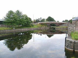
Mullingar is a civil parish in County Westmeath, Ireland. It includes Mullingar the county town of Westmeath, as well as the eponymous townland. Mullingar parish is located about 75 kilometres (47 mi) west of Dublin on the N4 road and the N52 road which meet east of Mullingar town. It is served by Mullingar railway station on the Dublin to Sligo line. The Royal Canal also passes through the parish and the town.

Ballynakill is a townland in County Westmeath, Ireland. It is located about 13.23 kilometres (8 mi) north of Mullingar on the western shore of Lough Derravaragh.

Multyfarnham is a village in County Westmeath, Ireland.

Clonava is a townland in County Westmeath, Ireland. It is located about 16.31 kilometres (10 mi) north of county town Mullingar.

Knockdrin is a townland in County Westmeath, Ireland. It is located about 6.34 kilometres (4 mi) north–north–east of Mullingar.

<span class="mw-page-title-main">Culleen More</span> Townland in Leinster, Ireland

Culleen More is a townland in County Westmeath, Ireland. It is located about 3.84 kilometres (2 mi) north of Mullingar.

References

  1. Corkaree The Placenames Database of Ireland Retrieved 29 May 2015
  2. 1 2 3 Corkaree townlands.ie Retrieved 21 May 2015
  3. Rigby, S.H., (2003) A Companion to Britain in the Later Middle Ages, Historical Association, Blackwell Publishing, ISBN   0-631-21785-1, p. 587
  4. Annals of the Four Masters the original: Maoil Iosa Ua Dálaigh ollamh Ereann, & Alban ard taoiseach Corca Raidhe & Corcadain, Saoi oirdherc ar dhán, ar eneach, & ar uaisle do écc i c-Cluain Ioraird oca oilithre.
  5. Lough Owel www.askaboutireland.ie Retrieved 21 May 2015
  6. Irish Rail Printable Timetables Archived 2012-08-25 at the Wayback Machine irishrail.ie Retrieved 21 May 2015
  7. Civil parishes of the barony of Corkaree. The Placenames Database of Ireland 7 June 2015