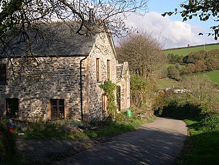
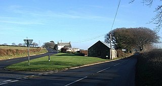
Muchlarnick (Cornish : Lannergh Meur, meaning great woodland clearing) is a hamlet in Cornwall, England. [1] It is about two miles east of Lanreath [2] in the civil parish of Pelynt. [3]

Churchbridge is a hamlet in Cornwall, England. It is a mile west of Duloe, and is situated on the West Looe River. Both banks of the river are wooded, and to the north of the bridge is a disused quarry and Tremadart Mills, marked as a corn mill on the 1882 map.

Congdon's Shop is a hamlet in the parish of North Hill, Cornwall, England. It is at the junction of the B3254 Launceston to Liskeard road and the B3257 road from Plusha to Callington.

Dutson is a hamlet northeast of Launceston in Cornwall, England, and on the A388 main road. It is in the civil parish of St Stephens by Launceston Rural

Gang is a hamlet in the parish of St Ive and Pensilva in east Cornwall, England, UK.
Haye Farm is a farm in the parish of Callington, Cornwall, England.

Hick's Mill is a hamlet in Cornwall, England. It is about a mile southeast of Trewen on the River Inny. It is in the civil parish of Gwennap

Langore is a village in Cornwall, England. It is in the parish of St Stephens by Launceston Rural and is about halfway between St Stephens and Egloskerry.

Milcombe is a hamlet in the parish of Pelynt in Cornwall, England. Milcombe is in the valley of the West Looe River south of Sowden's Bridge and east of Muchlarnick.

Paynter's Cross is a hamlet on the A388 main road southeast of St Mellion in southeast Cornwall, England, UK.
Penpillick is a hamlet in Cornwall, England, UK. It is about two miles north of St Blazey on the A390 road.
Penpont is a hamlet in the parish of St Breward, in north Cornwall, England, UK, in the Camel Valley.

Piper's Pool is a hamlet in east Cornwall, England, UK. It is on the A395 road about 5½ miles west of Launceston.

Plusha is a hamlet in Cornwall, England, UK. It is not far from Polyphant on the A30 main road at its junction with the B3257.
Redmoor is a hamlet in Cornwall, England, United Kingdom.

Shutta is a northern suburb of Looe, Cornwall, England, United Kingdom.

Tremar is a hamlet in the parish of St Cleer, Cornwall, England, United Kingdom. It is about 1 km south of Darite and includes Lower Tremar and Venland Cross.
Treven is a hamlet between Trevena and Tregatta in the parish of Tintagel, Cornwall, England, United Kingdom. Tintagel Primary School is at Treven.

Truscott is a hamlet in Cornwall, England, United Kingdom. It is in the parish of St Stephens by Launceston Rural and is about halfway between St Stephens and Egloskerry.

The River Kensey is a river in east Cornwall, England, UK which is a tributary of the River Tamar.

The River Seaton is a river in east Cornwall, England, UK which flows southwards for 11 miles (17 km) into the English Channel.
Coordinates: 50°22′50″N4°30′21″W / 50.3804294°N 4.50588°W